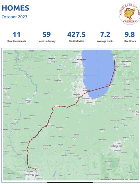
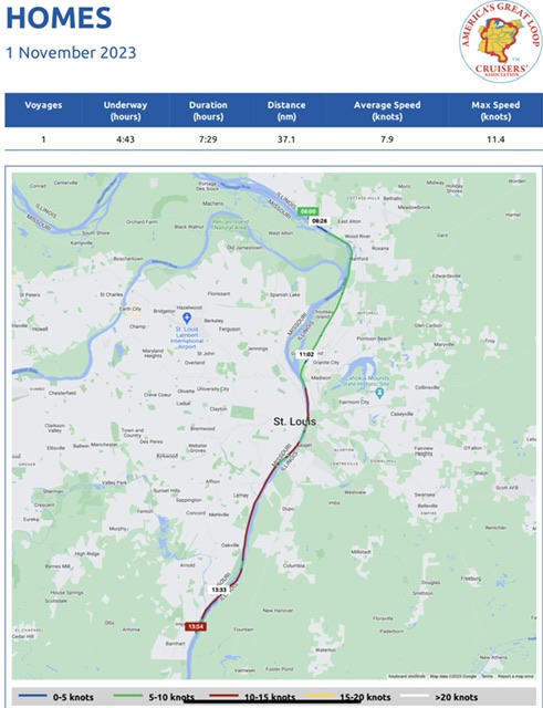
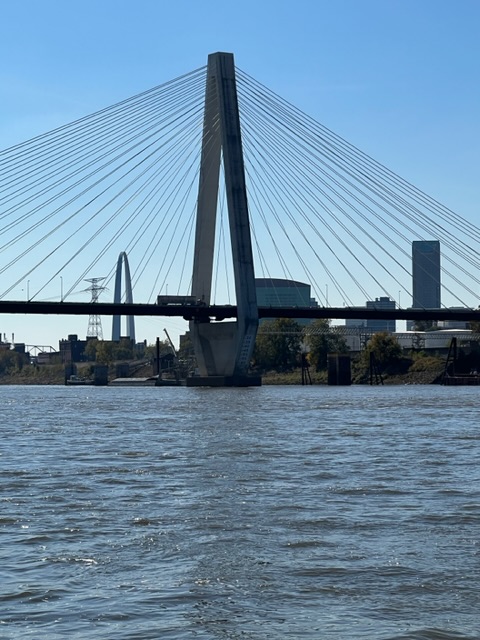
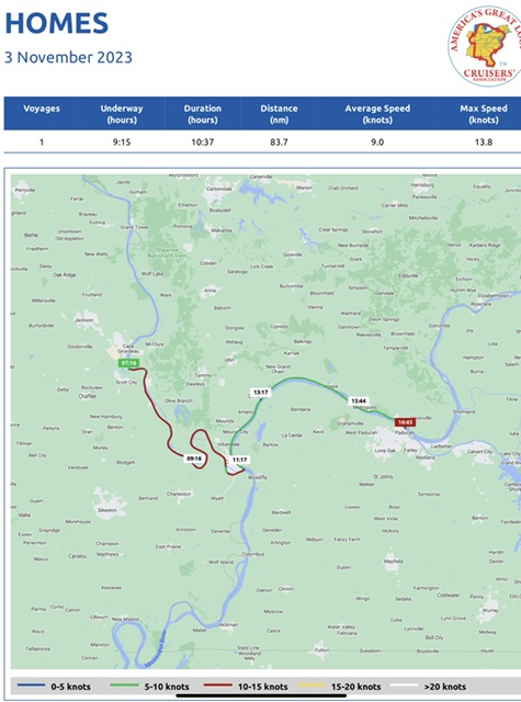
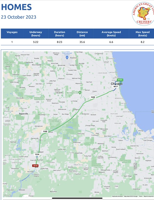
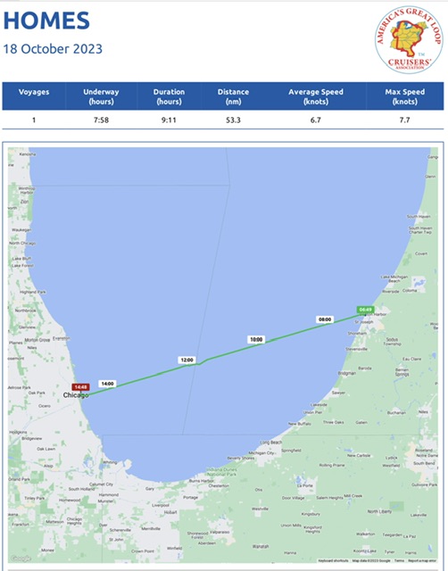
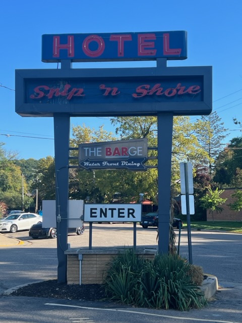
Weeks 5-6, Part III – March 4-17, 2024 – Cabbage Key, FL to Everglades National Park (Shark River, Monroe County, FL)
Week 5 – March 4 – March 10, 2024 – Cabbage Key, FL to Punta Gorda, FL
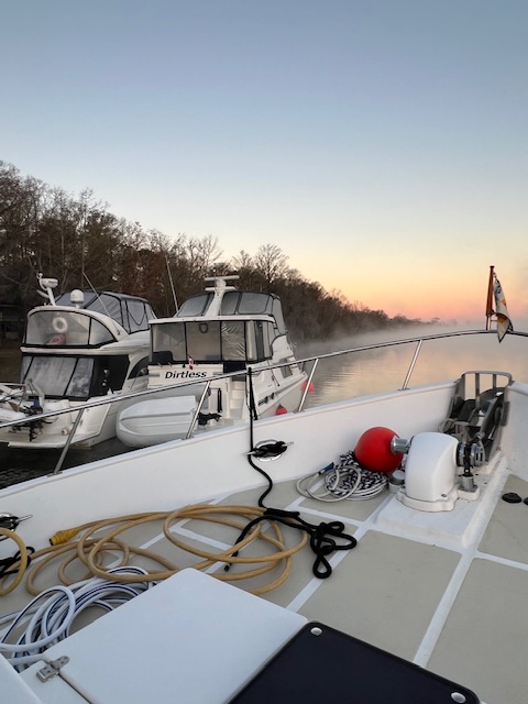
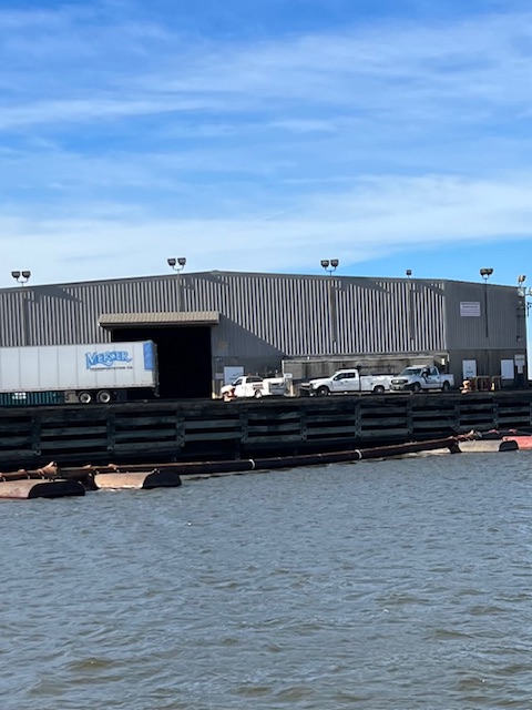
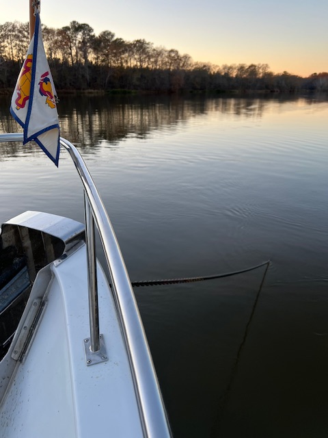
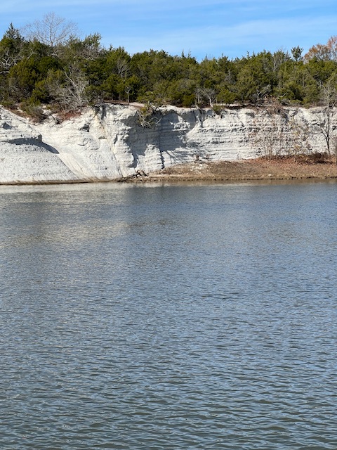
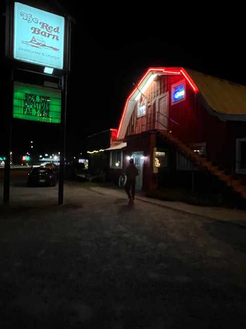
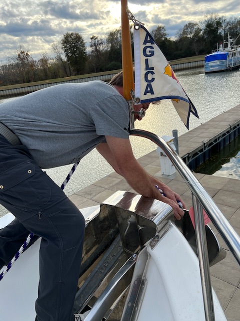
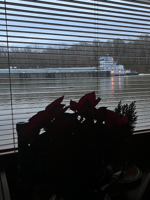
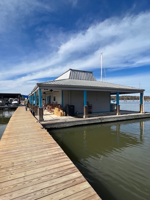
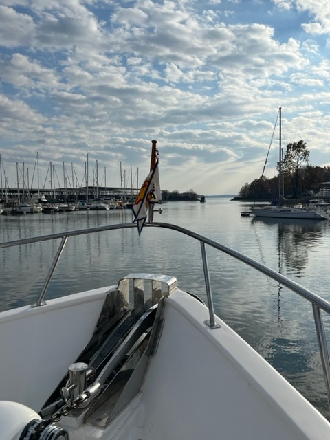
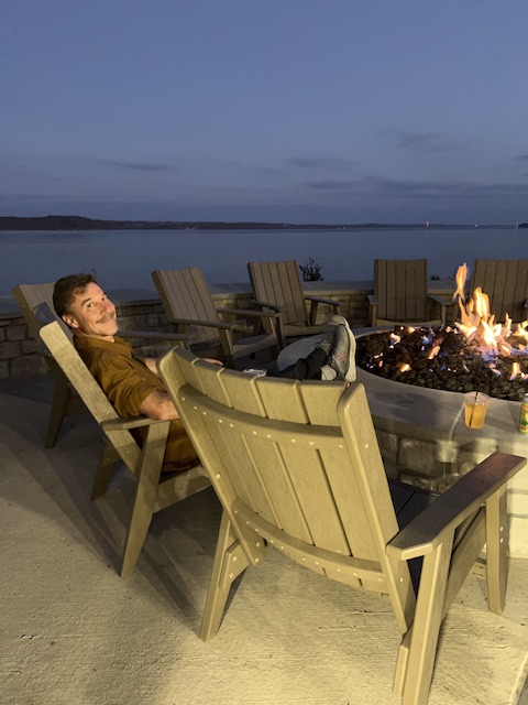
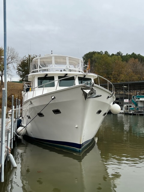
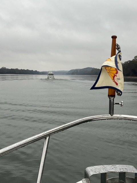
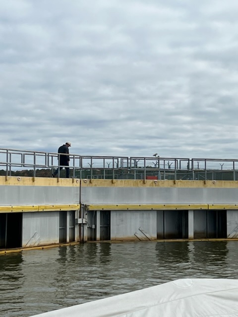
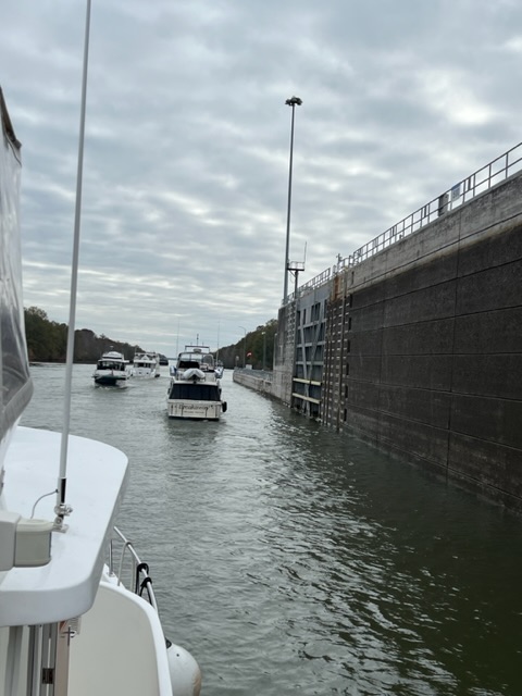
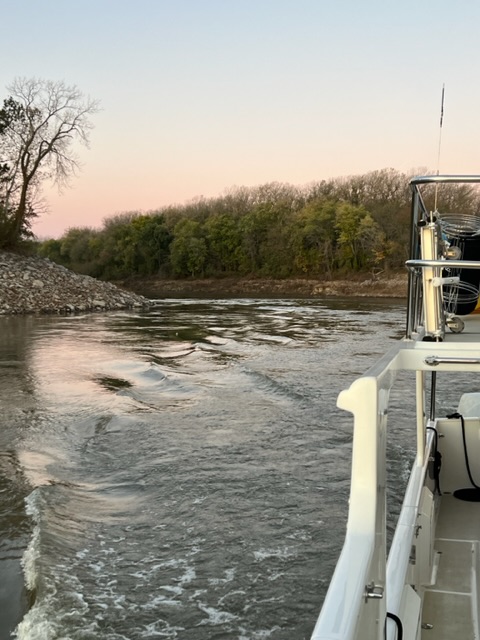
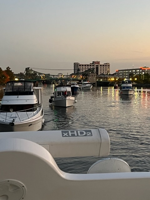
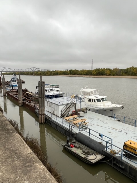
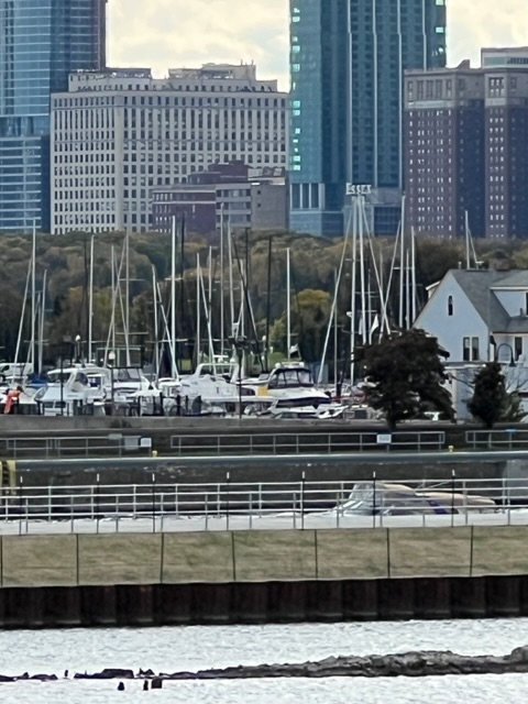
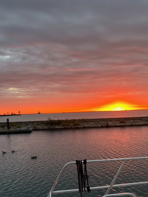
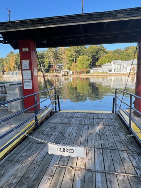
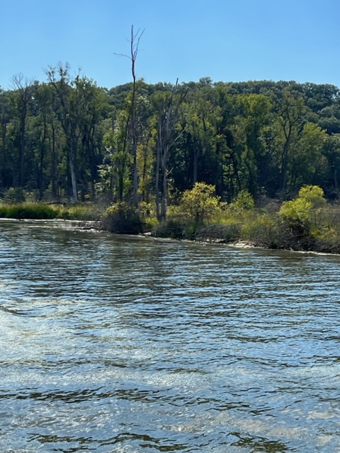
Hanging out at our anchorage, with Cabbage Key in the background.The Cabbage Key Channel.
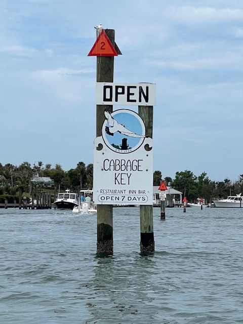
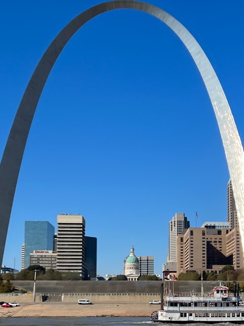
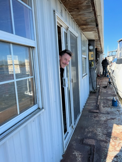
On Monday, March 4th, we were still anchored near Cabbage Key, where we left you last time, after having had dinner at Cabbage Key Inn with two other boater couples. Those two boats left the anchorage this morning, but we stayed to explore Cabbage Key and Cayo CostaKey– both are only accessible by boat or ferry…or by helicopter as we saw one Cabbage Key resident arrive.
Our anchorage is between Cabbage Key and Useppa Island. What’s the difference between a key and an island? A key (also called a cay; from the Spanish word cayo, meaning island) is a small, low-lying island formed on the surface of a coral reef. And, an island is a subcontinental land that is surrounded by water. Therefore the “land” of Cabbage Key is all sand and shells.
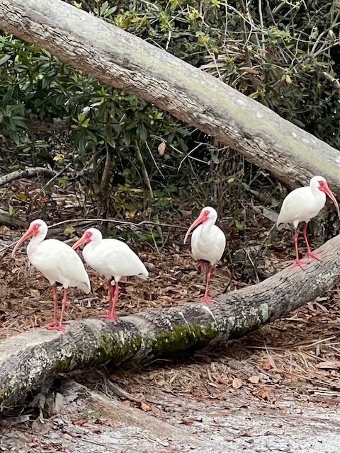
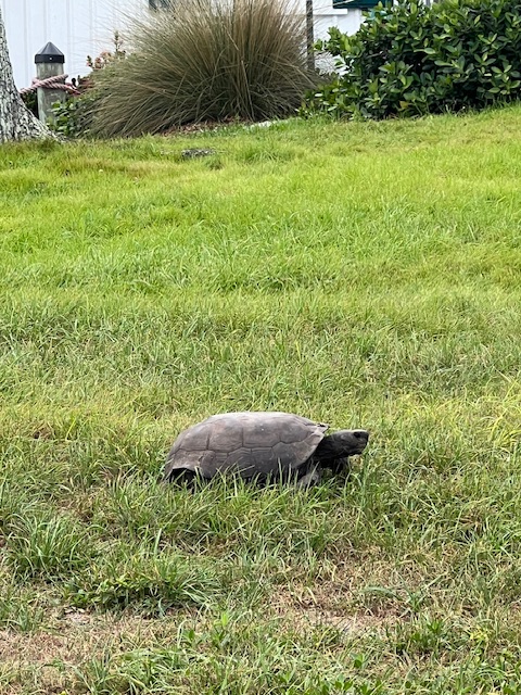
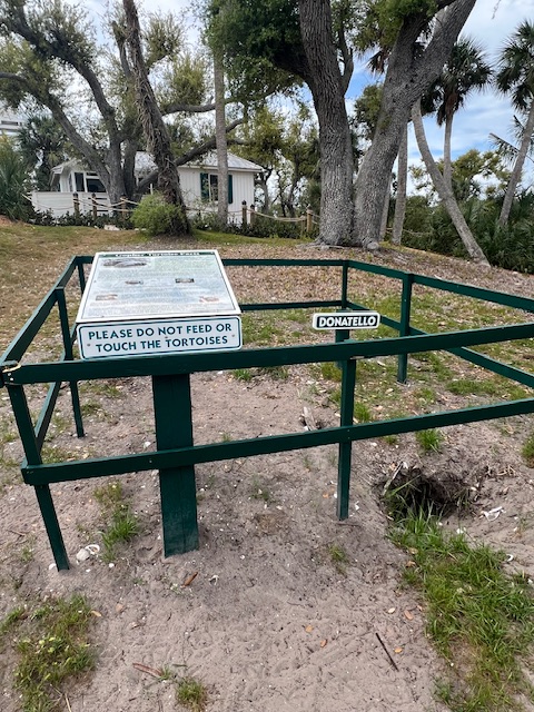
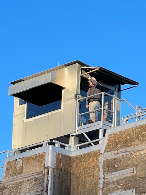
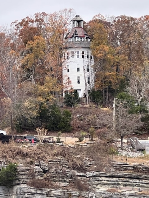
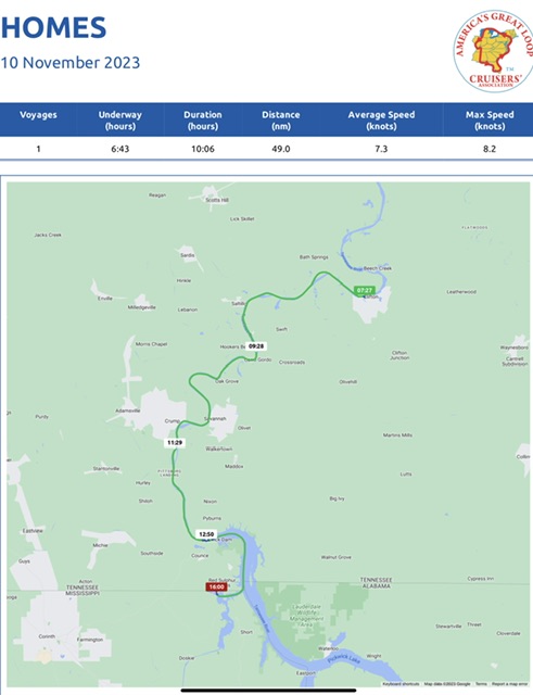
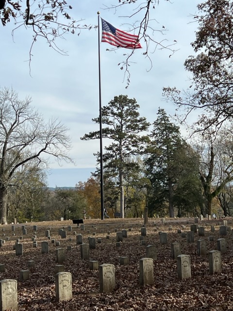
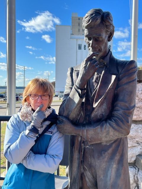
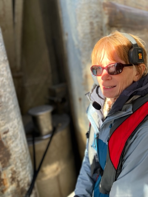
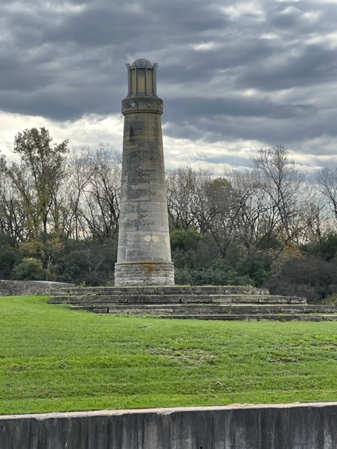
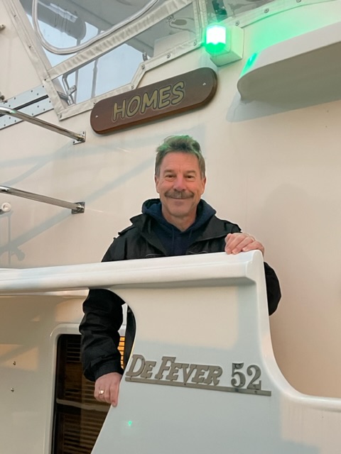
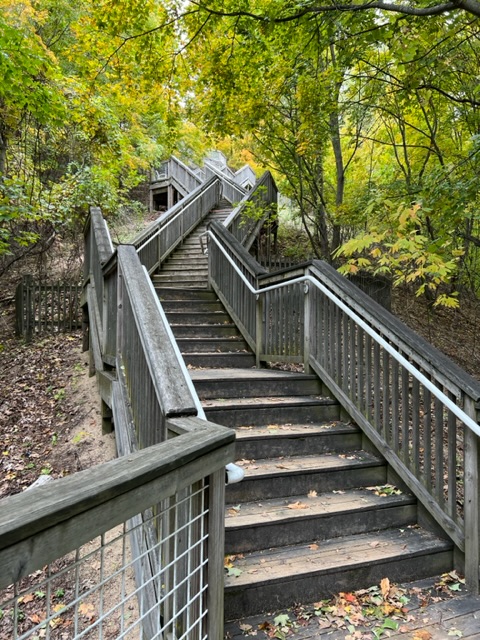
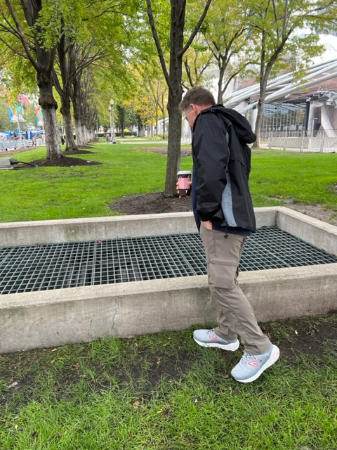
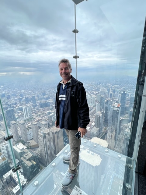
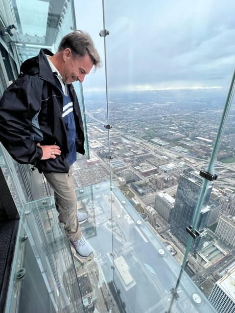
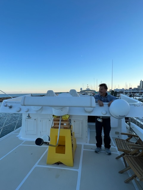
We took the dinghy over and beached it as before. We hiked the two short trails around this 100-acre key, seeing several gopher tortoises and many birds. We then climbed the water tower, which gave us a nice view of HOMES.
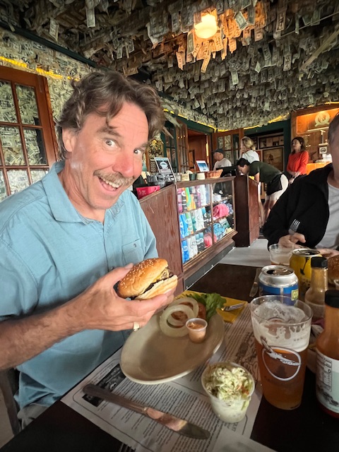
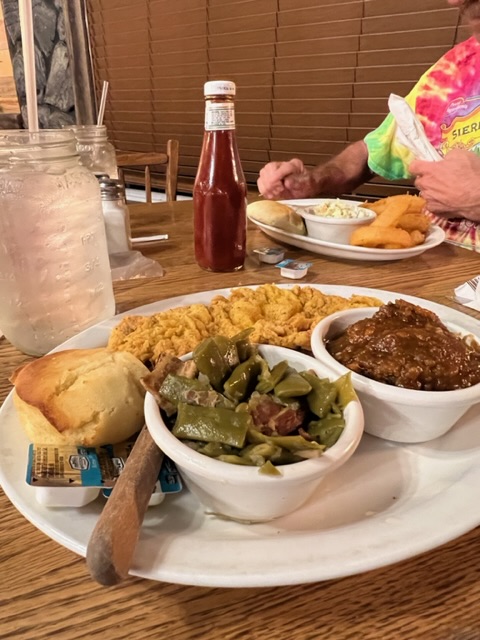
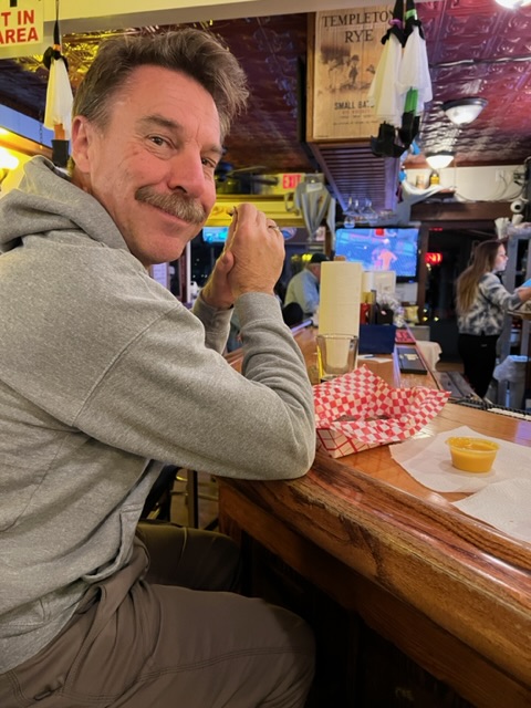
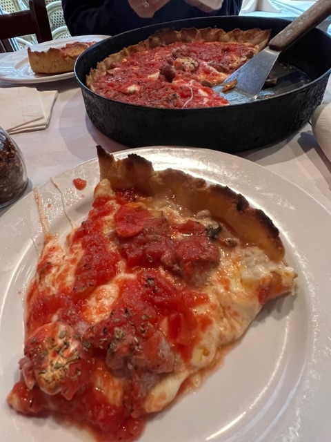
Hiking on Cabbage Key.Seeing birds……and gopher tortoises.Here is burrow of one of the tortoises.The water tower.View of HOMES from the water tower.The Cabbage Creeper!On a return trip, Tim had the Cheeseburger in Paradise.
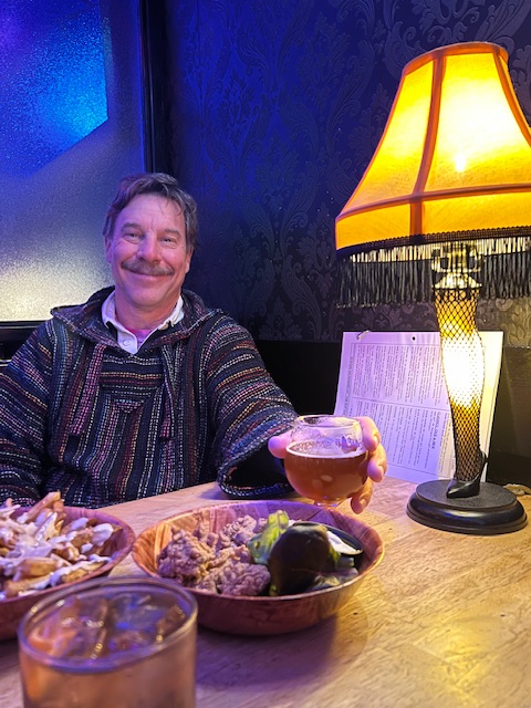
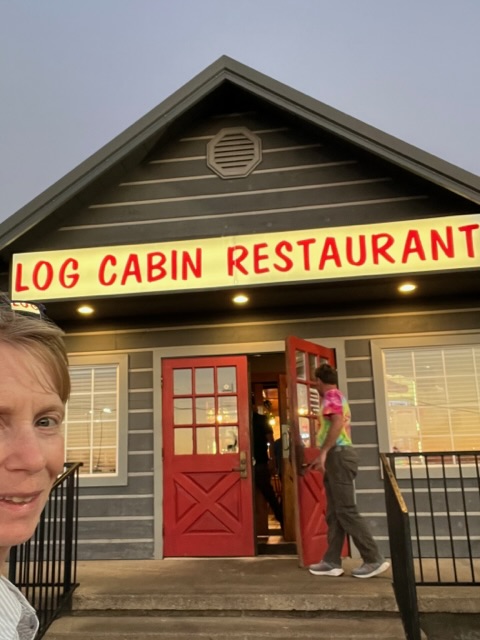
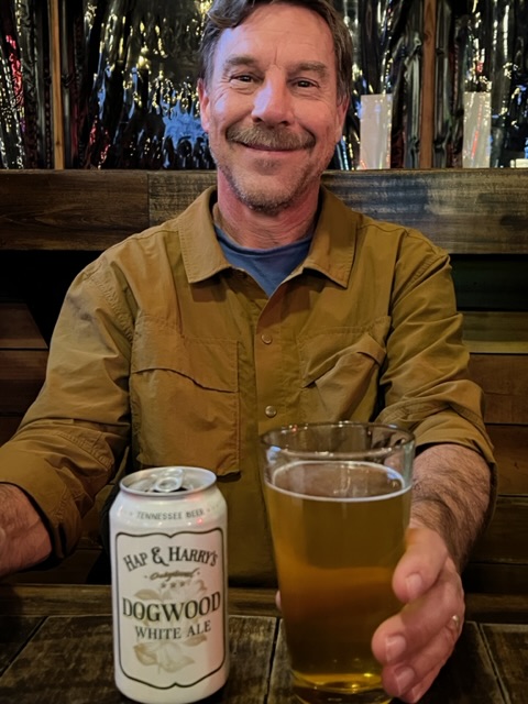
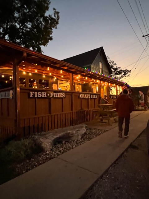
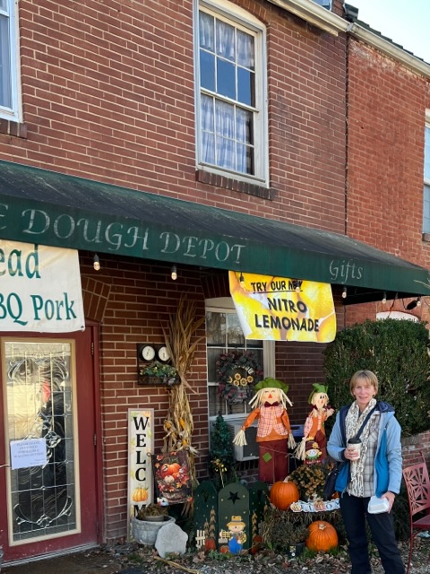
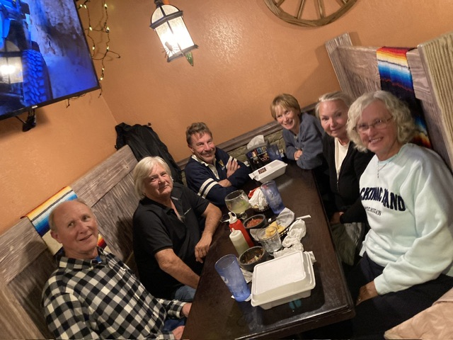
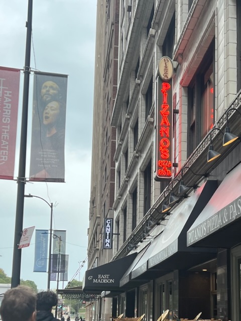
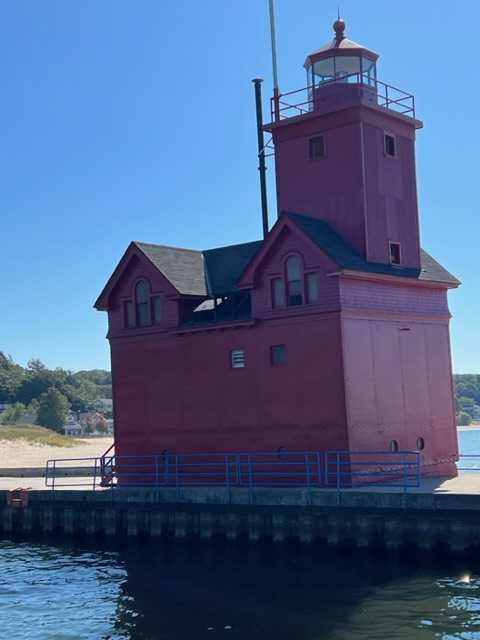
After soaking in the peacefulness of the key, we walked to Cabbage Key Inn and I had their signature drink – Cabbage Creeper – consisting of Pina colada mix, rum and a coffee liqueur floater. Tim had a local craft beer. We enjoyed our drinks in the bar, known as Dollar Bill Bar, because visitors write messages on dollar bills and tape them to the walls. This bar was also a well-known hangout of the late Jimmy Buffet, who allegedly wrote Cheeseburger in Paradise about the Inn’s cheeseburger.
Beached at Cayo Costa
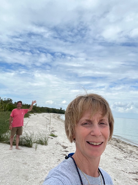
After leaving Cabbage Key, we headed to Cayo Costa. We beached the dinghy on Cayo Costa State Park in Pelican Bay. There was no access to the State Park trails from Pelican Bay, due to storm damage, but we just wanted to walk on the beach anyway.
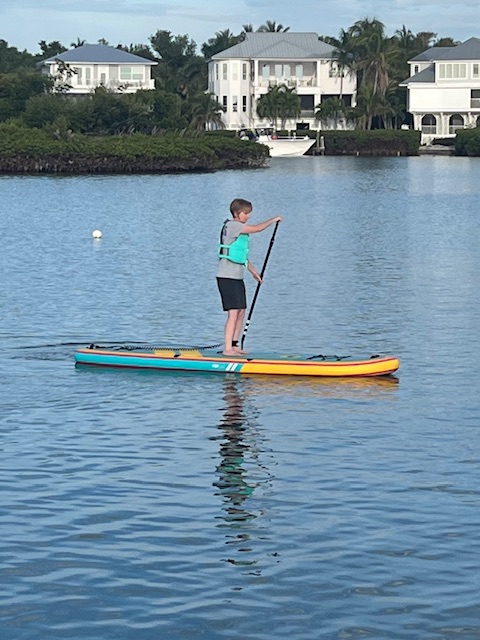
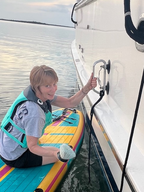
When we got back to HOMES, we decided to inflate my paddleboard. I had fun and even got a little work done! The paddleboard is so stable, it makes a good platform to clean HOMES’s waterline.
Inflating the paddleboard with our new electric pump.Play.Work.
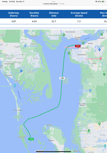
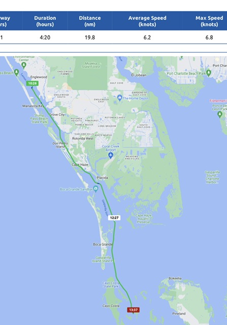
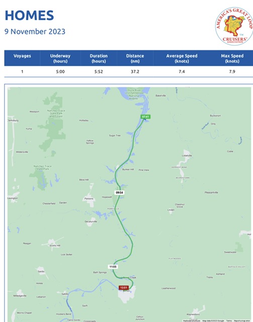
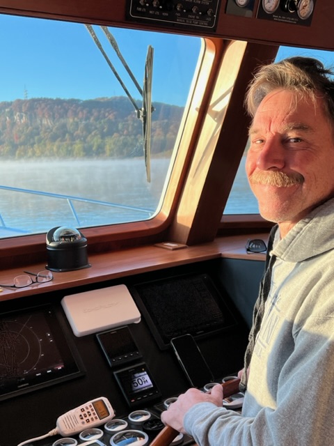
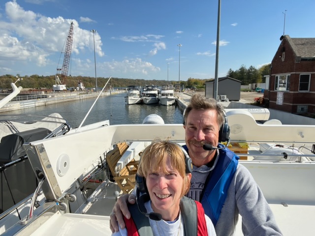
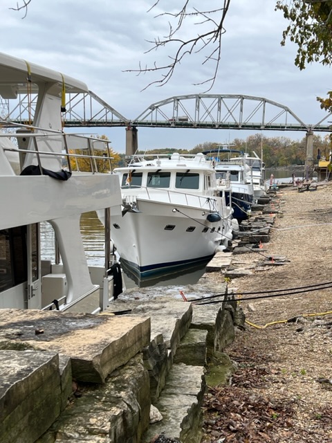
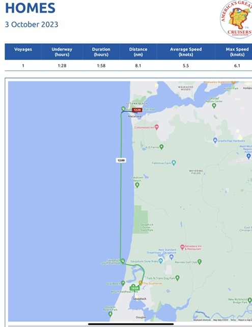
Tuesday, March 5, 2024 – Cabbage Key, FL anchorage to Punta Gorda, FL, Fisherman’s Village Marina
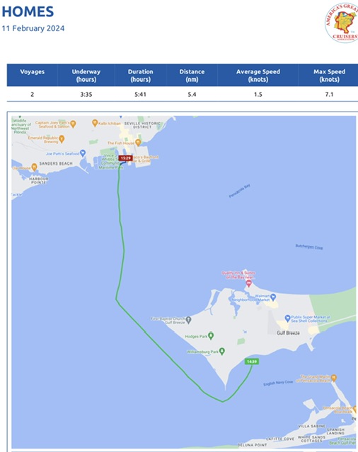
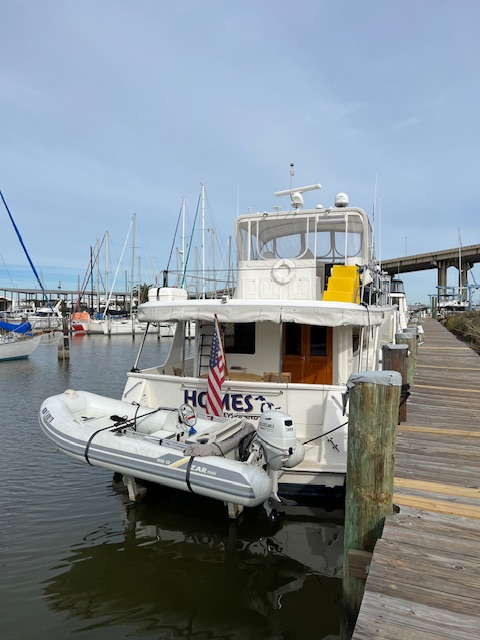
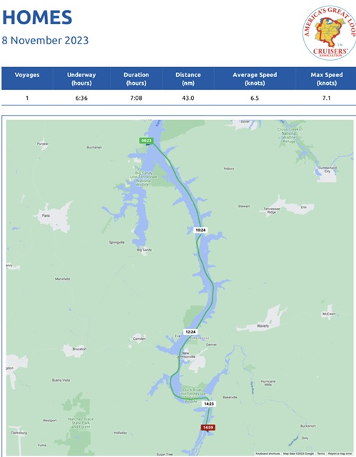
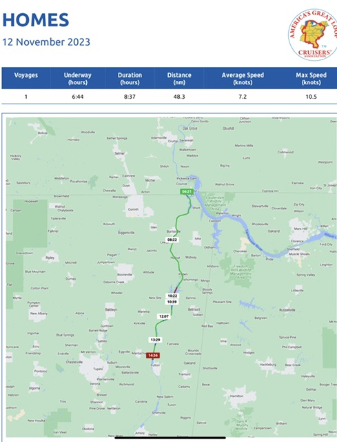
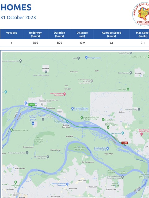
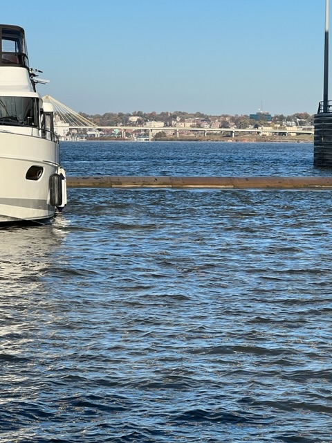
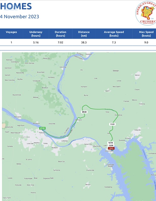
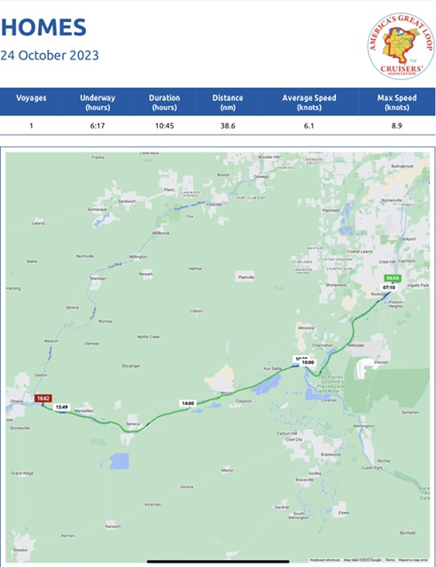
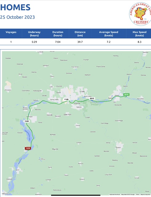
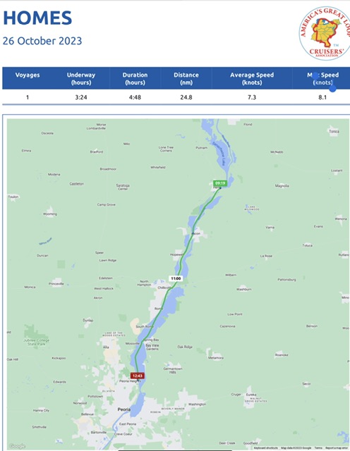
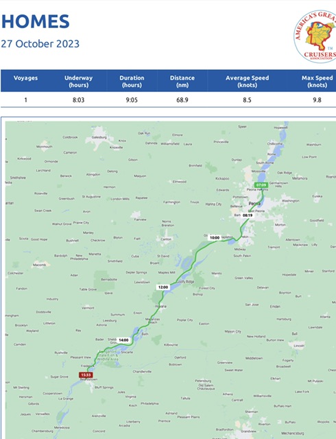
Our voyage today took 3 hours and 7 minutes, going 26 miles (22.7 nm), at an average speed of 8 MPH (7.3 knots). We had hoped to stay at this anchorage near Cabbage Key for another day, but a storm was heading our way. We already had reservations to stay a week at Fishermen’s Village Marina in Punta Gorda, starting on Wednesday, so we just added a day to our reservation.
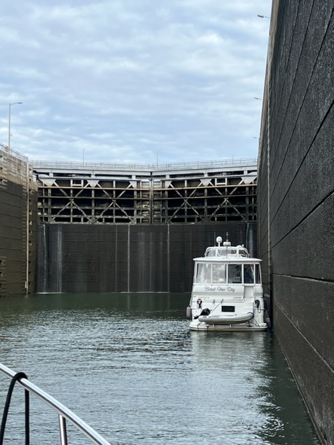
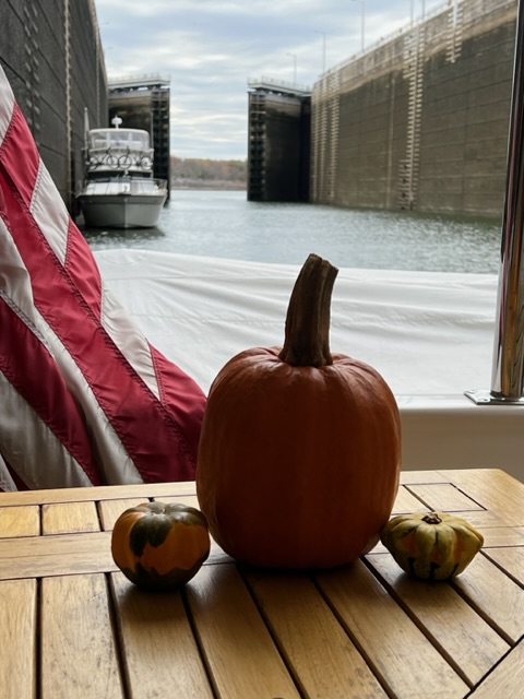
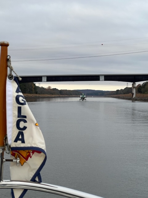
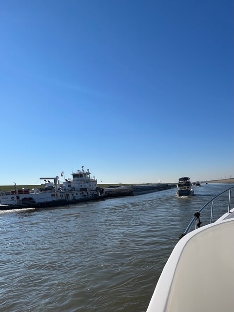
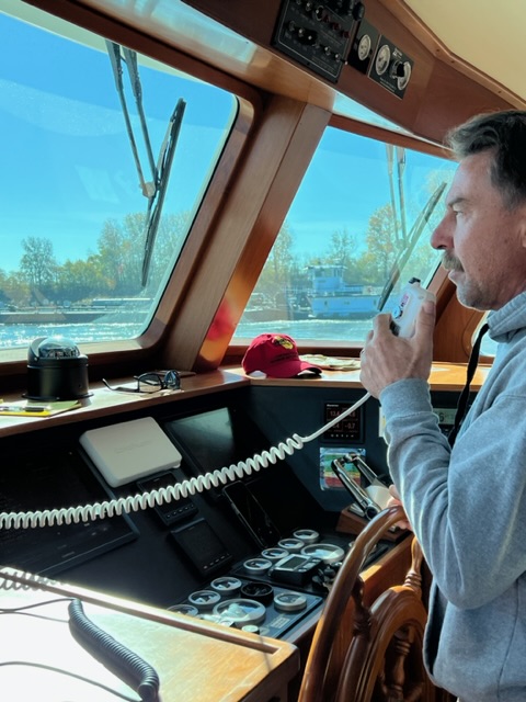
We backtracked up the Gulf IWC and then turn up Gasparilla Sound to Charlotte Harbor. We passed a Looper friend, Brand New Day, coming the opposite, so we exchanged a few words on the radio. We hadn’t seen them since Iuka, Mississippi.
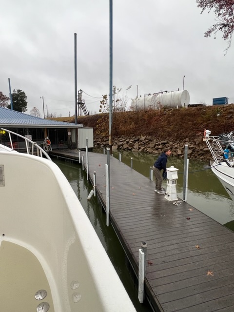
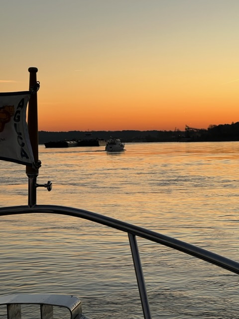
Once we got to Charlotte Harbor, an American Cruise Ship was anchored at the mouth of the channel and unloading people into a tender to take into Punta Gorda. We negotiated around the cruise ship and made our way into Fishermen’s Village Marina.
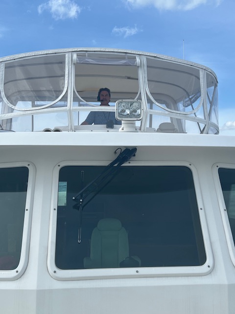
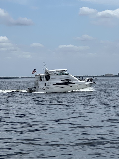
On our way to Punta Gorda.Passing Brand New Day, going the opposite direction.The American Cruise Ship – American Glory.
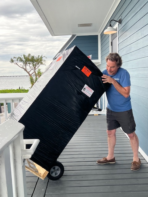
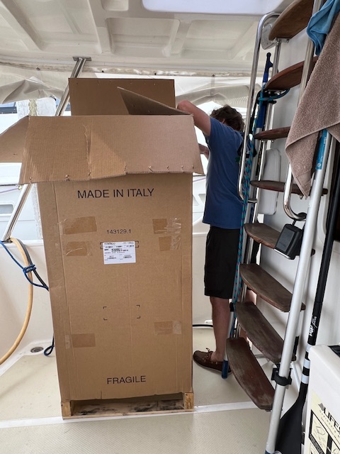
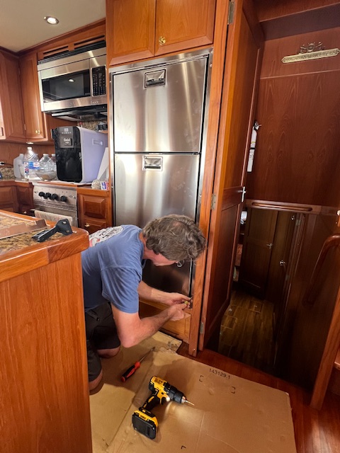
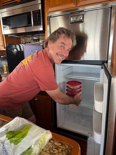
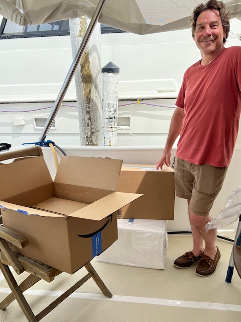
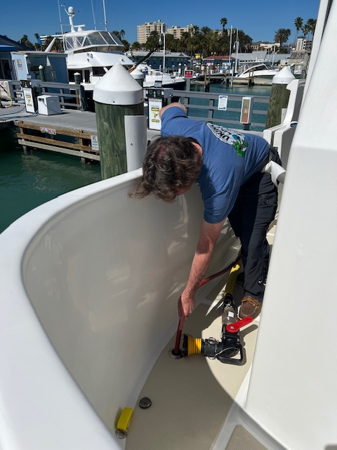
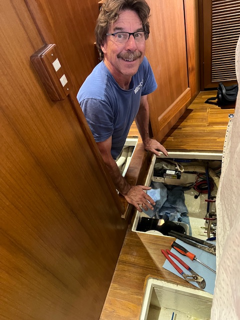
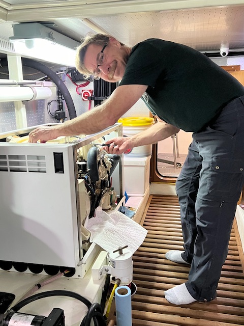
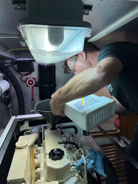
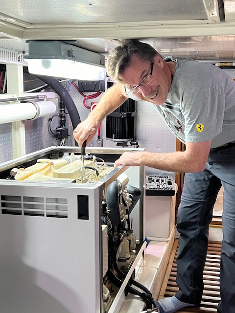
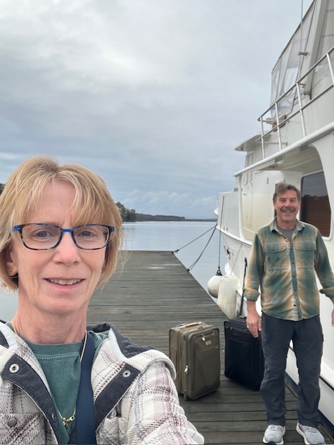
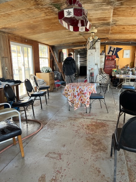
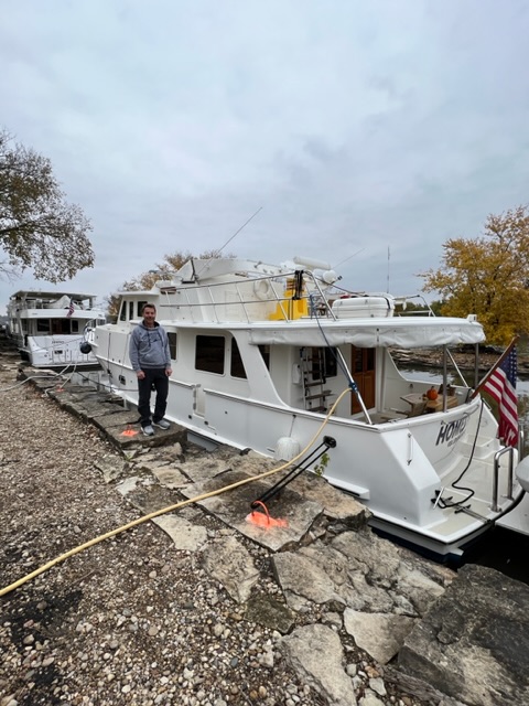
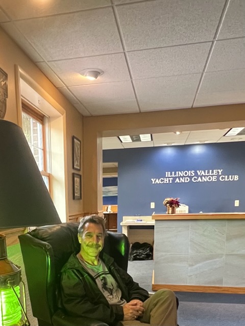
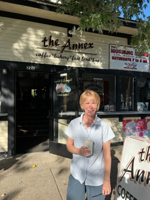
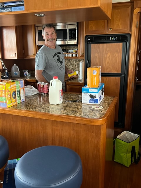
We had two reasons for booking into Fisherman’s Village Marina in Punta Gorda for a week-long stay. First, we have friends coming to visit for four days. Second, we need to have some deliveries…namely a refrigerator! Our refrigerator died back in Venice. We have been keeping our food cold in a tiny electric refrigerator, which came with the boat, but we had never used; and, a Yeti cooler full of ice. Our refrigerator was on its last leg and then I mistakenly finished it off. At the marina in Sarasota, Tim made yogurt. It wasn’t quite cool by morning, but I put it in the refrigerator anyway. The poor old refrigerator wasn’t able to handle the load. Fortunately, Tim tracked down a refrigerator in Fort Myers and it was delivered the day after we got to Punta Gorda, and the day before our friends arrived! Our old refrigerator/ freezer was a combined 7-cubic-foot unit. Our new one is 7-cubic-foot refrigerator and has a 2-cubic-foot freezer – which actually freezes food. Our old refrigerator only kept frozen food frozen. Things have come a long way since 2014!
Our new refrigerator!Our old refrigerator going away.Installing the new refrigerator. See the min-frig on the counter that saved a lot of our food.The wiring took some time.After 24 hours, it was ready to use!
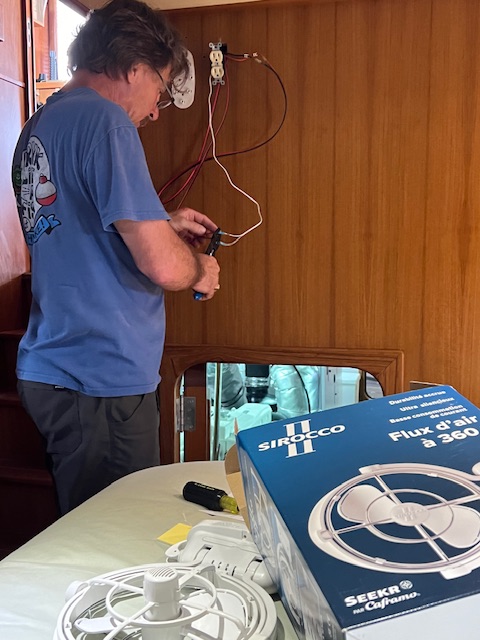
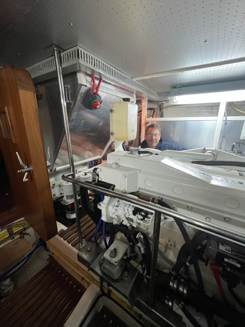
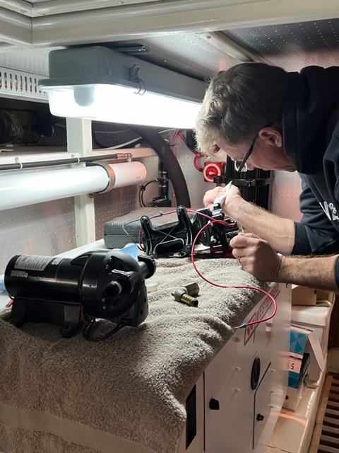
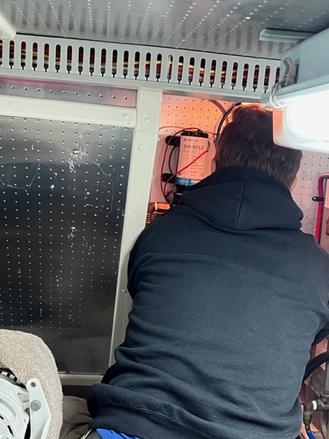
While Tim had the refrigerator pulled out, he also added a fuse box and wired up a fan for our stateroom. We had miscellaneous other spare parts delivered to the marina over our stay.
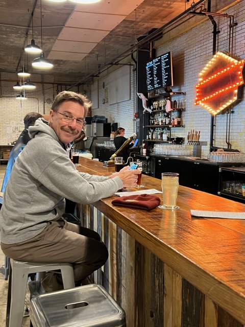
Installing the fan in our stateroom.Amazon love us this week.We still had time to walk up to Village Brewhouse for drinks.
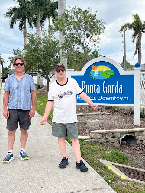
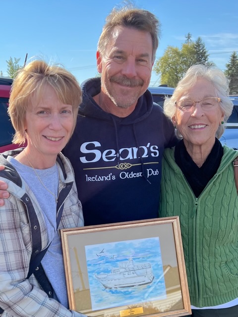
As I said, our second reason for staying in Punta Gorda was so that our friends could come visit us on their spring break. We had a fabulous time with them – visiting Punta Gorda, Manatee Park in Fort Myers, Cabbage Key (by ferry), and Stump Pass Beach State Park, where we found lots of sharks teeth.
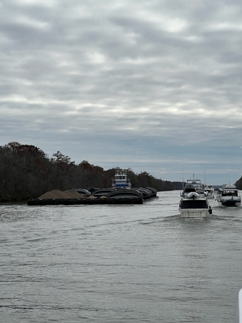
Heading to ACE Hardware and then TT’s Tiki Bar.Manatee Park. We didn’t see any manatee today.The captain of the ferry from Fishermen’s Village to Cabbage Key……let everyone drive.The extreme tides made for a great day to find sharks’ teeth Lounging on the top deck watching for dolphins in Charlotte Harbor.A trunk full of groceries!Heading off for a few more days of vacation.
Before leaving, Janet and Ewan took us to the grocery store in their rental car, so that we could fill up our new refrigerator! We stocked up on everything, because our plan is to anchor out until we get to Marathon, FL in the keys.
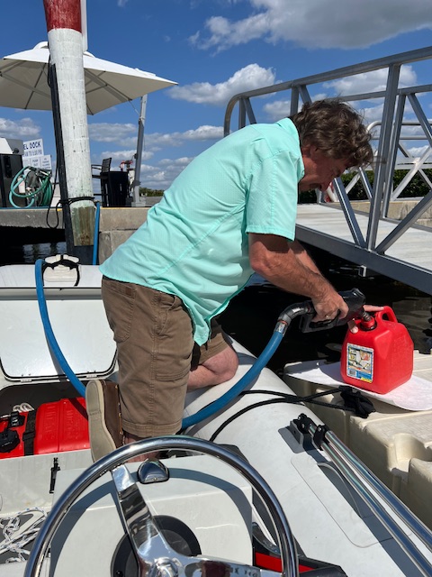
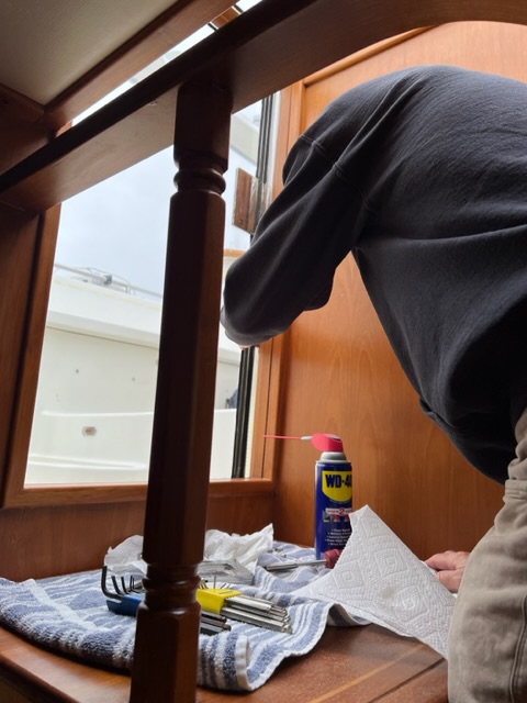
After Janet and Ewan left, we still had one day to prepare for the next leg to the keys. Tim finished installing the fan in our stateroom, which will be nice on nights at anchor. We got gas in the dinghy, as well as in the dinghy’s extra gas can. With that all done, we were ready for our next voyage.
Wednesday, March 13, 2024 – Fishermen’s Village Marina, Punta Gorda, FL to an anchorage near Sanibel Island
Today, we were underway 5 hours and 53 minutes, going 42 miles (36.9 nm), at an average speed of 7 MPH (6.3 knots).
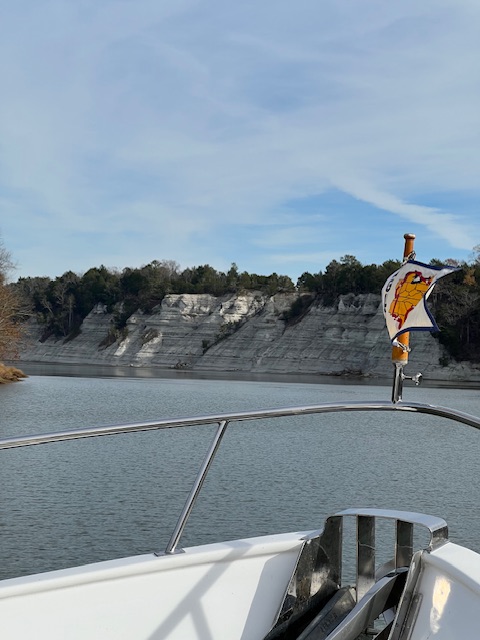
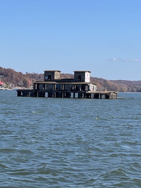
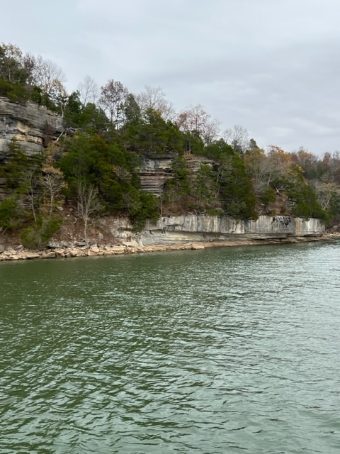
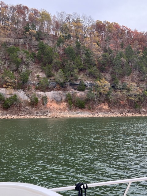
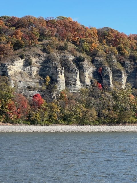
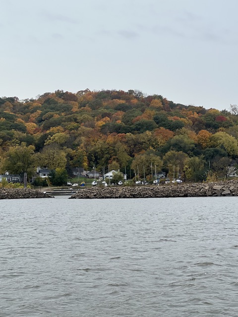
After passing Cabbage Key and entering Pine Island Sound, we were in new waters. Before reaching North Captiva Island, we passed Pine Island Sound’s Historic Fishing Shacks. These fishing shacks were built 100 years ago on stilts in the middle of the sound. All but one of them survived Hurricane Ian in 2022, while property on Captiva Island and Sanibel Island received devastating damage. That may say something for old fashion craftsmanship or maybe it was just luck. Either way, it was fascinating to see them standing alone in the water. Tonight, we were all alone in an anchorage in J.N. Ding Darling National Wildlife Refuge, near Sanibel Island.
Filling up the dinghy’s gas’s tank and spare tank.Leaving Punta Gorda after a week.The historic Pine Island Fishing Shacks.
Thursday, March 14, 2024 – Anchorage near Sanibel Island to anchorage near Marco Island
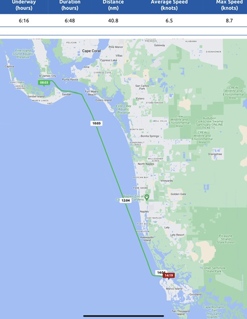
On our voyage today, we were underway 6 hours and 16 minutes, going 47 miles (40.8 nm), at an average speed of 7 MPH (6.5 knots).
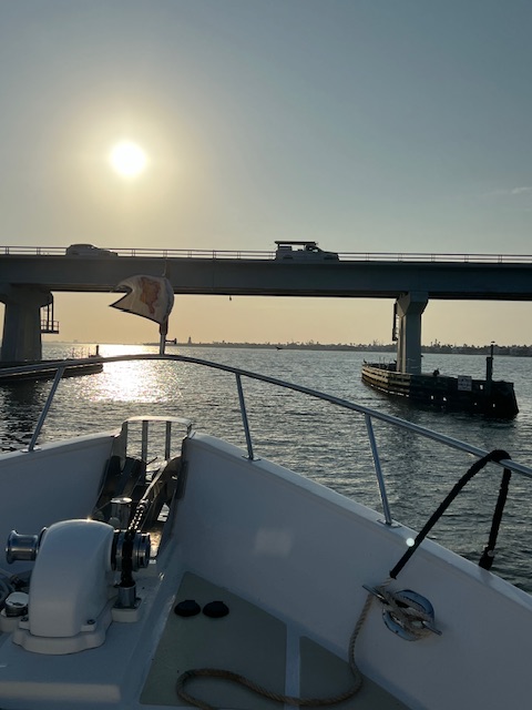
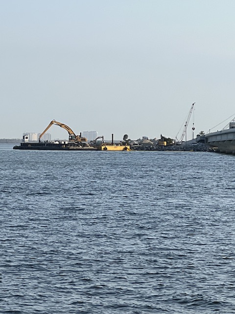
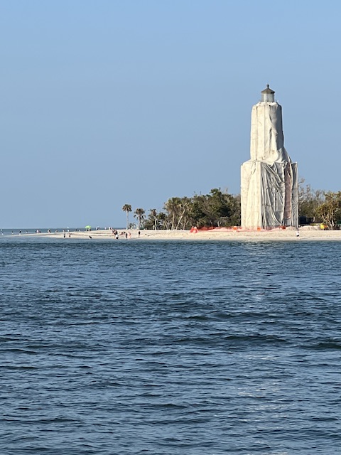
As we cruised under the Sanibel Causeway Bridge, we saw the ongoing efforts to repair the bridge, from damage sustained during Hurricane Ian. The Sanibel Lighthouse is still covered in tarps, with hopes of being repaired by 2026.
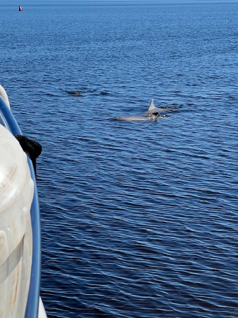
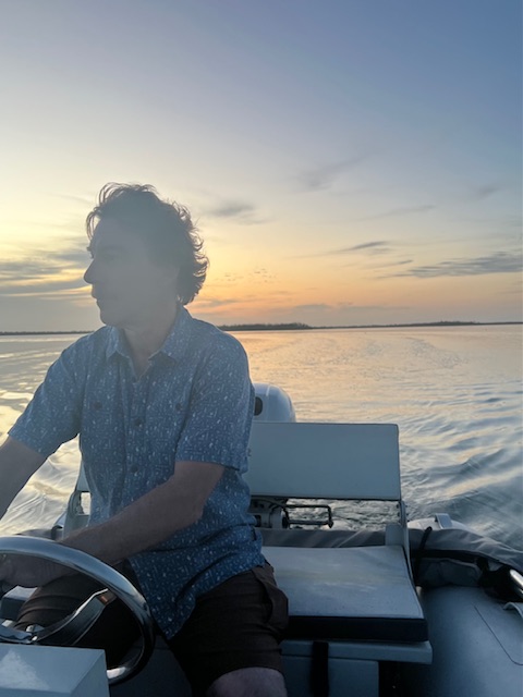
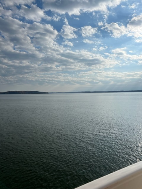
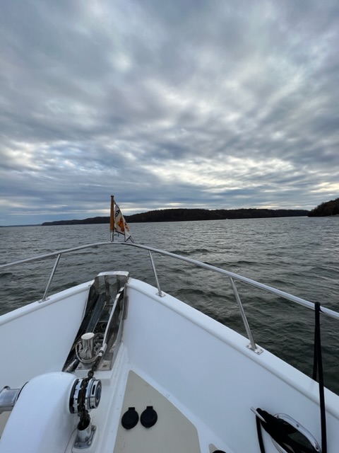
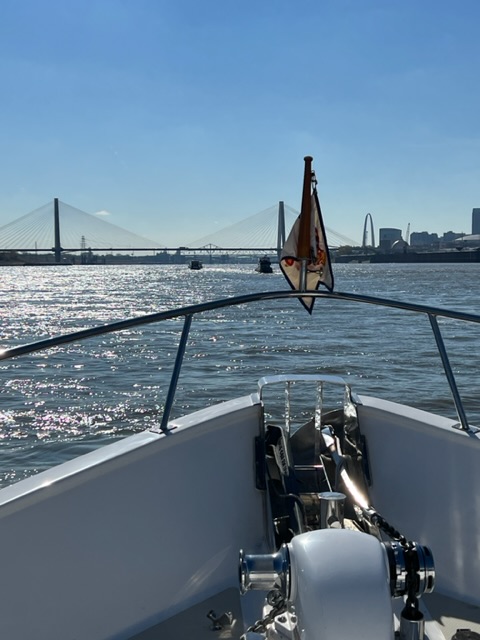
As we rounded Sanibel Island, we headed out into the Gulf of Mexico for the first time since our crossing. The Gulf was beautiful! With flat, open waters, Tim was able to use the autopilot and enjoy the scenery and watch as the dolphins ran with our bow.
Early morning cruise under the Sanibel Causeway Bridge.Ongoing efforts to repair the bridge.The Sanibel Lighthouse, which hopefully will be repaired by 2026.A very flat Gulf of Mexico!Enjoying autopilot on this big, open water!Watching the dolphins chase our bow.
By mid-afternoon, we pulled into our anchorage at Marco Island in Factory Bay. We didn’t need any groceries; however, Tim found a Winn Dixie with a free dinghy dock! It was a 25-minute dinghy ride through a canal network of houses. It probably would have been easier to pay $10 at the marina dinghy dock and walk a few blocks, but where is the fun in that! 😁
We found somethings to buy at Winn Dixie.Loading up the dinghy.Our dinghy ride to the grocery store.
Friday, March 15, 2024 – Anchorage near Marco Island to Anchorage in The Everglades National Park, near Everglades City, FL
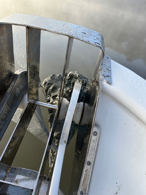
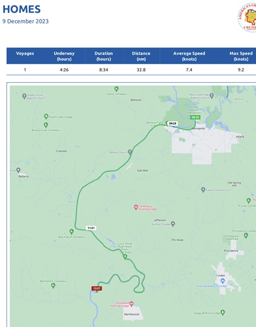
On our voyage today, we were underway 5 hours and 15 minutes, going 38 miles (32.8 nm), at an average speed of 7 MPH (6.2 knots). We pulled up a very clean anchor in Factory Bay and headed out from Marco Island and into the Gulf of Mexico. Our journey today was much choppier, with 2-3 foot waves. It wasn’t as an enjoyable ride as yesterday. It still amazes me that the Gulf of Mexico, where we’re traveling along the coast, is on 14-20 feet, and it will get shallower as we near the Florida keys.
Our anchorage in the Everglades was beautiful, but remote. Everglade City was about 4 miles away, up a made-man channel. If it wasn’t for our Starlink Dish, we would have been off the grid.
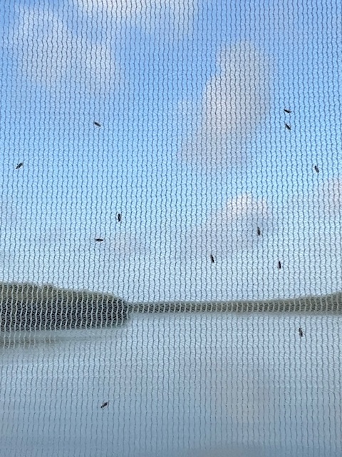
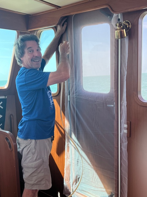
While the scenery was beautiful, we encountered our first biting midges, or as they are more commonly known –no-see-ums. They may be hard to see, but you definitely feel their bite! As always, Tim is prepared! Before starting our trip in 2022, he bought no-see-um netting to make screens.
Choppier water on the Gulf today, heading for the Everglades.HOMES all alone in the Everglades National Park.The no-see-sums are kept out my the netting Tim used as screens.
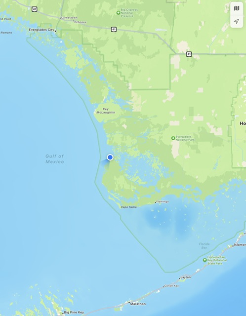
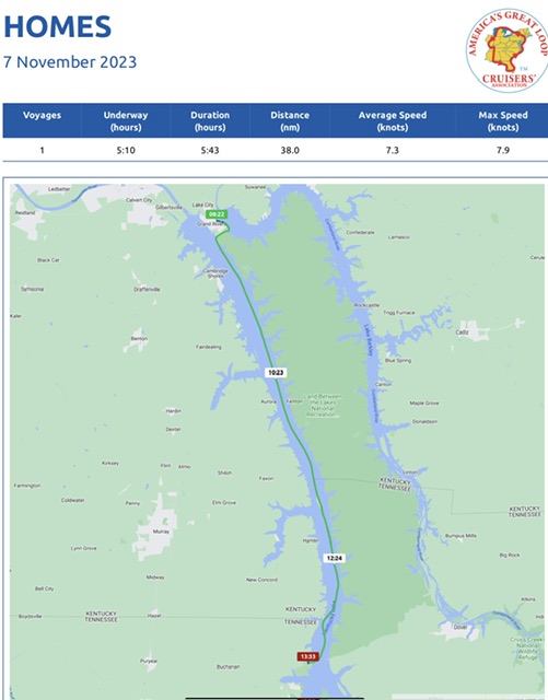
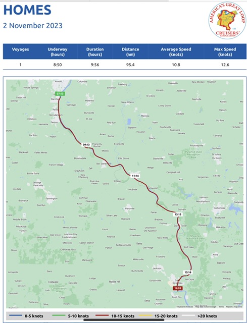
Saturday, March 16, 2024 – The Everglades National Park, near Everglade City to The Everglades National Park, on the Shark River, Monroe County, FL
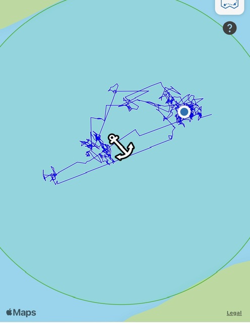
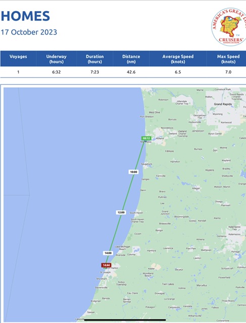
No Nebo log, but HOMES is the blue dot.
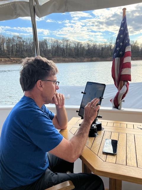
I have no Nebo log to share for this voyage, because we lost cell service. While our phones can work using Starlink, Nebo cannot. If you check our Nebo link, it looks like we are anchored in the Gulf of Mexico! 😁
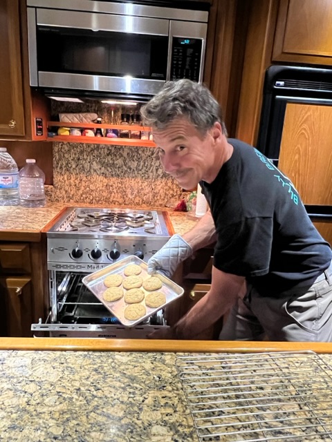
However, according to our Aquamaps, today we traveled 5 hours and 8 minutes, going 41 miles (36 nm), averaging about 7 MPH (6.5 knots). The Gulf was as flat as glass today, so I worked on my blog and Tim declared war on the no-see-ums. He spent the afternoon making screens for every door and porthole on the boat. In the evening, we got out our no-see-um mesh tent. He bought this tent back in 2022, but we never had a reason to use it…until now.
Because of the tent, we were able to sit on the back deck last night and enjoy the sights and sounds of the Everglades. The Shark River is tidal, so as we sat on the back deck, HOMES began to slowly spin 180 degrees, from high tide to low tide. After dark, the sounds amplified, with an orchestra of owls hooting, insects chirping, birds singing, fish splashing… what a wonderful evening!
Flat, open water allowed time to make screens……take that you no-see-ums!The path of our achor on this tidal Shark River.
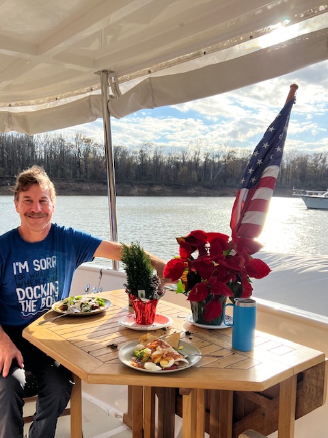
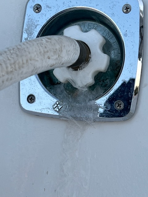
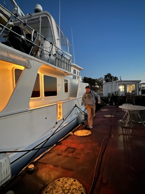
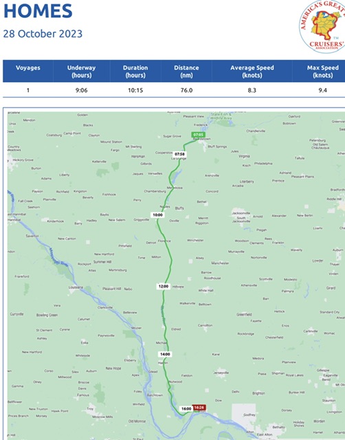
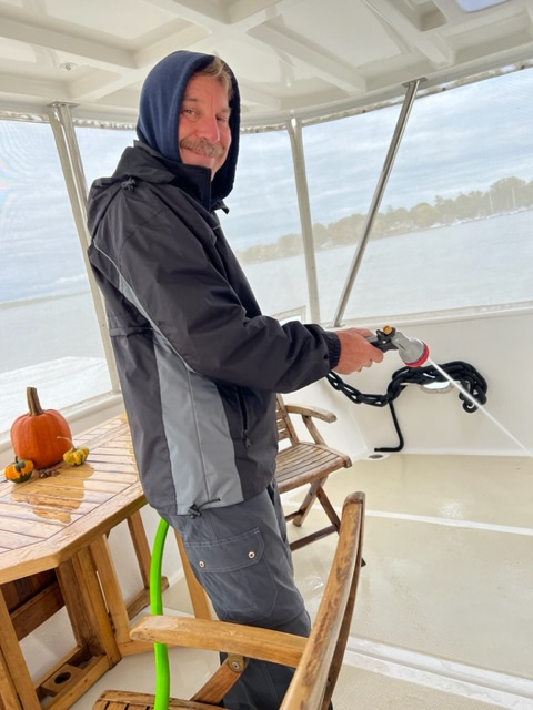
Today, Sunday, March 17th, we opted to stay at this anchorage for another night, because Tim preferred not to anchor near Marathon, FL on St. Patrick’s Day. We had plenty to keep us busy today. Since this is our 5th day at anchor, we were getting low on water. So, Tim turned on the water maker and filled all of our jugs, plus he filled HOMES’s water tank, even though that tank was still relatively full.
While I worked on my blog, Tim played on his ham radio. He was excited to make contact with a guy in Italy. Also, we made plans for our next few voyages. We have reservations for Thursday in Marathon at Marlin Bay Marina.
See you next Sunday. Thank you for following along!
Beth
17 Mar, 2024
Beth
17 Mar, 2024
Blog
Weeks 1-4, Part III – Feb. 9 – Mar. 3, 2024 – Mobile, AL to Cabbage Key, FL
Part III – Our final leg to complete our Loop!
Weeks 1-4, Part III – Feb. 5 – Mar. 3, 2024 – Mobile, AL to Cabbage Key, FL
Ahoy! My blog is back! During the month of February, we traveled 15 days, were underway 81 hours, and went 563 miles (489.5 nm). Of course, nearly 23 of those hours and 171.5 of those miles were added on our overnightcrossing of the Gulf of Mexico!
I’ll give a quick recap of our February travels and then hopefully get do a blog every Sunday again. I’m calling this Part III of our trip, because it’s the final leg of our journey back to Delray Beach, FL to complete our Loop – which is called “crossing our wake.”
We last left you when we were heading home for Christmas. We flew out of Mobile, AL on December 19, for a week-long trip home; however, it turned into a month-and-a-half stay, due to my mom having emergency surgery, which led her to decide to move to assisted living in Columbus. Despite the circumstances, our family still spent the holidays together – can’t ask for more than that!
Boarding our connecting flight from Atlanta to MobileHOMES Sweet HOMES!
Week 1, Part III – Feb. 6 – 11, 2024, Mobile, AL to Pensacola, FL
With Mom, settling into her new apartment at Wesley Glen and it was time to fly back to HOMES. We rented a car for two days to re-provision and to visit downtown Mobile during Mardi Gras. It was much livelier than our visit back in December.🎭
Before our first voyage, we had some maintenance to do on HOMES. Mobile got colder than we thought. A few nights got to below freezing, so Tim had to fix a broken water line. He also put on new windshield wipers and changed the glow plugs in the generator. Once we had our groceries unpacked and dropped off the rental car, we were ready to start the last leg of our trip.
Replacing the glow plugsInstalling 3 new wiper bladesAll provisioned up
On Friday, Feb. 9th, we resumed our trip, leaving Turner Marina, cruising out of the Dog River, and crossing Mobile Bay to the Gulf Intracoastal Waterway. We were underway 5 hours, going 36 miles (31 nm). Mobile Bay looks big, but outside the channel, it could be 1-4 feet deep!
After crossing Mobile Bay, we entered the Gulf Intracoastal Waterway (ICW). Completed in 1949, the Gulf ICW is basically a man-made ditch designed primarily to connect numerous rivers and waterways for barge transportation. The channel has a controlling depth of 12 feet. HOMES only need 4 feet 8 inches to float.
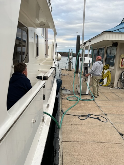
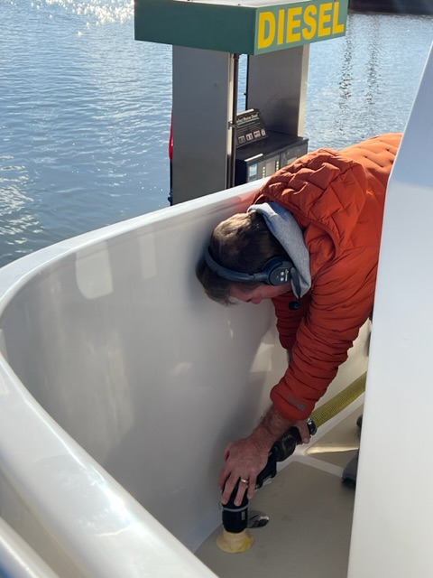
Our cruise took us to Homeport Marina, in Gulf Shores, AL, where we fueled up with diesel and pumped out our waste tank.
A freighter passing in front of us in Mobile BayFilling up and pumping out.Lu Lu’s of Gulfport was across from our dock, so we visited there for a drink.
On Saturday, Feb. 10th, we finally made it back to Florida! We were underway 4 hours and 39 minutes, going 32 miles (28.7 nm) to an anchorage near Gulf Breeze, FL. On Sunday, March 11th, it was too foggy to move in the morning and there was a storm heading our way. Once the fog cleared in the afternoon, we backtracked up to Pensacola, FL to tuck into a marina for two nights. In hindsight, we were glad the storm forced us into Pensacola, because we enjoyed its cute downtown and historic district. Also, we met a Looper family on their boat, Chasing Soulshine – we’ll come back to them later in the blog.
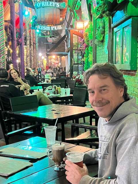
Backtrack up to Pensacola The marina was on Palafox PierWe found an Irish pub – O’Riley’s.
Week 2, Part III – Feb. 12-18th – Pensacola, FL to Carabelle, FL
HOMES nearing Destin, FLHOMES private dock in Destin Harbor
On Tuesday, Feb. 13th, we headed toward Destin. We had an anchorage picked out near Fort Walton Beach, but we couldn’t get the anchor to hold, so we ended up at a private dock in Destin Harbor. This is the off season, plus the area marinas are still recovering from damage caused by a tornado that hit the area on January 9th. Therefore, when we called a marina to see if we could get in, the dock master referred us to this private dock. We were underway 6 hours and 54 minutes, going 50 miles (43.1 nm); however, due to our anchoring attempt, our trip duration was 8 hours and 18 minutes. That was a long day.
On Wednesday, Feb. 14th, we left Destine Harbor and headed toward Choctawhatchee Bay. We avoided the area in Choctawhatchee Bay near Elgin Air Force Base where the U.S. Air Force detonated 3 WWII bombs, recently found in the Bay. We never thought that we’d need to avoid bombs while doing the Loop! From the Bay, we re-entered the Gulf ICW, which took us to West Bay. We spent the night at a beautiful anchorage, after being underway 6 hours and 44 minutes, going 54 miles (46.9 nm). It was sad seeing the sunken or beached boats along the way, from the January 9th storm.
Leaving Choctawatchee Bay……and entering the narrow IWCDolphins greeted us in West Bay.
On Thursday, Feb. 15th, we pulled up a muddy anchor in West Bay and traveled 7 hours and 32 minutes, going 56 miles (50.1 nm), to our next anchorage at Searcy Creek. Our voyage took us past Panama City, Fl, which was hit the hardest by the tornado. We later found out that two Loopers boats that we had traveled with had been totaled here at Point South Marina Bay Point. Thankfully, both couples sought refuge at a hotel and stayed safe.
I had a lot of squirting off to do this morning.A Looper on land took this picture of us going by Panama City.The two Looper boats that were totaled in the tornado. So sad.
After Panama City, we re-entered the narrow Gulf ICW, which connected us with Searcy Creek. Our anchorage for the night was off Searcy Creek in an “ox bow.” An ox bow is a u-shaped formation. We have anchored in several ox bows in the river systems. This one is on my list of favorites. It was narrow, so we had to put out a stern anchor to prevent HOMES from swinging into shore. We were sitting on the line separating the Central Time Zone with the Eastern Time Zone, so our phones and electronics periodically went back and forth. Luckily, we didn’t need to know what time it was.
Our anchorage on a Searcy Creek ox bowSetting the stern anchor to prevent swinging into shoreEnjoying the peaceful surroundings
On Friday, Feb. 16th, we checked the weather and it appeared that we wouldn’t be crossing the Gulf of Mexico until Tuesday. So, instead of heading to straight to Carabelle, FL today, we decided to add a stop at Apalachicola, FL for two nights. It was worth the stop! Aplalachicola Marina was nothing more than a dock for about 2-3 boats, situated near quaint downtown of locally-owned restaurants, shops and galleries. Granted we were here at the off-season, but it seems like this is a hidden gem. It is known for some of the finest oysters by top chefs throughout the country. Apalachicola harvests over 90% of the oysters sold in Florida and 10% nationwide.
HOMES sitting at Apalachicola MarinaSeveral locally-owned coffee shops and restaurants for us to indulge our coffee and craft beer obsession Apalachicola is known for its fishing and seafoodOur “Gulf-Crossing” Group – HOMES, Next Adventure and ClasSea
On Sunday, February 18th, we left Apalachicola, after a two-night stay, and headed to Carabelle, FL. Our voyage took 4 hours, going 29 miles (25.6 nm). It was so cold that we almost turned the generator on so that we’d have heat. At Apalachicola, we met two other Loopers. We all traveled to Carabelle together and will do the crossing of the Gulf of Mexico together on Tuesday. The marina in Carabelle, C-Quarters Marina, was nothing fancy, but Carabelle had a grocery store and a hardware store to help us get ready for our crossing.
Week 3, Part III – Feb. 19 – 25, Carabelle, FL to Clearwater Beach, FL
On Tuesday, February 20th, around 1:00 PM, we pulled away from the fuel dock at C-Quarters Marina in Carabelle to begin our overnight crossing – our fuel tanks were full and our refrigerator was full. ClasSea left before us and Next Adventure brought up the rear. Next Adventure is a faster boat, so they passed us around 4:00 AM. After leaving the fuel dock, we made our way out of the Carabelle River and across Apalachicola Bay. We entered the Gulf of Mexico around 2:00 PM, with flat water and sunny skies! We lost cell service around 4:40 PM, but two dolphins came at about the same time, which is better than anything a phone has to offer!
Fueling up!On the Gulf of MexicoDolphins traveled with us off and on
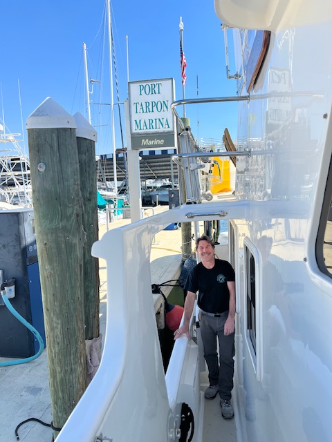
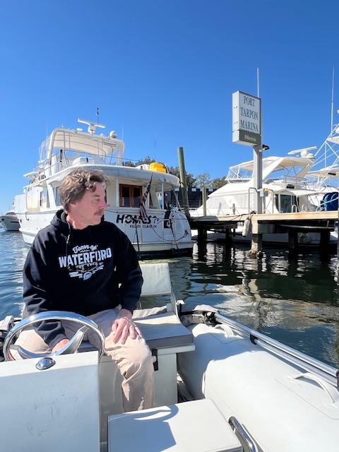
The sun began to set around 6:30 PM and we had dinner. I slept from around 8:00 PM until taking my watch at midnight. Tim relieved me around 4:30 AM. I then dozed again until sunrise. We got back our cell service back around 8:30 AM. It was somewhat of an eerie feeling knowing that you are totally off the grid. We were only in radio range of the two boats around us – usually about 5 miles apart. However, we were so prepared that there was no fear. We pulled into Port Tarpon Marina in Tarpon Springs, FL, after being underway 22 hours and 49 minutes, going 171.6 miles (149.1 nm). The duration of our trip, which includes getting fuel and docking, was 25 hours and 18 min. Crossing the Gulf of Mexico is probably the biggest milestone for all Loopers. Our next big milestone will be crossing our wake (finishing our Loop) in Delray Beach, FL…which is getting closer!
Sunset on the Gulf of MexicoDinner in the pilothouse12:47 AM – this the view during my watch. Nothing interestingWe made it through the night!Our bed was this bench in the pilothouse25+ hours after leaving Carabelle, FL, we were docked Tarpon Springs, FL
After a little nap nap from around 12:30 PM to 2:00 PM, we took the dinghy to explore. Not far from the marina, we saw a guy whose boat had died. We towed him back to his marina and on the way, he gave us some suggestions on where to eat and what to do in Tarpon Springs.
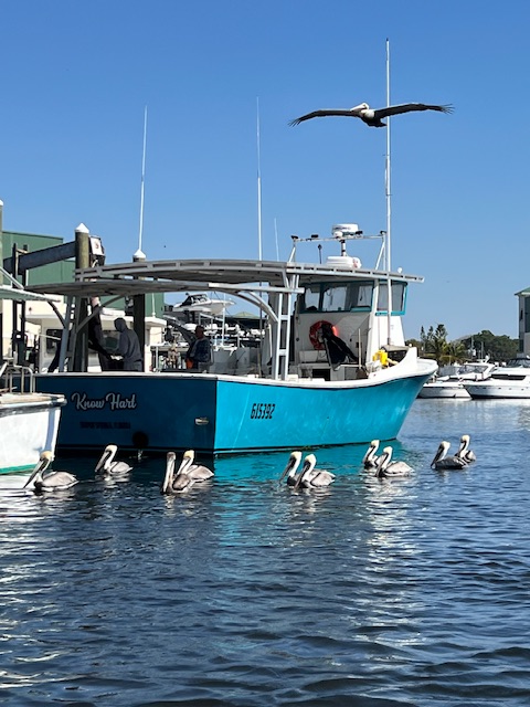
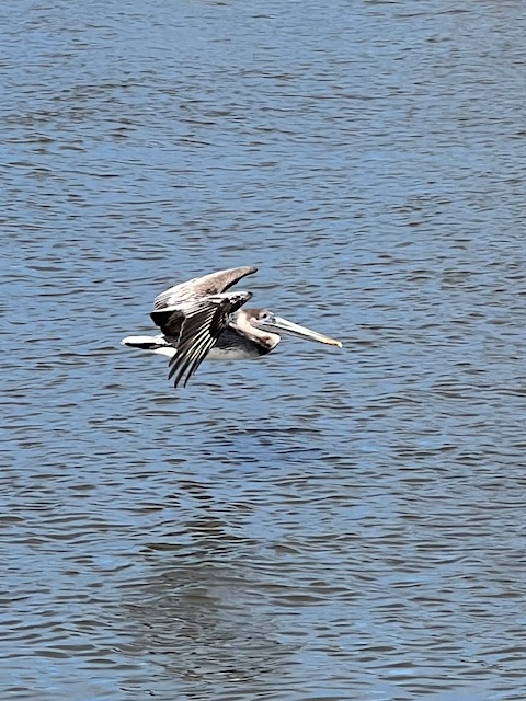
To the rescue! Tim lied a line on the boat and we pulled him to his marina.I love the pelicans!
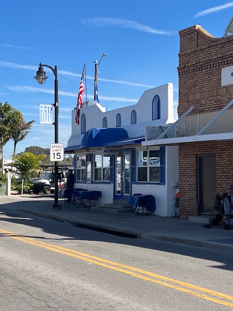
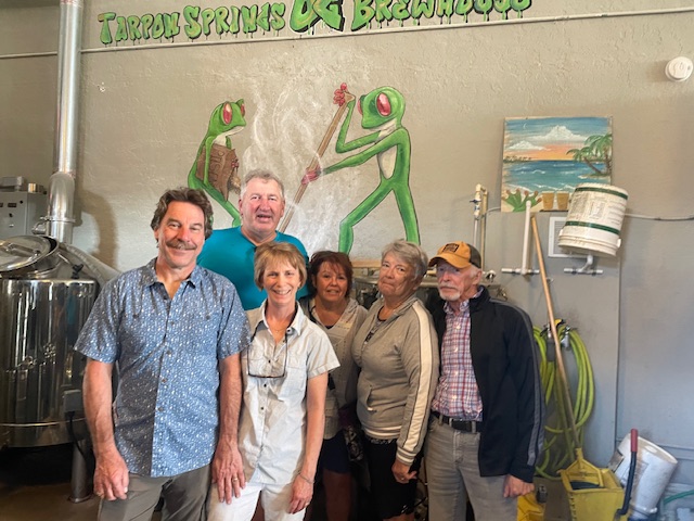
Thursday and Friday (Feb. 22 -23) were layover days in Tarpon Springs. On Thursday, we did some cleaning before taking the dinghy into Tarpon Springs for some Greek food at Mykonos, on the Sponge Docks. In the late 1800s, these waters were teeming with sponges and it was Florida’s most lucrative maritime business. Greeks brought experienced diving crews to Tarpon Springs. By using rubberized diving suits and helmets, they increased the harvests. By 1905, over 500 Greek sponge divers were at work on 50 boats. In the 1940s, blight reduced the growth of sponges. By the 1950, sponging, as a profitable industry, was nearly wiped out. However, in the 1980s, new sponge beds were found and Tarpon Springs is now back to being a leader in the worlds’s natural sponge market.
Finally warm enough to was the boatSponges hanging to dryMykonos Greek restaurant along the Sponge DocksWe continued our walk into historic downtown Tarpon Srpings……and found Two Frogs Brewing Co., where we got lots of local knowledge from the bar keep Back to HOMES after a busy day walking around Tarpon Springs
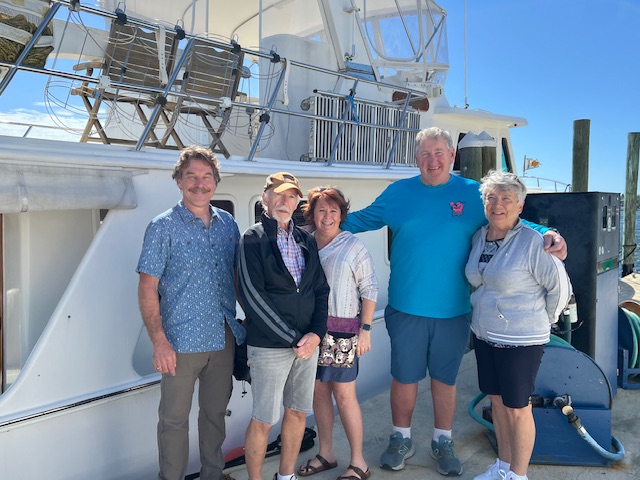
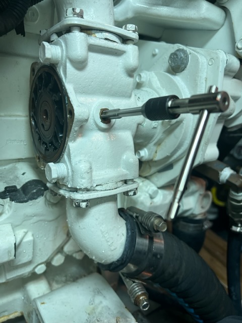
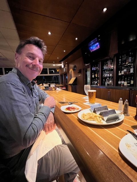
On Friday, we had a visit from friends. Willie and Theresa drove to Florida to vacation with Roberta and Dennis, who have a home at The Villages, FL. It was so nice to see them and give them a tour of HOMES for the first time. We spent the afternoon in historic downtown Tarpon Springs, having lunch at Johnny’s Taphouse and Grill and visiting Two Frogs again, plus Brighter Days Brewing Co. In the evening, Tim cleaned out the air compressors of the stabilizer system. We discovered that they were overheating during our overnight passage of the Gulf. This evening, Tim discovered they were clogged with black “gunk.” He’s not sure what the gunk was, but with it gone, the stabilizers are working well again. If you recall, the stabilizers are the four fins under the boat that keep us from rocking in the waves while cruising – especially helpful when a boat zips by, creating a big wake.
Tim, Dennis, Theresa, Willie and RobertaTim, me, Willie, Theresa, Roberta and Dennis at Two Frogs Brewing Co.Cleaning the air compressors.
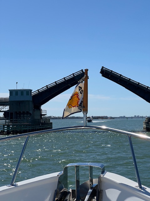
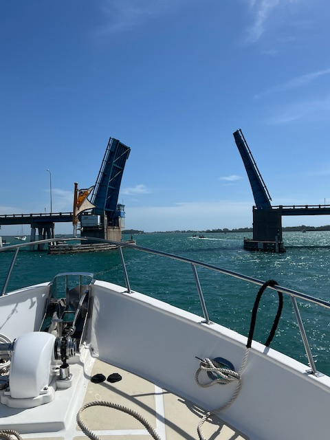
Saturday, February 24th, we traveled 3 hours, going 21 miles (18.2 nm), to Clearwater Beach, FL. Dunedin Causeway Drawbridge needed to be raised for us. We caused quite the traffic back up! Unfortunately, during the entirety of our trip, we watched a Coast Guard helicopter and Sheriff boat searching for a lost kayaker. As we left Clearwater on Monday morning, we heard a shrimp boat captain radio the Coast Guard saying that he found a floating body. The Coast Guard quickly had him call a telephone number, so we didn’t hear the rest of the story.
Dunedin Causeway Drawbridge lifting for us.…and causing a traffic jam.Coast Guard helicopter on a search mission.
By Saturday, mid-afternoon, we had successfully made it through the shallow waters off the ICW that took us to Clearwater Beach Municipal Marina, where we’d being staying for two nights. We had our waste tank pumped out before docking. We thought that we were going to pump out while crossing the Gulf of Mexico, but we discovered that our waste-discharge pump wasn’t working. However, we thought it might not work, so Tim had the parts to fix it. We can only use the discharge pump when we are 9 miles off the Gulf Coast or 3 miles off the Atlantic Coast. So it is fixed for now, but we can’t use it.
Pumping out the waste tank.Clearwater Beach, FLFixing the waste-discharge pump.
Tim’s sister, Laurie, came to visit on Sunday,February 25th for the day. We walked around Clearwater Beach – the town and beach – but it really isn’t our type of place. It was very crowded with tourists/ beach goers. However, it was great to see Laurie and we had a great time people watching and searching for a shell ring in the souvenir shops. The tiny restaurant/ bait house on the dock with the marina, called Bait House, had excellent food and was a great place to talk and watch the pelicans.
Lunch at the Bait House.Setting the tide clock that Laurie bought us for Christmas……because last night was the full moon.
Week 4, Part III – February 26 – March 3 – Clearwater Beach, FL to near Cabbage Key, FL
Walking back from Publix. HOMES is in the background.Leaving Clearwater Beach.
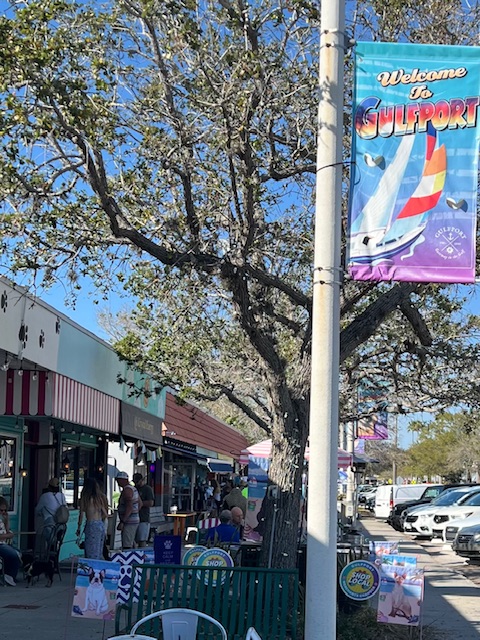
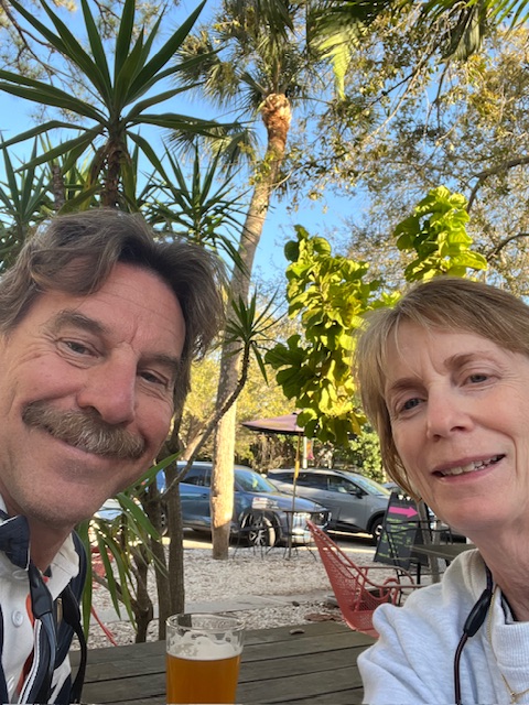
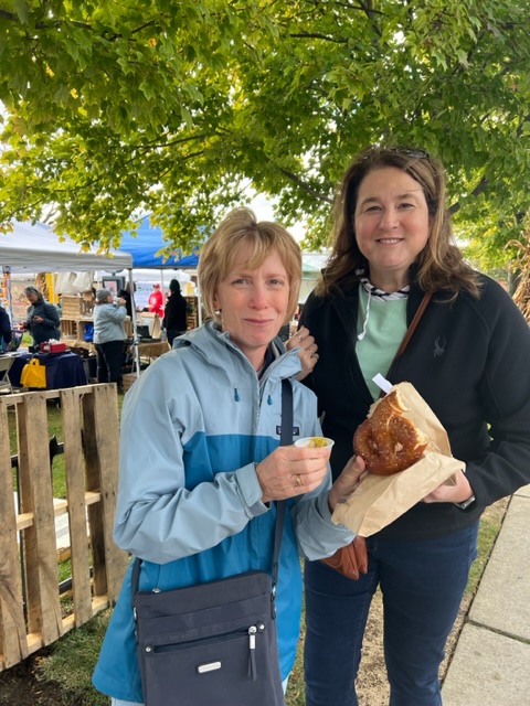
On Monday, February 26th, before leaving Clearwater Beach, we walked about a mile each way to Publix Super Market to stock up on food. We left Clearwater Beach around 10:30 AM and cruised 3 hours and 24 minutes, going 23 miles (20.2 nm), to an anchorage near Gulfport, FL. We took the dinghy into Gulfport’s free dinghy dock and immediately fell in love with this quaint little town, with its laidback, hippie-type vibe. The owner of a little art gallery told us that we should stay tomorrow for Tuesday’s Fresh Market. This year-round market has locally produced goods, locally grown produce, breads, cheese, desserts…need I say more? We immediately decided to stay another day.
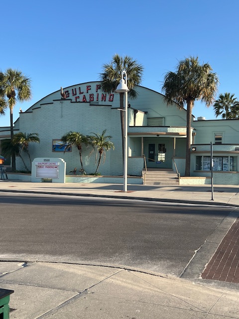
Gulfport’s Beach Blvd. is lined with locally-owned shops, restaurants, a brewery and galleries.Gulfport Brewing Co. was a nice place to watch life go by.Bringing the dinghy back from GulfportThe “Casino”means “meeting place” – never been a gambling place. Still a meeting place and dance hall.Having coffee and cinnamon roll from a Tuesday Market vendor.Bringing the dinghy back in the dark.
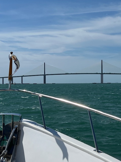
Wednesday morning, Feb. 28th, we pulled up a sandy anchor and headed toward Sarasota, traveling 7 hours and 18 min, going. 48 miles (41.4 nm). Because of shallow water, we cruised up into Tampa Bay and then down, going under the Sunshine Skyway Bridge (I-275). This bridge is considered the flagship bridge of Florida and serves as the gateway to Tampa Bay. This is the second bridge at this location and opened in 1987. There is a toll to go across, but HOMES cruised under for free. 😁
The Sunshine Skyway Bridge – I-275.Going under the Sunshine Skyway Bridge.Manatee River – Cortez Rd. Drawbridge.
Tampa Bay, like all of the other bays that we have experienced, is very shallow outside the channel. We left the choppy waters of Tampa Bay behind and entered the Manatee River. The water of the Manatee River was flat, but the Cortez Rd. Drawbridge had to be opened for us. We were hoping to anchor near Sarasota, but the anchorage wasn’t protected – add in the wind, shallow water and the anchor not setting, we opted to go to Marina Jack in Sarasota. Due to our anchoring attempts, we got into the marina after 5:00 PM. With our anchoring attempt, the duration of our trip was 8 hours and 25 min, but we still took a little walk around Bayfront Park. On our walk, we met a young English guy and his girlfriend. Hearing his accent, we asked him about narrowing boating the canals of England. Ironically, his brother had just sold his narrow boat that morning. He said most Americans, like his girlfriend, don’t know what a narrow boat is. He seemed pleased that our bucket list includes renting a narrow boat and cruising the canals of England.
Our view of Sarasota from Marina Jack.An evening walk at Bayfront Park.A relaxing evening.
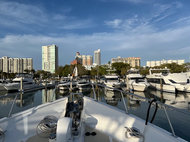
On Thursday, Feb. 29th, we spent the morning walking around downtown Sarasota. We found Ofkors Bakery and got coffee and a delicious “lobster tail,” which is like a huge cream horn. Our journey today took us 17 miles (14.8 nm) to Venice, FL. We hadn’t originally planned to go to Venice, but we decided to see if we could find space at the marina. By the time we got a call back from Crow’s Nest Marina saying they had room for us after 1:00 PM. We were already on our way…so, we had 4 hours to go the 17 miles. We went an average speed of 5 MPH (4.1 knots) – which is slow for even HOMES! However, it gave us plenty of time to enjoy the views along the Gulf ICW, which included a lot of big homes along both sides, a swing bridge and drawbridge.
A “lobster tail” and coffee at Ofkors Bakery – Main St., SarasotaBlackburn Point Bridge – 1925 historic swing bridge.Albee Rd. Drawbridge – 1 mile from the Venice Inlet.
When we arrived at the marina, the Looper family, on Chasing Soulshine, was just pulling out. We exchanged shouts and waves as we passed. Remember, we met this family back in Pensacola and I said that we’d get back to them. Well, shortly after docking, we got a message on Nebo asking if we could do them a huge favor. Their two girls had left their laundry in the dryer at the marina. After a good laugh on both sides, we made arrangements to deliver their laundry to them tomorrow. 😁
Today, it was FINALLY warm enough to break out the shorts and sandals!! Later in the afternoon, we enjoyed the 1.3 mile walk into historic downtown Venice. The marina had free bikes, but we enjoy walking. On our way back to the marina, we walked along Venice Beach. In the evening, we had drinks with the Looper couple on Lady Grace Marie at the marina restaurant, The Crow’s Nest. We had been traveling with Lady Grace Marie off and on since Gulfport, but this is the first time that we really met. It was a nice evening!
Coming into Venice FL.Chasing Soulshine leaving.First day warm enough for shorts!!Crown’s Nest MarinaWalking Venice Beach back to the marina.
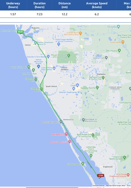
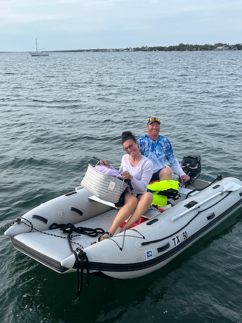
On Friday, March 1st, we traveled about 2 hours, going 14 miles (12.2 nm), to an anchorage near Englewood, FL – to make the laundry delivery. We had a nice afternoon visiting with Chasing Soulshine and drinking the beer that they insisted we take as the delivery fee. 😂
We spent two nights at this anchorage, since we didn’t have time to explore Englewood after visiting with Chasing Soulshine on Friday. So, on Saturday morning, we took the dinghy into the free dinghy dock at Indian Mound Park and walked into Englewood. Due to a car show, it was very crowded, so we didn’t stay long.
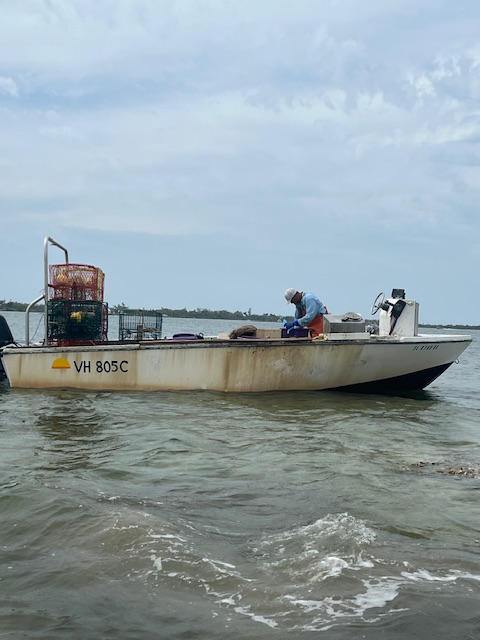
This anchorage is large, but had a lot of crab or oyster pots. We watched a fisherman tending his pots. We could see him measuring whatever he was catching. This anchorage also had some sunken boats, which looked like they had been there a long time. These types of obstacles can make anchoring a challenge.
Taking their laundry back home.This anchorage was full of crab or oyster pots. This fisherman is measuring what he has caught.The free dinghy dock at Englewood, FL.
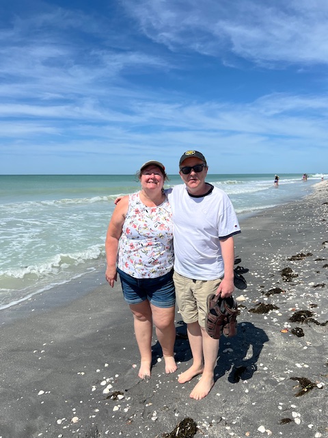
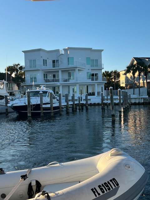
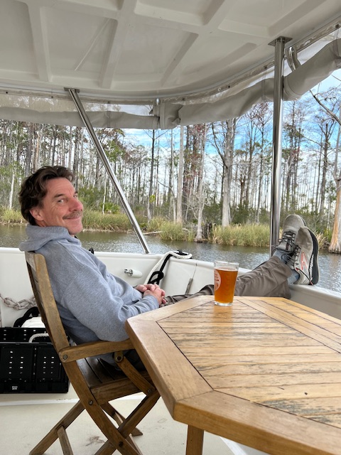
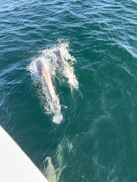
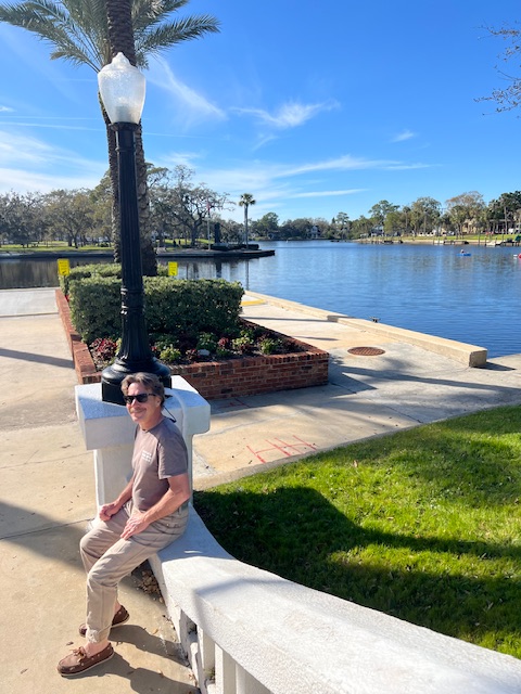
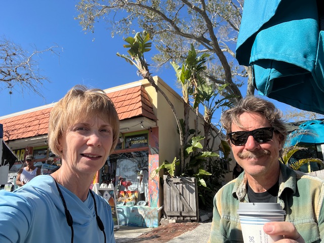
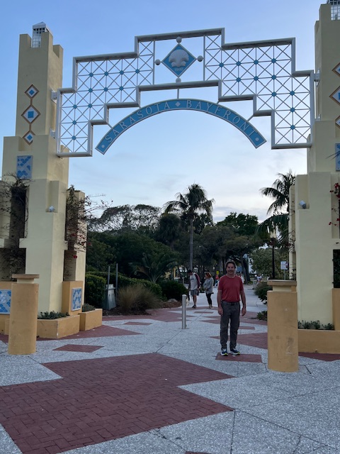
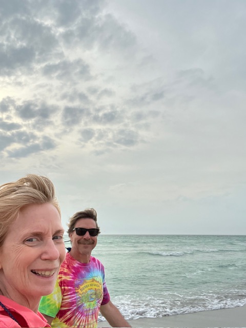
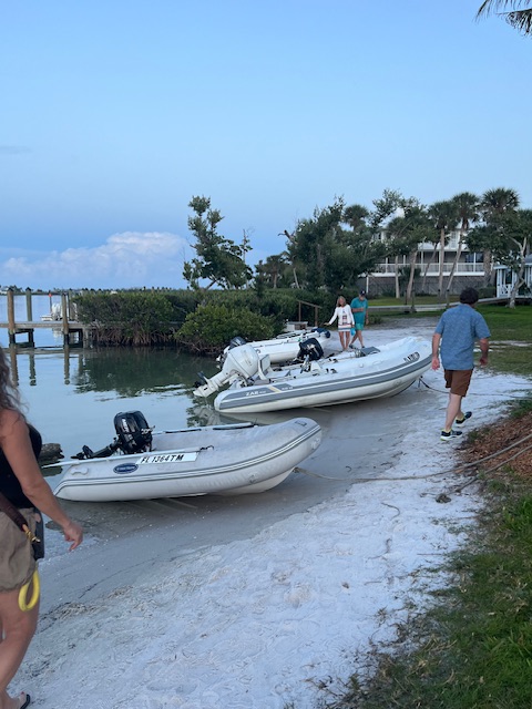
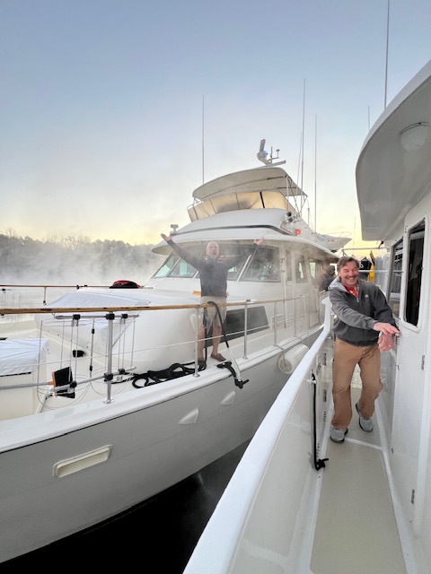
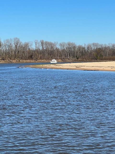
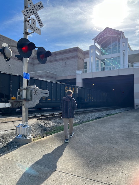
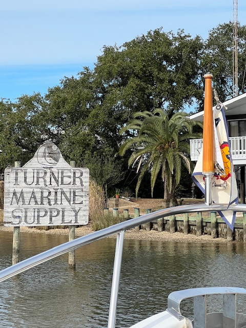
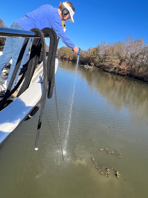
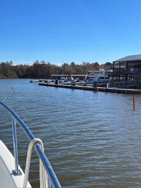
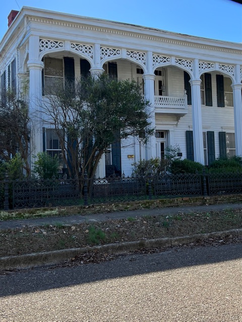
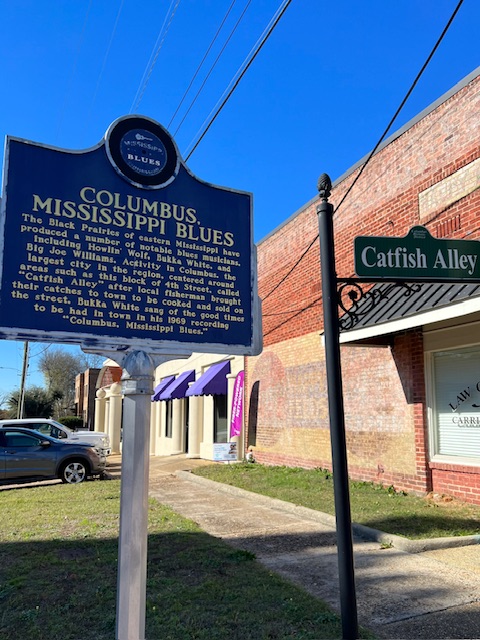
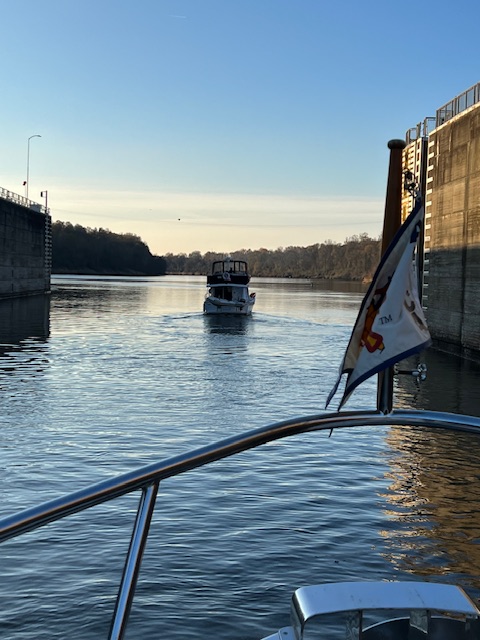
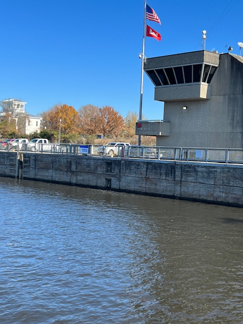
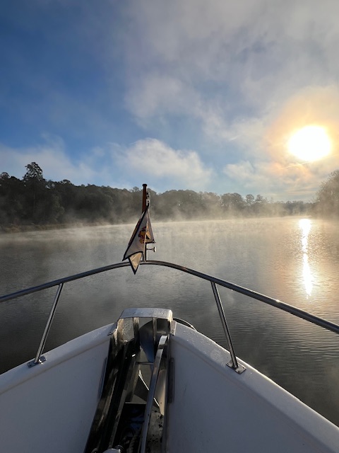
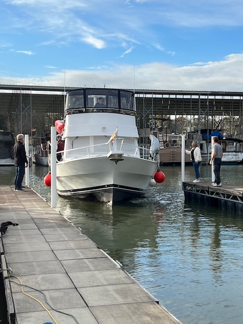
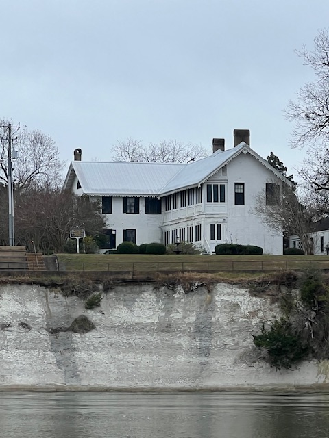
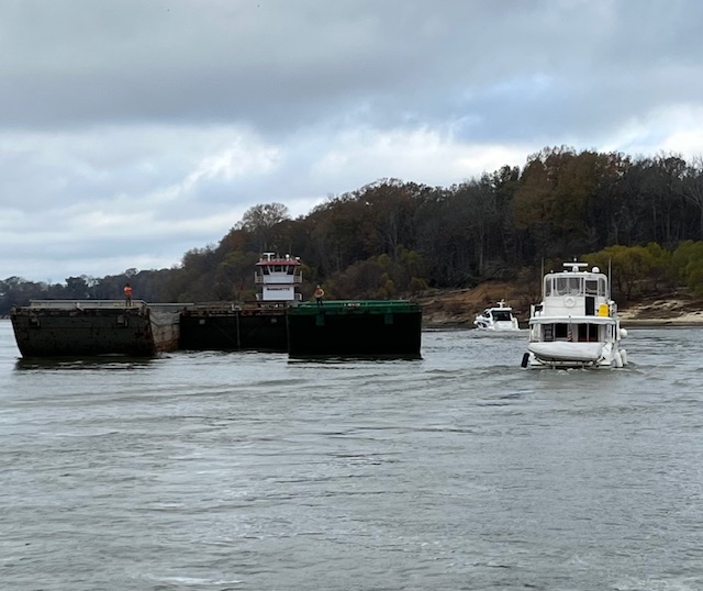
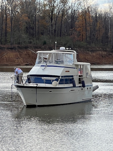
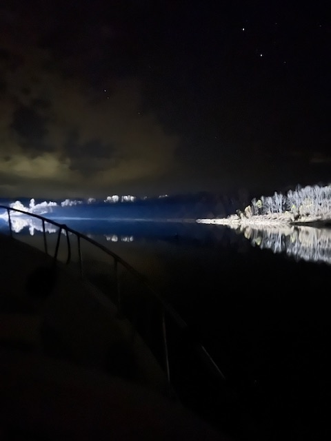
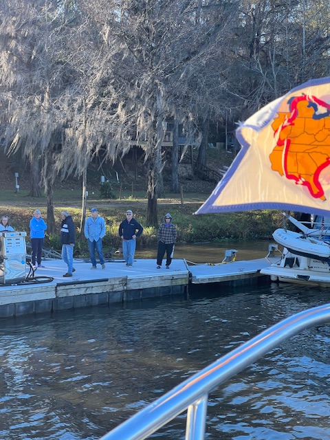
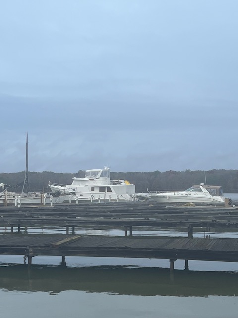
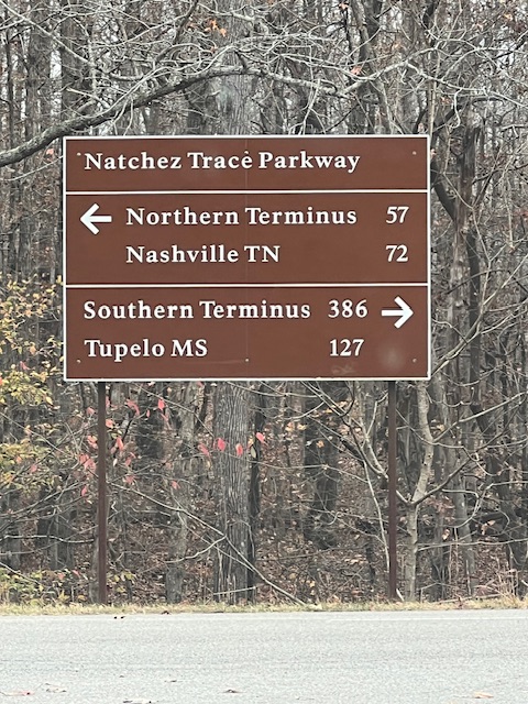
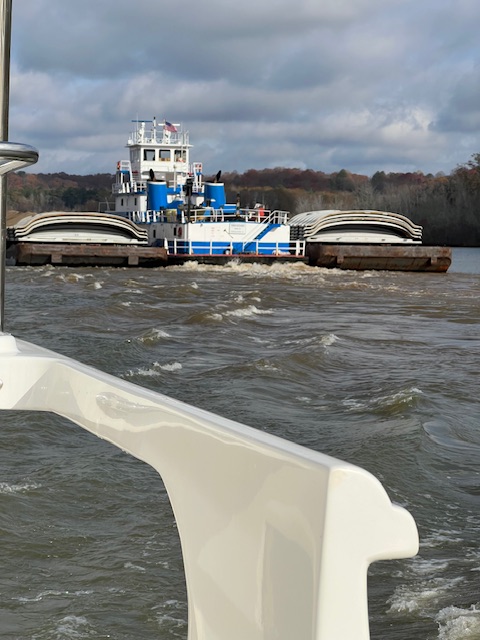
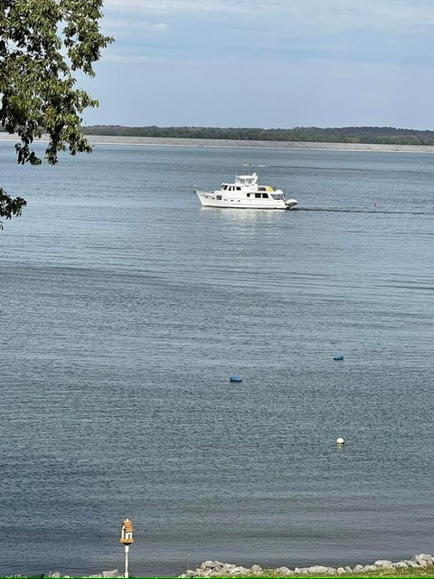
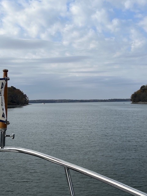
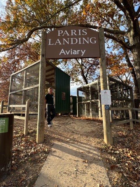
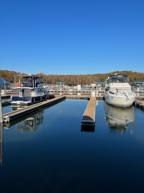
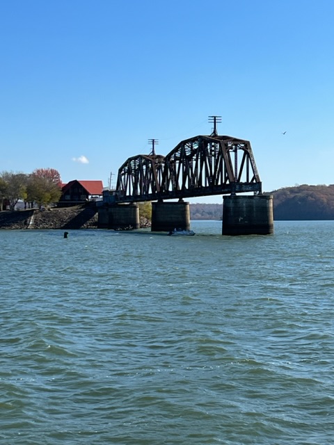
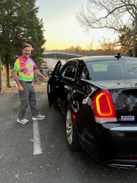
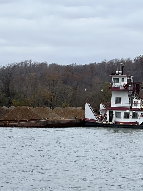
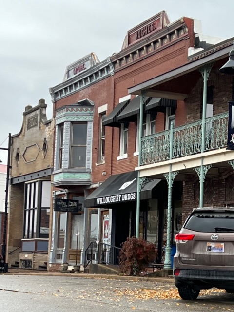
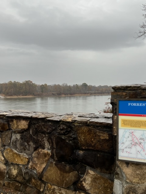
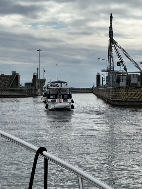
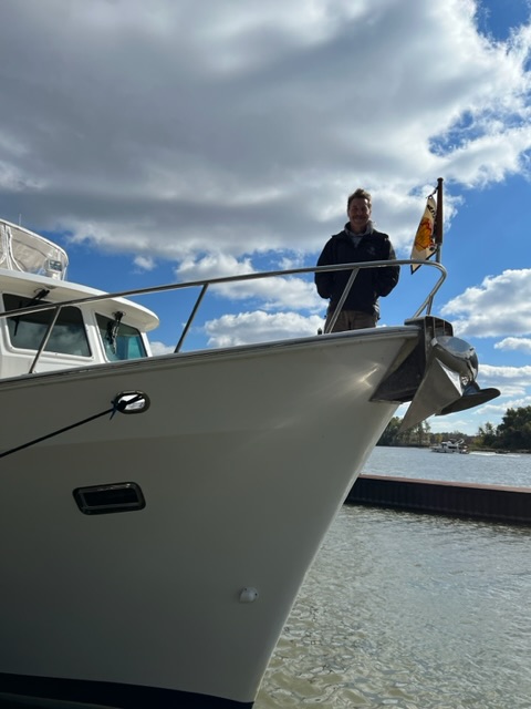
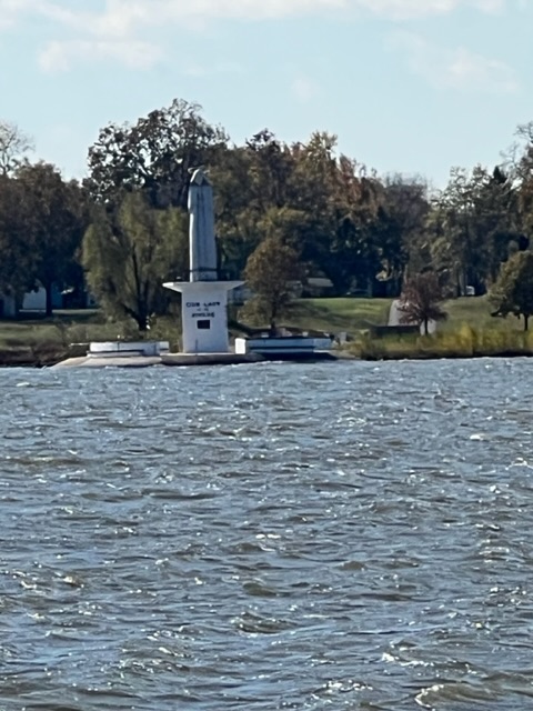
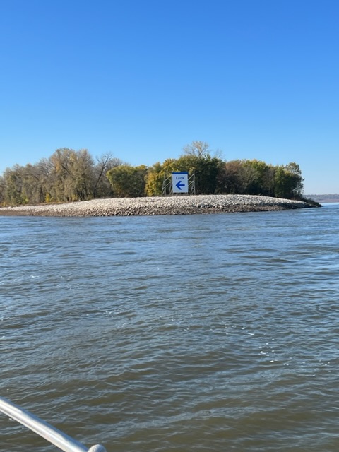
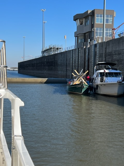
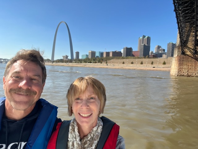
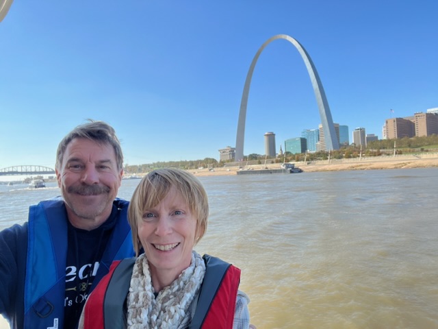
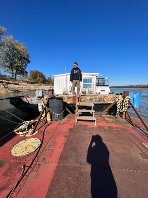
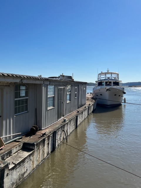
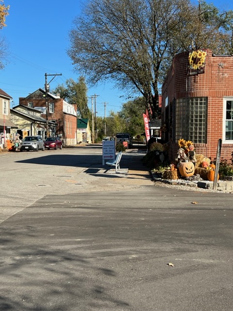
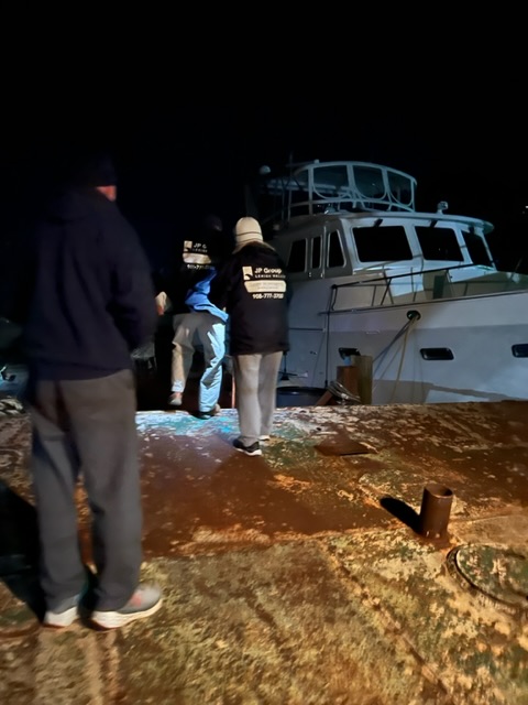
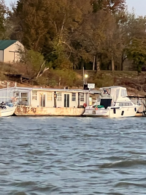
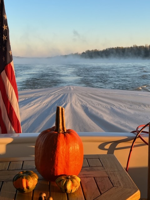
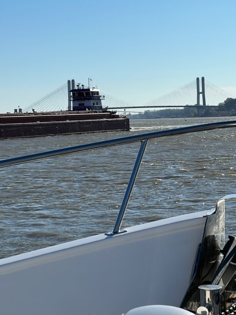
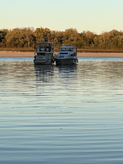
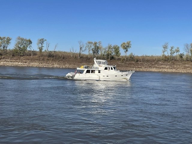
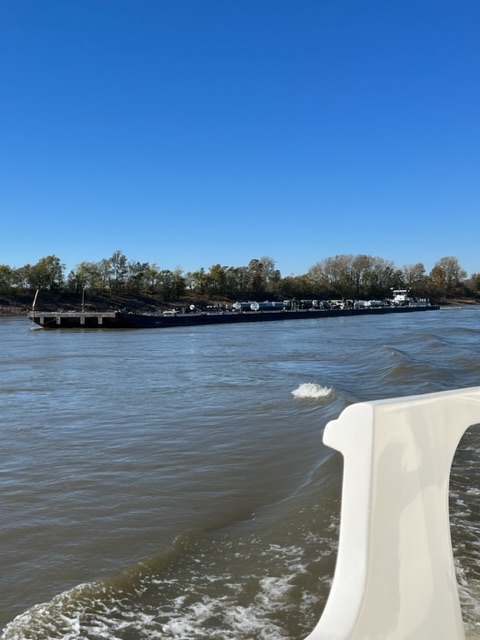
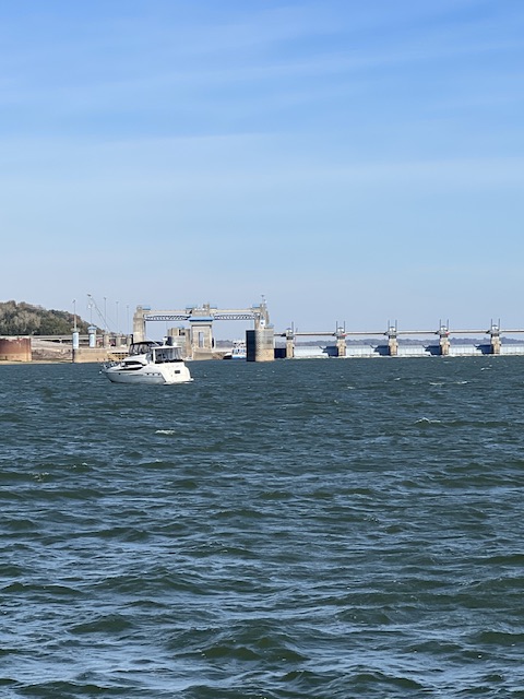
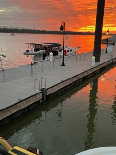
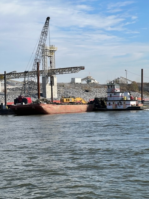
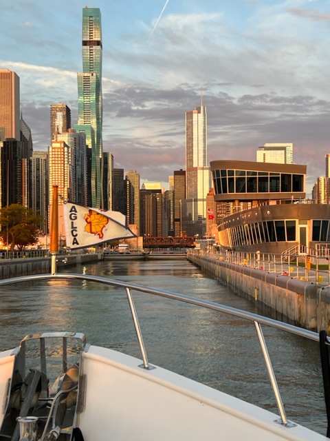
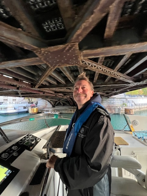
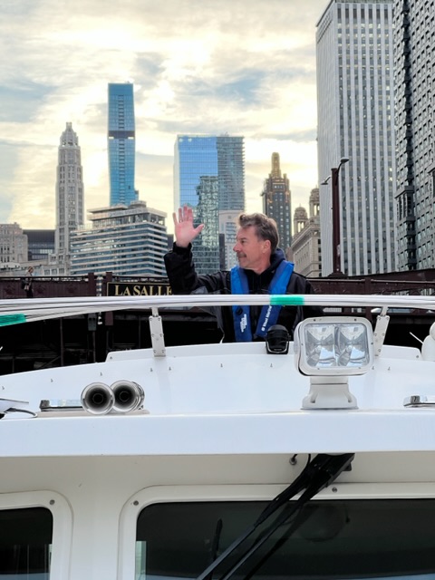
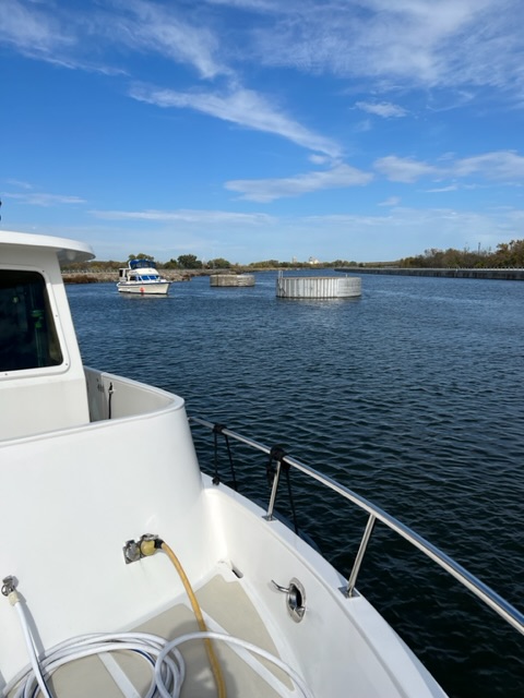
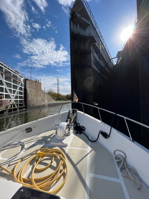
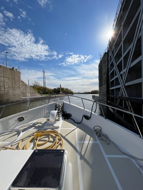
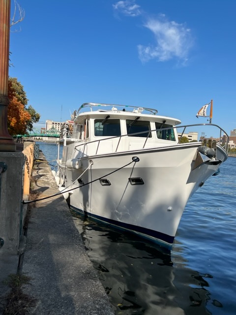
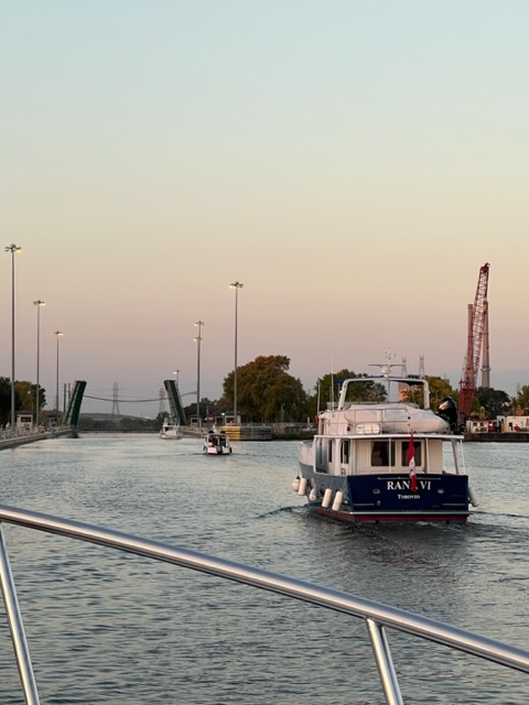
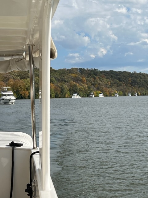
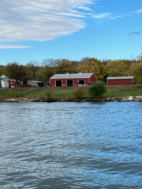
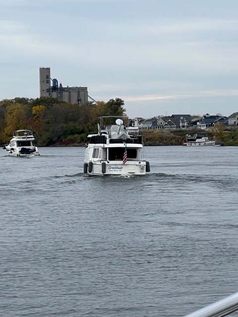
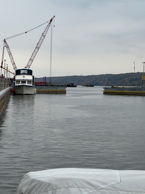
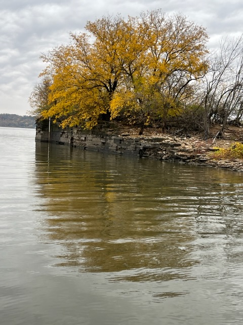
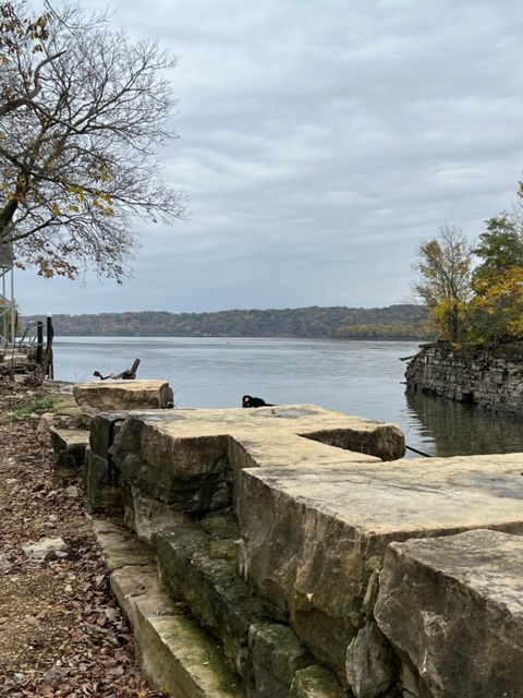
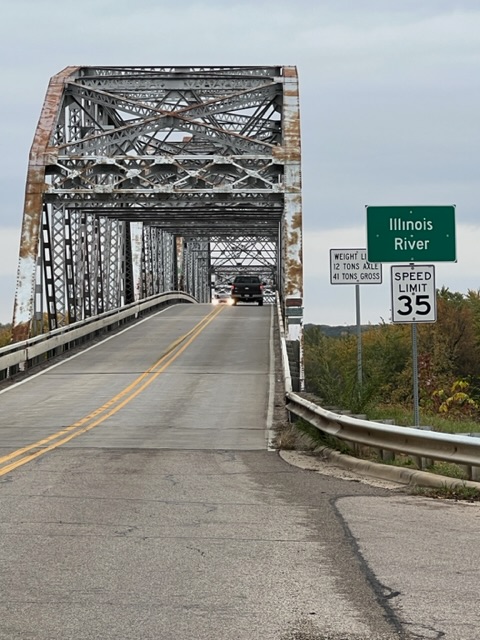
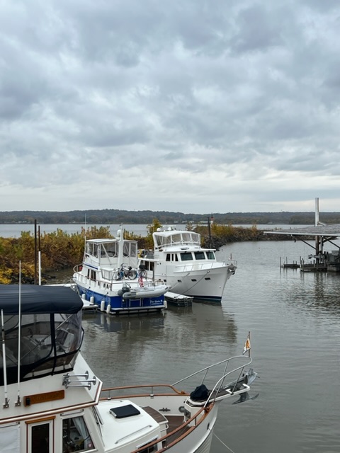
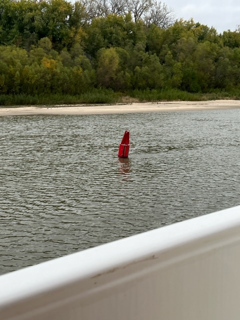
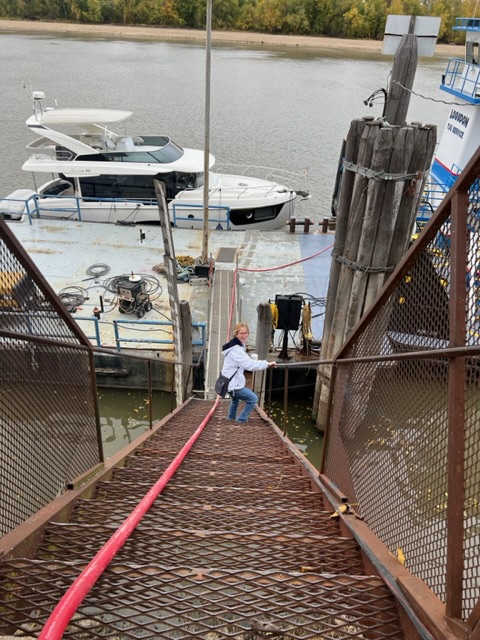
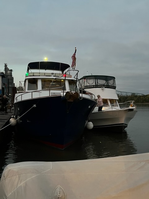
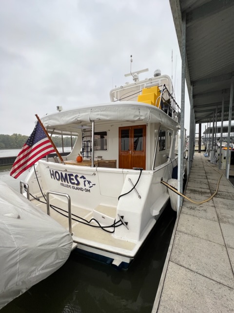
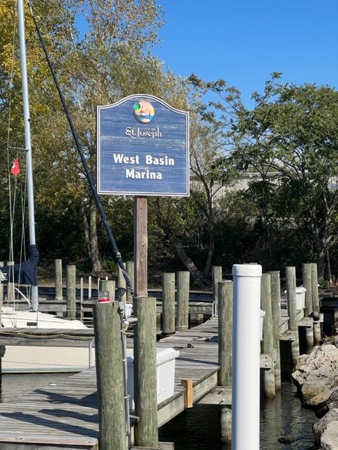
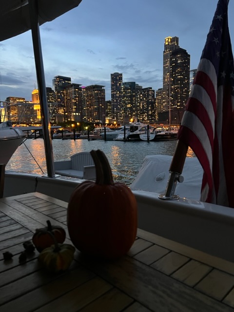
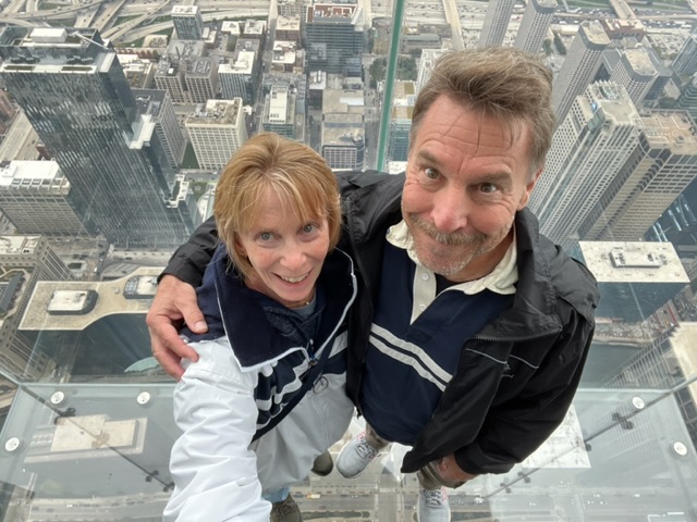
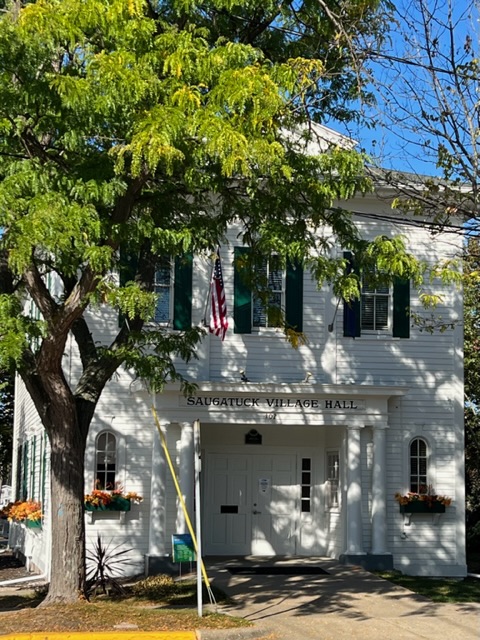
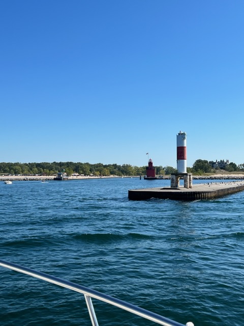
On Sunday, March 3, we traveled 3 hours and 11 minutes, going 22 miles (19.3 nm) to an anchorage between Cabbage Key and UseppaIsland (in the Punta Gorda/ Cape Coral area). The cruise today was absolutely beautiful, with several dolphins playing with us along the way.
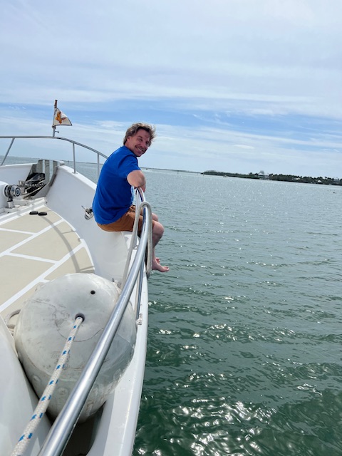
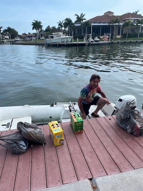
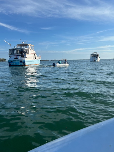
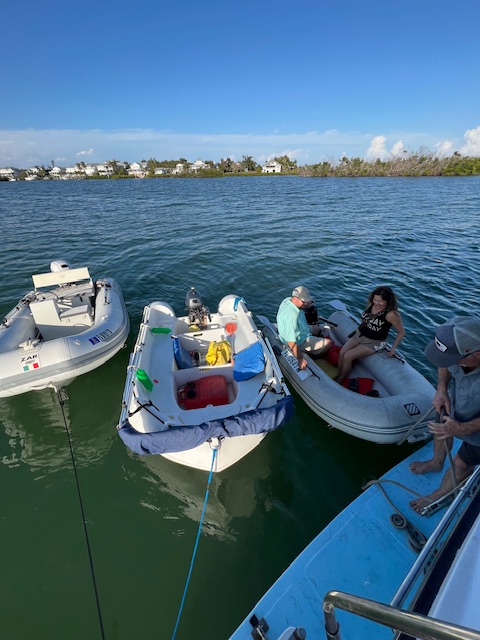
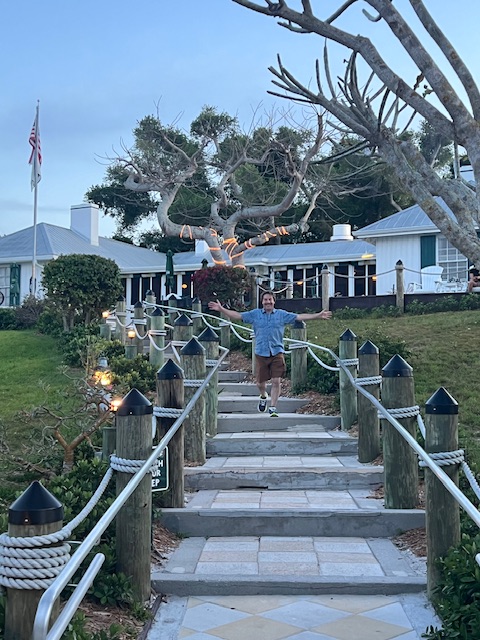
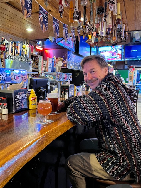
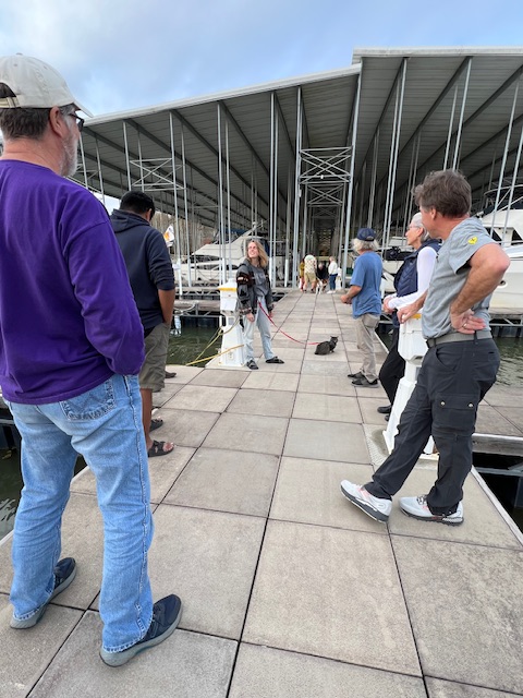
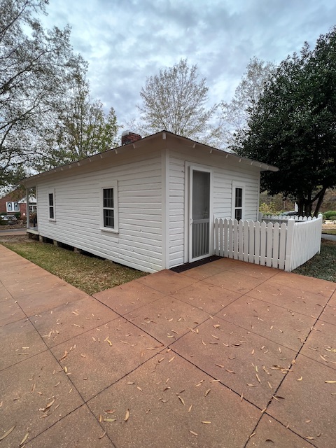
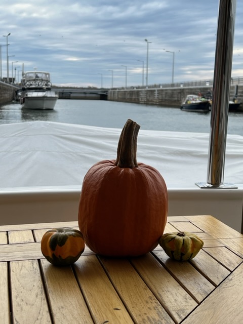
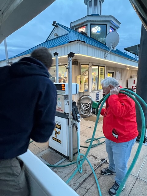
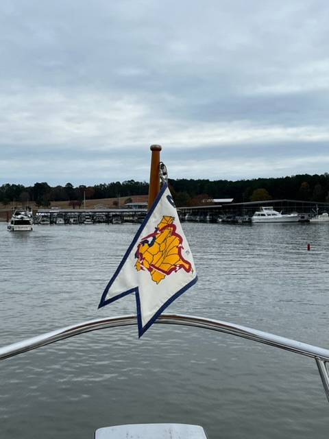
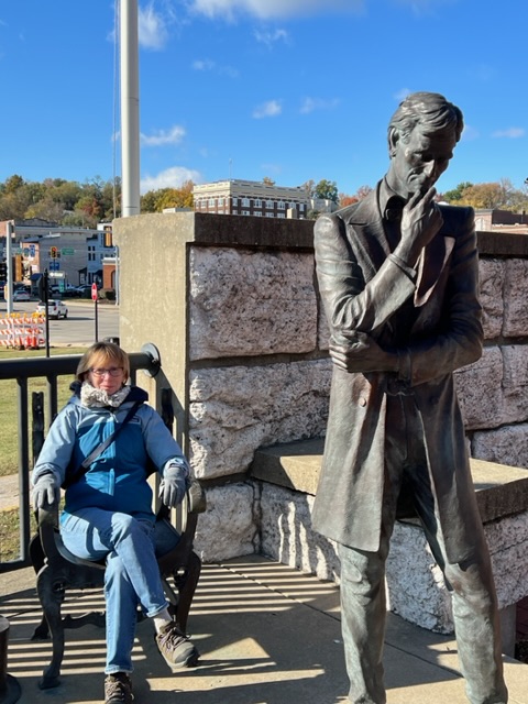
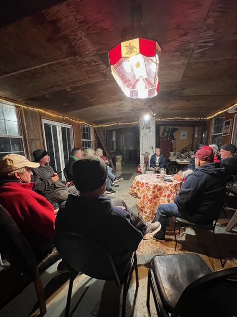
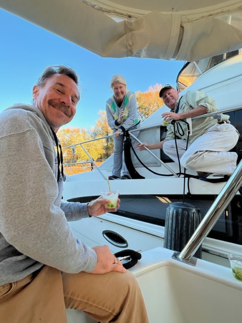
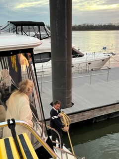
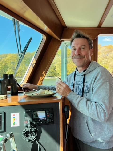
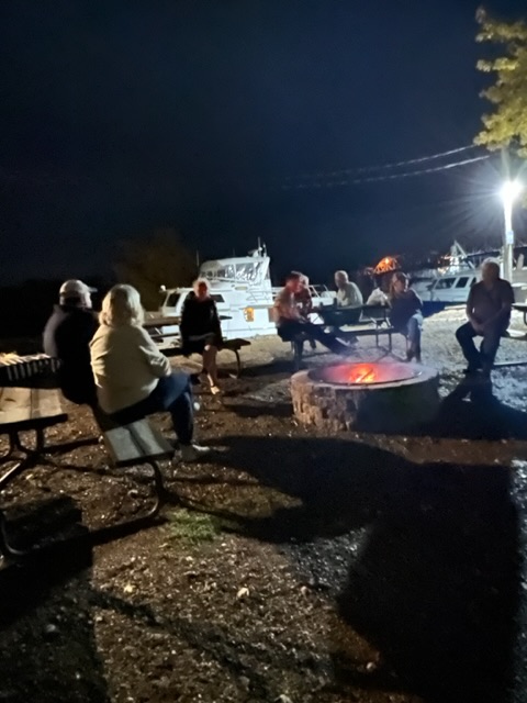
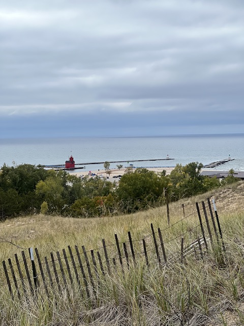
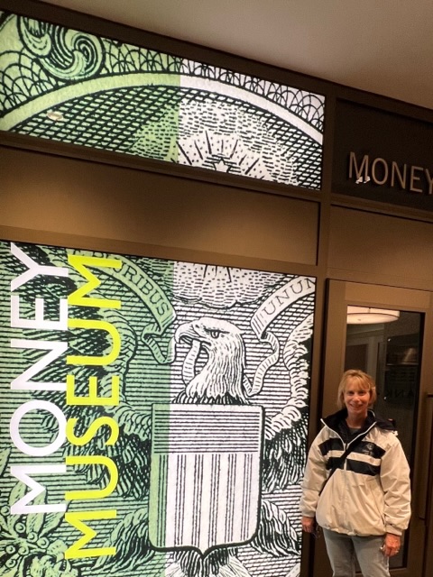
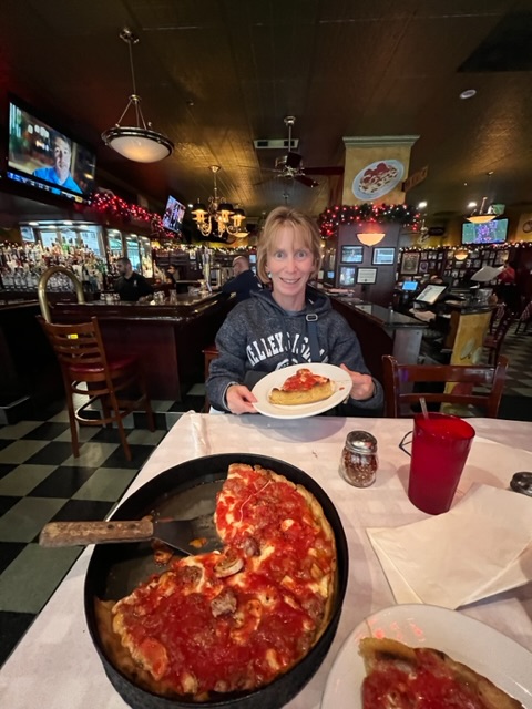
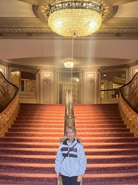
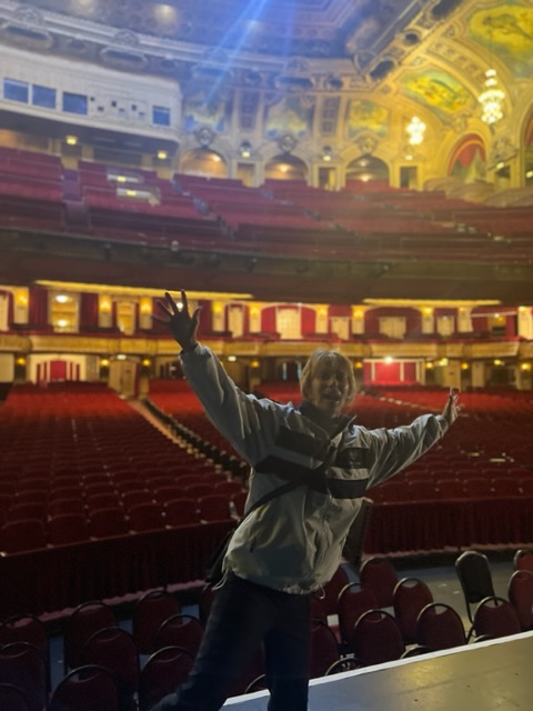
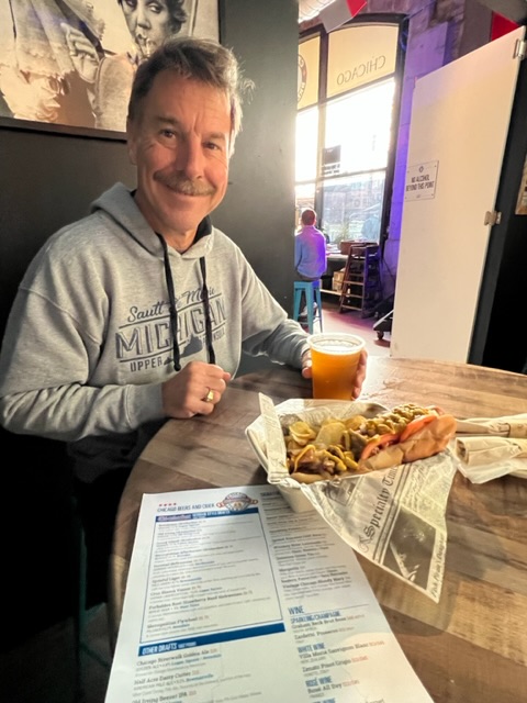
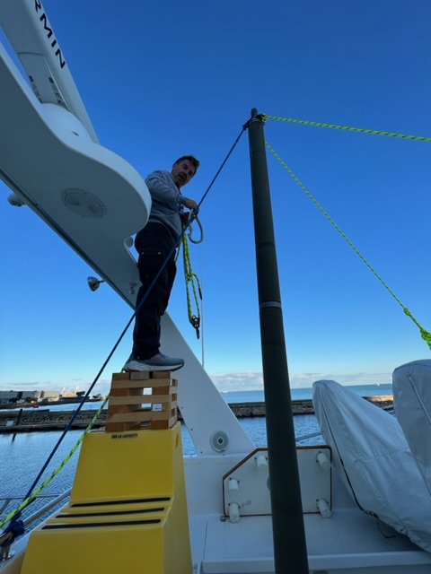
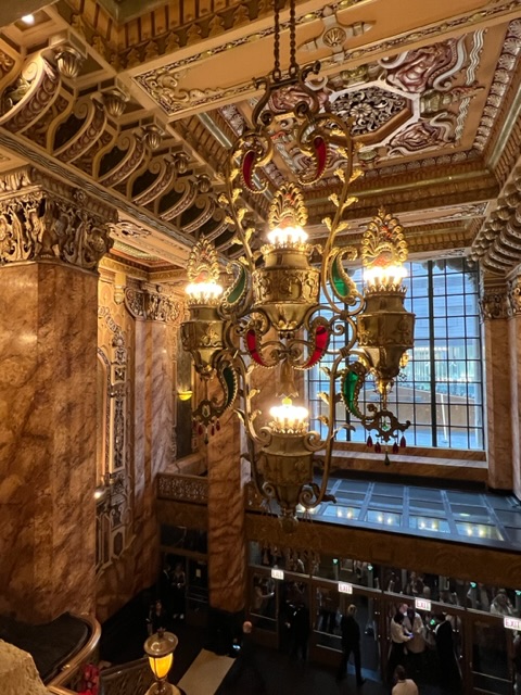
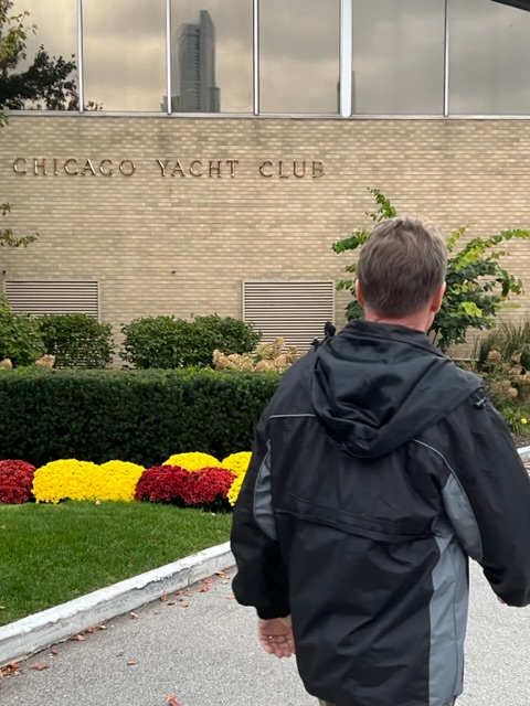
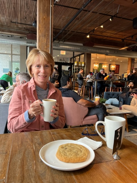
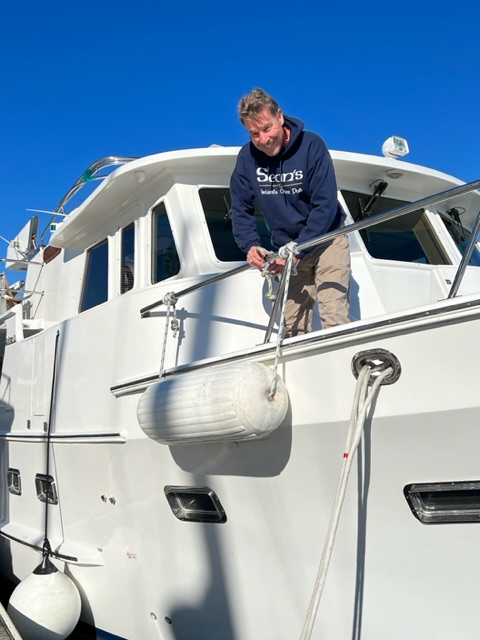
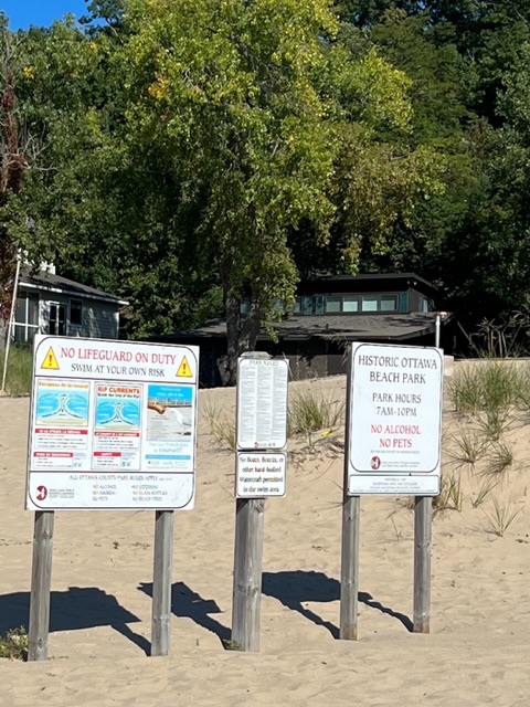
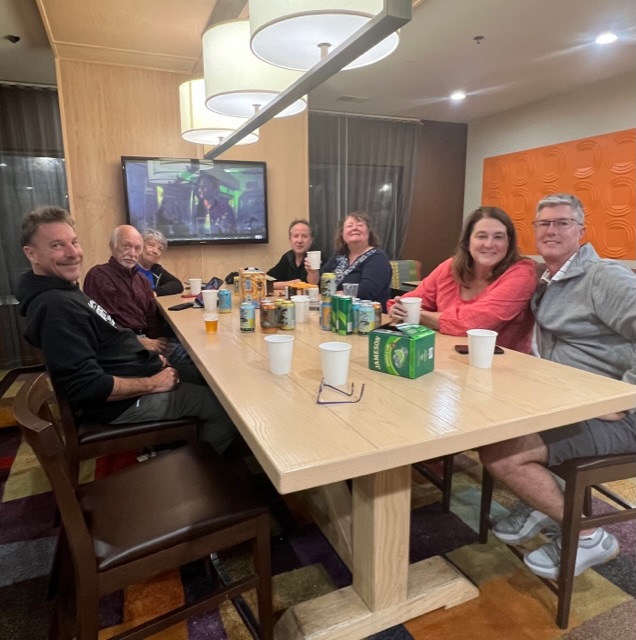
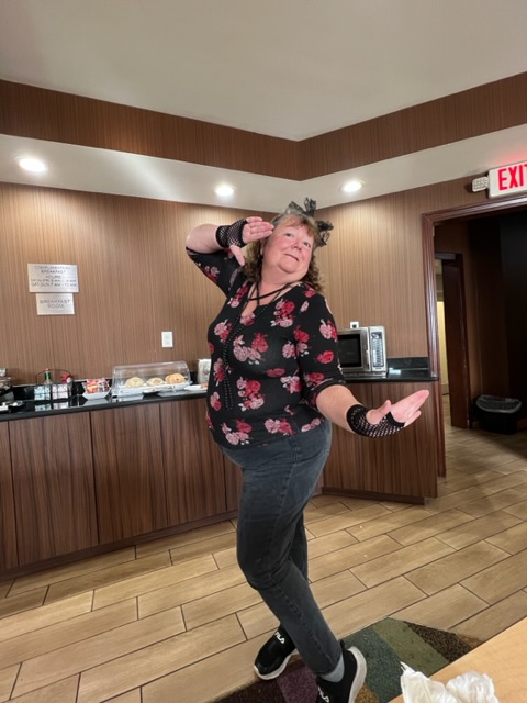
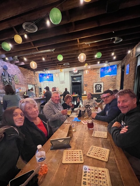
When we got to the anchorage, we joined two other boats – one being a Looper. We got a Nebo message saying to stop over. So, we launched the dinghy and went to their boat, WH-T-T, for a drink. They are Florida residents, and just started the Loop a few days ago. Their friends, on the other boat, joined us. Soon, we all took our dinghies over to Cabbage Key – named so for all of the cabbage palms trees on the key. We beached our dinghies with the help of employees from Cabbage Key Marina. As we walked up to Cabbage Key Inn for dinner, we were immediately greeted by a meandering wild gopher tortoise. About a dozen wild gopher tortoises make this key their home. I’ll talk more about Cabbage Key in my next blog. Tim and I fell in love with Cabbage Key!
Our anchorage.Three dinghies ready to go to dinner.One of at least 12 wild gopher tortoises who make Cabbage Key their home.Leaving the Cabbage Key Inn after dinner. Shoving off.An end to another beautiful week!
For now, I will end my summary of our first month of travel – since getting back from our extended Christmas break. I will resume posting a blog every Sunday…unless I have more website technical difficulties, which are out of my control. 😖🖥️
Thanks for following along!
Beth
17 Mar, 2024
Beth
17 Dec, 2023
Blog
Week 21, Part II – Dec. 11, 2023 – Silas, AL (Bobby’s Fish Camp) to Mobile, AL (Turner Marina)
Monday, Dec. 11, 2023 – Silas, AL (Bobby’s Fish Camp) to Alabama River Cutoff Anchorage (near Stockton, AL)
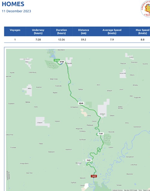
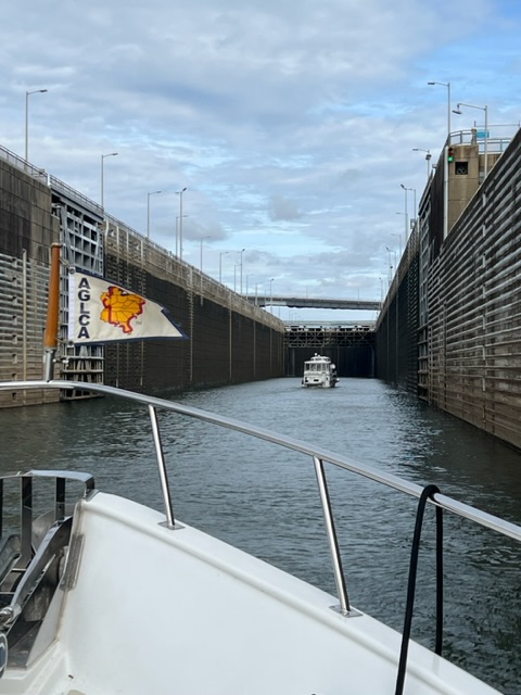
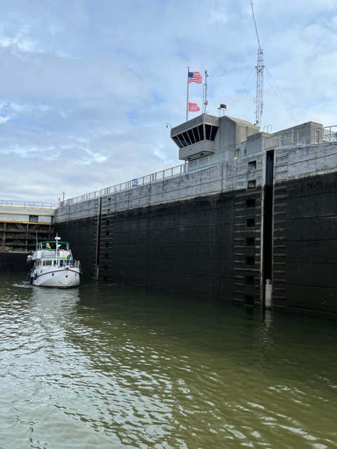
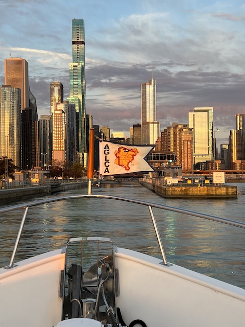
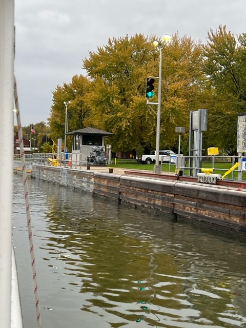
As of today, we are ALL DONE WITH LOCKS! We completed 21 locks, since beginning our voyage from Chicago on October 23!
On our voyage today, we were underway 7 hours and 28 minutes, going 59.2 nm (68 miles) at an average speed of 7.9 knots (9 MPH). Our duration of 12 hours and 26 minutes is a result of turning on our electronics 30 minutes before leaving, completing one lock, and leaving our electronics on for a while after anchoring.
We awoke to a foggy, 34-degree morning, with frost shimmering on the decks. Dirtless called the lock keeper at 6:00 AM and was told to call back in 30 min. The lock keeper had to find out what an up-bound barge was doing first. When we got the go-ahead 30 minutes later, we all scurried around starting engines and untying lines – careful in the frosty conditions.
Untying from the tree root.Everyone unhooking electric and linesGigi III is untied from us and pulling away to lead the flotilla
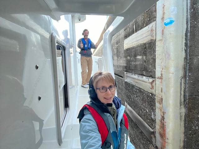
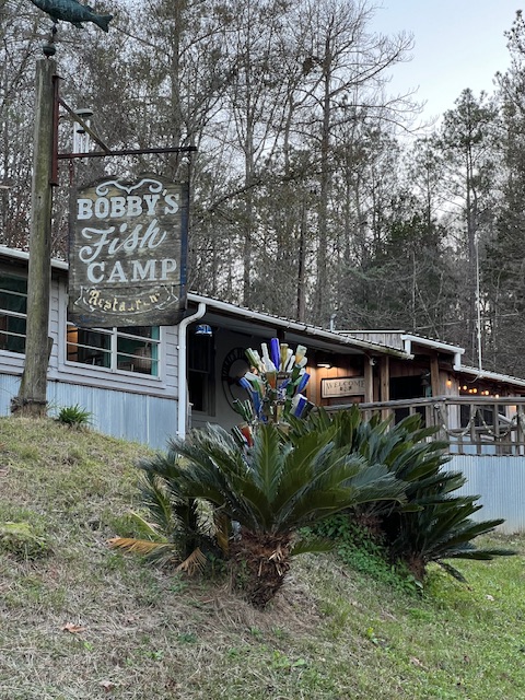
We started pulling away in unison from Bobby’s Fish Camp around 6:45 AM. Our Looper friends on Sea Cottage, who were able to get anchored last night, emerged from the fog to join us. We glided through the fog for about 15 minutes before getting to Coffeeville Lock and Dam. We filed into the lock single file and all nine boats were secured in about 20 minutes.
Pulling away from Bobby’s Fish CampSea Cottage joining us from their anchorage last nightHeading to the lock
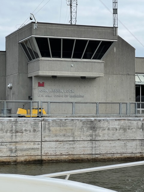
HOMES was the third boat into the lock. This is the LAST of 12 locks, since entering the Tennessee-Tombigbee Waterway back on November 10th. That realization made the cold, 34-foot drop a little more joyful than it would have been otherwise. Construction on this lock began in 1956 and it became operational in 1960. Hundreds of commercial vessels pass through here each year, carrying products such as coal, wood, steel, gas, oil and chemicals. We have seen a lot of barges on the Tombigbee River!
The Coffeevile Lock!
We waved to our last lock keeper (some nice and some not so nice) and began our last leg to the Gulf Coast! My fingers were very cold by the time I dropped the line. The town’s name – “Coffeeville” – made me desire a cute coffee shop with a steaming cup of coffee and a pastry. Alas, there was no stopping in Coffeeville, AL. The name doesn’t even have anything to do with my favorite hot beverage. The town, founded in the late 1800s, was re-named in 1819 after General John Coffee, a hero of the Creek War of 1813. This war was going on in conjunction with the War of 1812. General Andrew Jackson appointed General Coffee to fight the Native Americans, British and Spanish who were opposing the expansion of the United States. During Jackson’s presidency (1829-1833), Coffee was appointed to negotiate treaties with the Southeast American Indian tribes to remove them to the west of the Mississippi River and extinguish their land claims. Alabama’s name comes from the Choctaw phrase meaning “thicket-clearers” or “plant-cutters.”
Waving to our last lock keeperHOMES leading the pack, behind Gigi IIISpreading out as we get settled in our normal cruising speeds
As we traveled down the Tombigbee River, the boats began to spread out. Gigi III, a fast boat, took off quickly, so they could make it to Mobile today. We resumed our normal cruising speed, and soon we were cruising along with only Sea Cottage.
Hot teaTim forgot the shave
Holding a hot cup to tea felt so good on my cold fingers. Tim forgot to shave this morning, so he did that while driving.
There was a railroad lift bridge left in our path today; however, we had plenty of clearance to go under without a lift. We passed several north-bound barges. We saw timber stacked along the shore, as if it is a holding area for loading onto a barge. The timber was being watered. Filling the pores with water protects the timber from insects and fungi and prevents cracking. A little further downstream, we passed Boise Paper Company, which produces pulp, paper and board.
The rest of our voyage was curvy and scenic. After we left the lock this morning, the Tombigbee River became. At this point, the tide is only half a foot, but it’s a reminder that we’re getting closer to the Gulf of Mexico! There was also a swifter current, which gave us a nice push today.
Sea Cottage following us. Scenic viewsPulling off the river and into the anchorageSea Cottage coming in to anchor behind us
Around 2:30 PM, we arrived at our anchorage – Alabama River Cutoff. We traveled up the cutoff and dropped our anchor. It broke free on our first try, when Tim reversed on the anchor using both engines. However, on the second try, he reversed with just one engine and it held. We called it good, since we’ll have very little current in this cutoff. Plus, we’ll also have the stern anchor set.
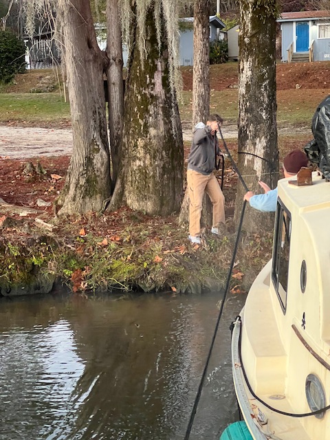
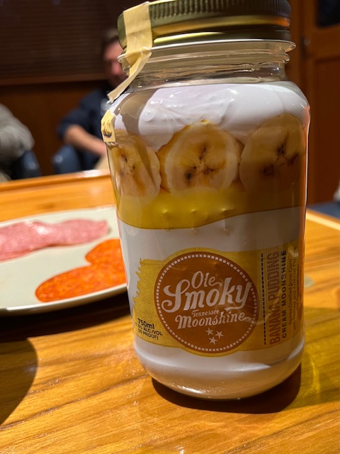
Sea Cottage anchored behind us. After we both got settled, Keith and Malinda from Sea Cottage came over in their dinghy. We had a nice evening of conversation, snacks and drinks. They are from Huntsville, Alabama and just began their loop. I made a charcuterie board, Keith brought bourbon and Malinda brought Ole Smoky Tennessee Moonshine – Banana Pudding Cream flavor. It was delicious! It was creamy like Bailey’s Irish Cream, but tasted just like banana pudding. After a tour of HOMES, they headed back to Sea Cottage. Tim used his flashlight with 12,000 lumens to light their way.
Our first visitors via dinghyConversation, snacks and drinksKeith and Malinda heading back to Sea Cottage
Tuesday, December 12, 2023 – Alabama River Cutoff Anchorage (near Stockton, AL) to Mobile, AL – Convention Center Dock
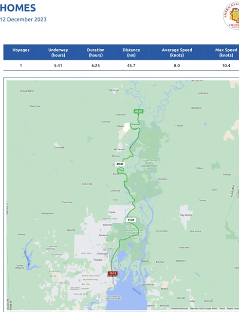
Today, our voyage took 5 hours and 41 minutes, going 45.7 nm (52.6 miles), at an average speed of 8 knots (9.2 MPH).
As our speed indicates, we got a nice push with the current and the tide. While the tide is only about half a foot on the Tombigbee River, it is around 2 foot on the Mobile River. It’s not a dramatic change, but it’s getting us into practice of considering tides again.
We awoke to another foggy, frosty morning. Around 7:20 AM, we started our engines and started pulling up our anchors – being careful on the icy decks.
After pulling up the stern anchor, Tim spun HOMES around and we followed Sea Cottage out of the anchorage and headed toward Mobile at 7:30 AM. We are happy to have an inside helm. It would have been cold driving from the upper helm today! Yesterday, HOMES and Gigi III were the only boats with inside helms. The others looked very cold.
Heading out of the anchorageHappy to have an inside helm. The upper helm needed a front-window defroster. 😂On our way to Mobile, ALAM/NS Steel Processing Plant- Calvert, ALA tow working along the plant’s river terminal
Just a little ways downstream from our anchorage, we passed Calvert, AL – the home of AM/NS steel processing plant. It opened in 2010 with the capacity to produce 5.3 million tons of flat-rolled carbon steel products annually, serving industries such as the automotive, construction and appliance/ HVAC. As we passed its river terminal, we could see tow working around some barges.
Around 8:25 AM, we came to the confluence of the Tombigbee River and The Alabama River. Here ended our journey on the Tombigbee River. We are now traveling on the Mobile River, which will dump us in Mobile Bay this afternoon. Just as we got to the Mobile River, the tide and current were really giving us a push. It was a little reminiscent of the Upper Mississippi with some floating logs and confused water caused by the barges. However, eventually the barge traffic lessened and the tide went slack.
The confluence of the Tombigbee River and the Alabama River to for the Mobile RiverConfused waters caused by the tows pushing the bargesWaiting for these barges to pass before passing the south-bound barge. Sea Cottage is in the distance
Around 11:00 AM, we cruised under the General W.K. Wilson Jr. Bridge, which takes Interstate 65 across the Mobile-Tensaw River Delta. Built from 1978-1980, this 6.08 mile bridge is the 8th longest bridge in the U.S. The Mackinac Bridge that we went under this summer was only 5-miles long.
General W.K.Wlison Jr. BridgeGoing under
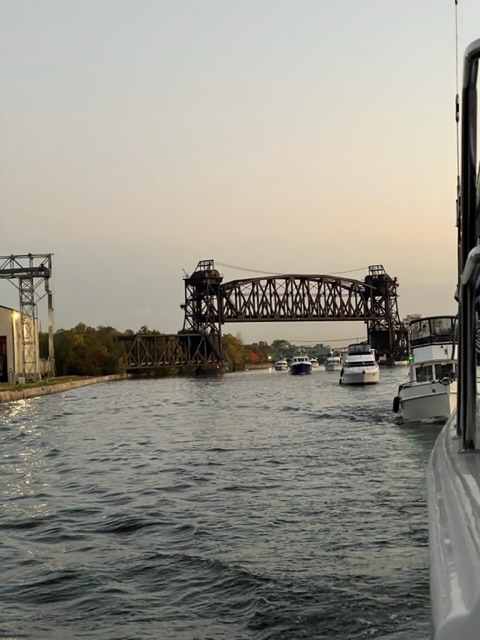
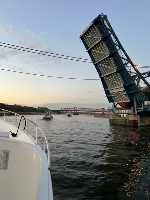
The locks were all behind us, but we still had one more obstacle in our path to Mobile – a CSX Railroad vertical lift bridge. When the bridge is in the down position, it has a clearance of 5 feet – HOMES needs 21 feet. Sea Cottage radioed the bridge for a lift, then Tim radioed to say that we were .7 miles behind Sea Cottage. The bridge tender told us to come on through.
CSX Railroad vertical lift bridgeUnder the bridge. No trains coming 😁The bridge will now lower back down to the other span.
As we cruised into the Mobile-Tensaw Delta, we began to enjoy new plants and wildlife – yuccas and pelicans! I have been looking forward to getting back south to see pelicans and dolphins. I won’t see dolphins for a while longer, but watching the pelicans diving for fish and flying around the boat is such a joy!
Yuccas and……pelicans!A fishing boat and a pelican flying
Around 12:15 PM, the skyline of Mobile started appearing on the horizon. As we passed under the bridge taking Route 10 over the Mobile River, we entered the Port of Mobile – a vital part of the economic growth of the Gulf Coast and the entire state of Alabama. There were freighters being loaded; tow boats being fixed in dry dock; military ships being built; and, trucks driving around warehouses on shore. It was amazing to watch the hive of activity, as we cruised along. Mobile is Alabama’s only saltwater port and the 12th-largest port in the U.S.
Passing a barge before going under the Rte. 10 bridge over the Mobile RiverBarges being loadedTrucks zooming around warehouses
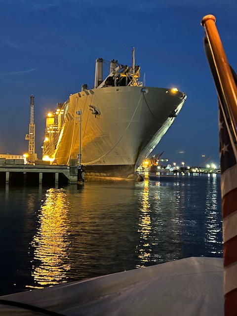
The view of our dock along the wall of the Mobile Convention Center was hidden by a huge ship – the USNS Bob Hope. The Bob Hope is a Navy ship that carries vehicles for the United States Army. The ramp for loading and unloading vehicles was up, and we didn’t see any activity around the ship.
Tim brought HOMES around in front of Bob Hope and safely docked us along the wall. This wall is on a first-come-first-serve basis and we can only stay for 2 days. There are no water or electric hookups, so it will be like anchoring. However, this dock offers the best way to experience downtown Mobile. For some reason, most Loopers pass by this stop.
They obviously weren’t thinking of pleasure boaters when they fitted out the dockLots of lines and fenders to protect HOMES from the busy river activityWe registered and paid online.
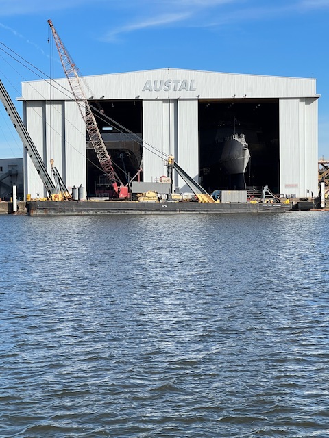
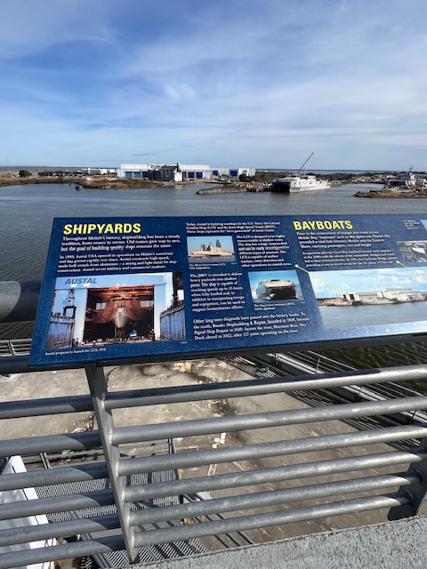
After getting all secured with lines and extra fenders, we registered and paid online for a two-day stay. On our bow is Mobile’s only dinner cruise boat – a sternwheeler called the Perdido Queen. Across the Mobile River from HOMES is Austal USA – a manufacturer of both aluminum and steel ships. It employs over 3,000 employees.
View behind – Military vehicle cargo ship – the Bob HopeView in front- the Perdido Queen -dinner cruise shipView across the Mobile River – Austal ship-building yard
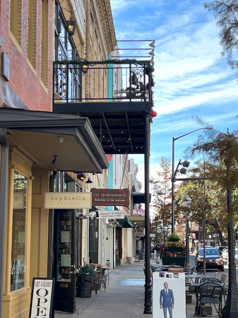
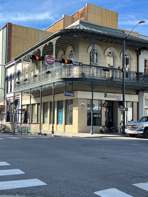
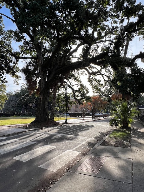
By 2:00 PM, we were all settled and ready to go explore downtown Mobile. As we were cutting through the parking garage of the convention center, which is next to our dock, we saw a security guard. She seemed a little offended when we asked if the area is safe. She said that we may see some homeless people, but the area is safe. She directed us to go across Water Street, where we’ll then be on Dauphin Street. We immediately fell in love with downtown Mobile – its historical buildings and quaint streets dotted with palm trees and majestic live oaks!
Just beyond the parking garage is Dauphin StreetDauphin StreetWe loved the porches surrounded by iron railingsPalm trees……and live oak trees
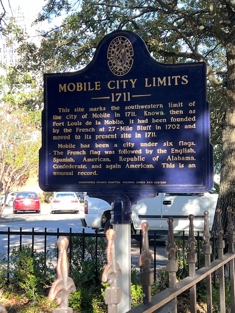
Dauphin Street was named by the French settlers for the son of King Louis XIV. The French were the first European settlers of area in 1702, in their attempt for an empire in America. In 1711, they moved a few miles to where the Mobile River meets the Mobile Bay – the current location of Mobile. Mobile was an important center for France’s Louisiana Territory and Dauphin Street was one of the principal streets of this new settlement. Mobile remained a major trade center with the Native Americans throughout the French period.
Mobile’s city limit was moved closer to the river in 1711Dauphin Street
Mobile’s history, however, did not begin with the French. Alabama’s indigenous history can be traced back more than 10,000 years. The indigenous people –the Chato – were living in Mobile when the Spanish Conquistadors began sailing Mobile Bay as early as 1500. The Conquistadors were explores and did not settle the area.
The French were the first Europeansettler; then came the British, after winning the French and Indian War in 1763; then came the Spanish, who captured Mobile during the American Revolution; then the U.S. took control when the Spanish lost control during the War of 1812. The area was annexed as part of the U.S. in 1813 by President James Madison.
Mobile had one other flag that few over her. Mobile was part of the Republic of Alabama, an independent republic that lasted for a month in 1861 – after Alabama seceded from the Union, but before it joined the Confederate States of America. In 1861, the population of Alabama was about one million and approximately 44% were slaves.
Marci Gras ParkSpanish Plaza Park
Mobile takes pride in being the birthplace of Mardi Gras. You may think of New Orleans as the home of Mardi Gras, but it actually began in Mobile in 1703 by the French-Catholic settlers, as part of their preparation for Ash Wednesday and the beginning of Lent. Mardi Gras had a history of ups and downs over the centuries, but it was revived after the Civil War. During the Reconstruction era, the morale of the people in Mobile was low. So, in 1867, resident Joe Cain revived the parade – decorating a charcoal wagon marching through town with six fellow Confederate veterans. Since 1966, the “Joe Cain Day” parade has been held on the Sunday before Mardi Gras. Mobile is very proud of Joe Cain, with many things being named after him.
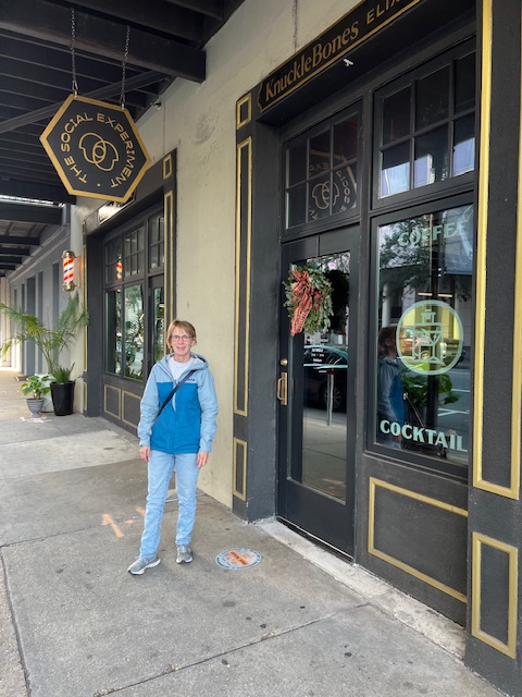
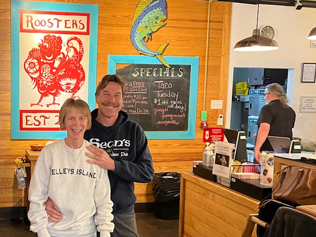
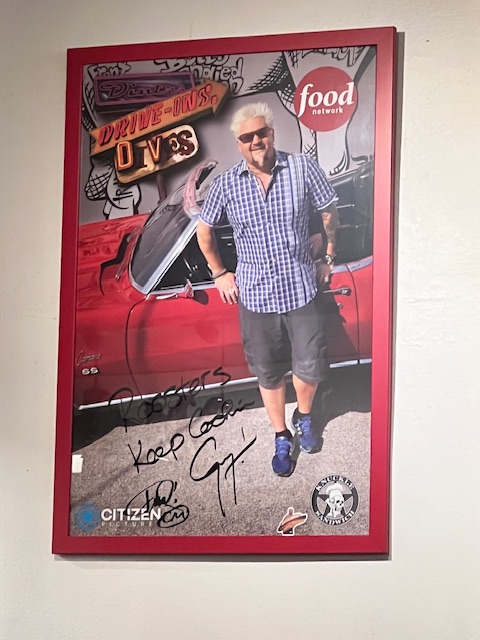
Our exploration of downtown Mobile wouldn’t be complete without experiencing food and drink. We found KnuckleBones Elixir Co. for coffee. It had a lounge vibe and also served alcoholic cocktails. We needed food next. We are used to eating “lupper” (lunch/supper) around 3:30 or 4:30. Unfortunately, that schedule has not caught on and many of the restaurants didn’t open until 5:00. So, we found Roosters – a Latin American restaurant. We discovered that it was featured on Food Network’s Diners, Drive-Ins & Dives – Season 38, Episode 8. My grilled veggie tacos, with a side of sweet plantains were delicious. And, once Tim figured out how to pick up his jerk chicken sandwich, topped with jalapeño cabbage slaw, grilled pineapple and mango habanero sauce, he only put it back down to blow his nose. The flavors exploded with just the right amount of heat from him.
Now sustained with coffee and food, we continue to meander through downtown around Cathedral Square. The Cathedral-Basilica Immaculate Conception parish was established in 1703 and is the oldest religious congregation of any denomination in Alabama and the Mississippi River Valley. This church was constructed in 1835-1850, with the portico, bell towers and stained glass added from 1870-1910.
The Ketchum House is an antebellum town home of W.H. Ketchum. It was commandeered headquarters for the Union forces, which occupied Mobile on April 12 1865. Since 1906, it has been used as Cathedral Rectory and home of the Bishop of Mobile.
Going a block further, we came to Government Street Presbyterian Church, known as the mother of Presbyterianism in Southern Alabama. It was founded in 1831 and worship has continued on this site since 1836 when the sanctuary was completed.
Cathedral-Basilica of Immaculate ConceptionThe Ketchum House-Cathedral RectoryGovernment St. Presbyterian Church
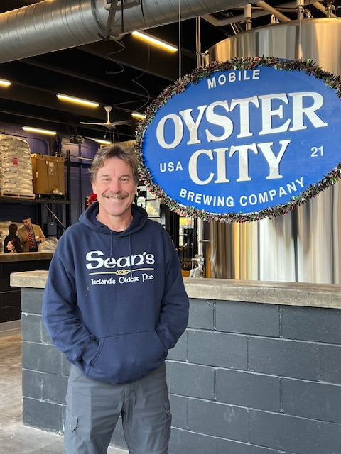
Our walk finally took us to Oyster City Brewing Company, the third location for this Apalachicola, Florida craft brewery. We will be staying in Apalachicola before our crossing of the Gulf of Mexico, so hopefully we’ll visit them at that location.
We then enjoyed the city in lights as we walked back to HOMES.
Wednesday, December 13, 2023 – Mobile, AL – Downtown (Layover day)
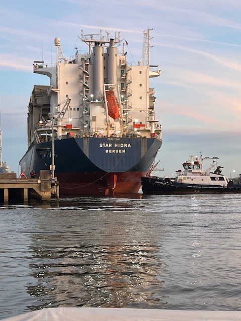
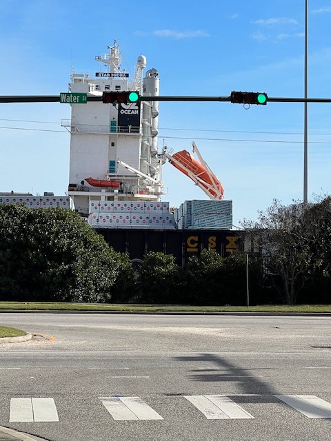
Our new neighbor- Star Hindra of Norway being pushed into dockIt was being loaded day and night
We slept so well last night that we didn’t hear the Bob Hope leave or the new freighter arrive. At 6:30 AM, I just caught a picture of the tug pushing the Star Hindra into the dock. It is a general cargo ship built in 1994 in Japan and currently sails under the flag of Norway.
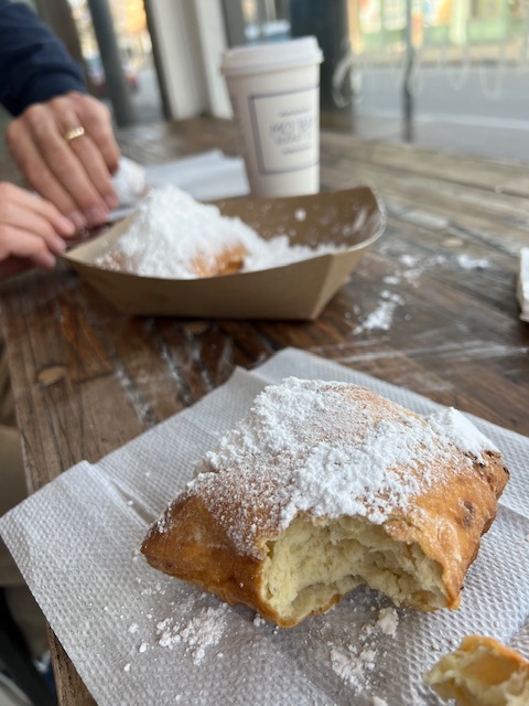
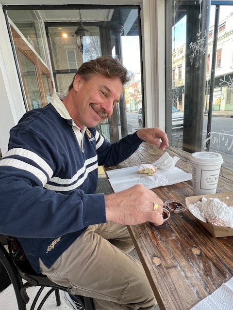
First on our agenda for today was to experience a cultural tradition down here – a beignet. For this, we headed to Mo’ Bay Beignet Co. on Dauphin St. Beignets are a French doughnut that is made up with yeast, sweetened dough, squared cuts and then fried. They are then covered in powdered sugar and put on a bed of powdered sugar. Unlike a dense doughnut, beignets are light and airy. Each are made to order, so ours were steaming hot, as we pulled them apart to dunk in our chocolate syrup. There were multiple syrups, including buttercream and cinnamon. We paired our beignets with hot chocolate – their peppermint flavor for Christmas.
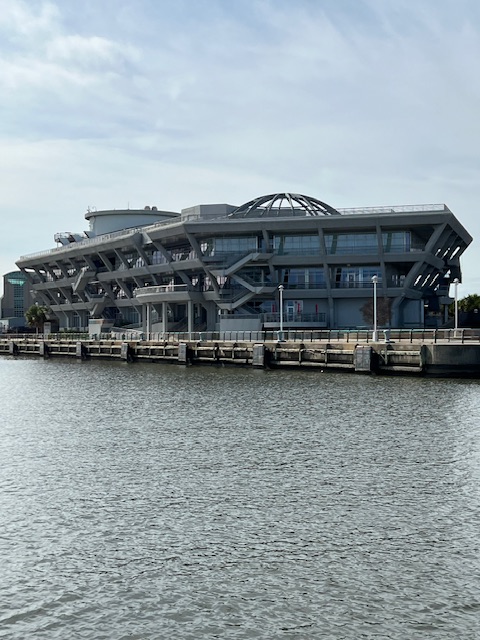
Mo’ Bay Beignet Co.Hot, light and airy deliciousness!Dipping into the chocolate sauceOutside of GulfQuest National Maritime Museum of the Gulf of MexicoInside, water surrounded what looked like a ship – the McLean
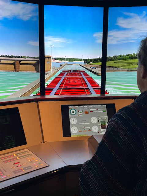
Surging on our sugar high, we headed back to the riverfront to GulfQuest National Maritime Museum of the Gulf of Mexico. The 90,000 square foot museum is shaped like a container ship headed into Mobile Bay. Mobile businessman, Malcolm McLean, invented the modern intermodal shipping container. Containerization led to a significant reduction in the cost of freight transportation by eliminating the need for repeated handling of individual pieces of cargo. It also improved reliability, reduced cargo theft and cut inventory costs by shortening transit time.
Inside the museum, there was water surrounding what looked like a 5-story container ship, named for McLean. We meandered our way through the 5-story museum, enjoying the interactive displays. Tim used a simulator to dock a freighter on the Mobile River and push a barge into Coffeeville Lock. The volunteer said that she had never seen anyone do so well!
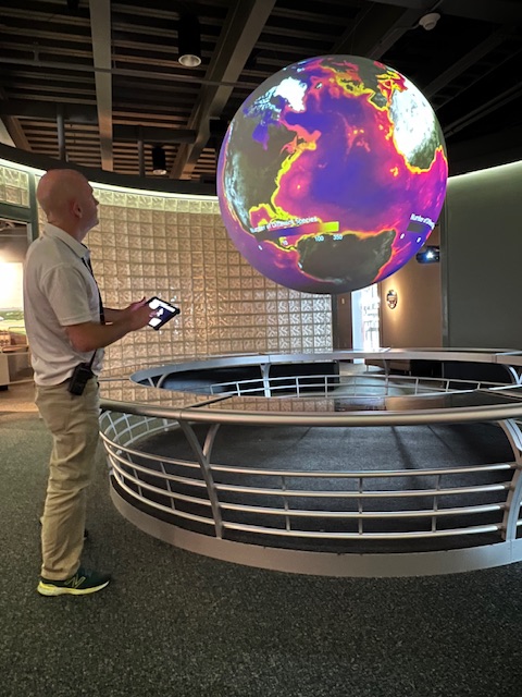
Learning to us a sextantPushing a barge into Coffeeville LockA demonstration of storms and sharks using NOAA data
The top floor had outside observation decks. There was a guy on the observation deck taking pictures of a boat across the river being lowering into the water. We saw several other people videoing the lowering of the ship. By the time we walked back to HOMES, there was a news crew setting up in the lot next to the parking garage. I couldn’t find anything specific about the launching of this ship, but I learned that it’s a big deal when Austal launches a boat.
Later in the afternoon, we decided to walk up to Serda’s Coffee Company for coffee. As you know, the reason we like coffee shops and local breweries or bars is to talk with locals. At Serda’s, we were fortunate enough to strike up a conversation with a guy who has lived his whole life and Mobile and is now a tour guide on Fridays, since he has retired. He told us that we needed to walk up Royal Street to Battle House hotel. It is on the site of the headquarters of Gen. Andrew Jackson in 1814. The $1.2 million hotel was constructed from 1906 – 1910. It was designed by Frank Mills Andrews – an architect famous at the time for building some of New York City’s most memorable buildings, including the New York Stock Exchange and the Vanderblit’s Fifth Ave. mansion.
Serda’s Coffee Co.Outside Battle HouseInside Battle House
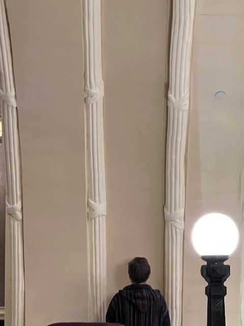
While we were awe stuck by the vast lobby – with its stain-glass dome ceiling – our friend from the coffee shop told us to go to the second floor to the “whispering arch.” It worked just as he said. Tim stood at one end facing the arch and I stood at the other end. We could hear each other as if we were standing next to each other!
The second floor “whispering arch”Tim is at one end and me at the otherTim talking to me.
After our fun at Battle House, we walked back to Dauphin Street to Loda Bier Garten. It has over 100 beers on tap, including from the local craft breweries. However, we just had one beer, because we had two other places that we wanted to try on our last evening here – The Haberdasher and Royal Street Tavern, which is inside Battle House. We found locals to talk with at both places and really enjoyed our time in Mobile. We were amazed at how friendly everyone is here. Even people passing us on the street said hello.
Lo Da Bier Gart
That night, I woke up around 2:00 AM, hearing boat traffic going by. I got up thinking that maybe the big Star Hindra was leaving. It wasn’t leaving, but I was fascinated with the hive of activity going on at 2:00 in the morning. Rolls of steel were being loaded on the Star Hindra; a tug was guiding a freighter up the river, while a tow was pushing a barge down the river. It was fascinating to watch! I reluctantly went back to bed, so that I’d be rested for our voyage tomorrow.
Our walk back to HOMES2:00 AM – tug guiding a freighter up river2:00 AM – a tow pushing a barge down river
Thursday, December 14, 2023 – Mobile, AL – Convention Center Dock to Mobile, AL – Turner Marine (Dog River)
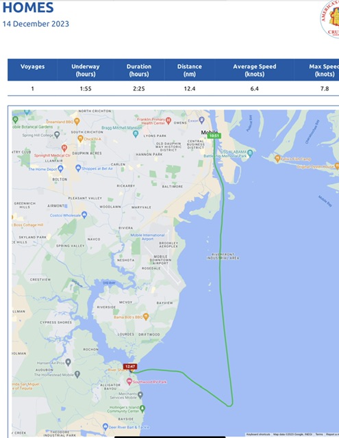
Our voyage today took 2 hours and 25 minutes, going 12 nm (14 miles), at an average speed of 6.4 knots (7.4 MPH). It was a short journey out into the bay and over to Turner Marine on the Dog River, where we’ll be leaving HOMES to come home for Christmas.
Mobile Bay is the fourth-largest estuary (enclosed coastal body of water) in the U.S. at may 31 miles long by 24 miles wide; however, it has an average depth of 10 feet outside the shipping channel! Hence, the reason for our weird-looking path today. We had to stay in the channel – no short cuts!
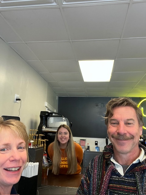
Since we had such a short voyage planned for today, we took the opportunity to walk into downtown one last time. This time, we picked Yellow Hammer Coffee. We had fun with the baristas. When asked for “a name for the order,” Tim likes to say “Voldemort.” It usually gets a laugh from Harry Potter fans. This barista actually typed in our order under “Thou Shalt Not be Named.” 😂 Harry Potter fans know you can’t say Voldemort’s name. We also found out that our barista did part of the Loop with her grandparents years ago. Her grandmother, who lives in Florida, still keeps in contact with Loopers. She is going to give her grandmother our card. We took a picture together, in case her grandmother checks out my blog.
Yellow Hammer CoffeeNot Voldemort – Thou shalt not be named 😂“Hi Grandma!”
We had to wait for a train to get back to HOMES. Boats and trains…Tim’s two favorite things!
The Star Hindra looks big from the water……but I think it looks bigger from land!Waiting for the train so we can cross over to the tracks to get to HOMES
Once back at HOMES, we cast off and headed down the Mobile River and into the Mobile Bay.
Heading to Mobile BayLeaving behind the city, the maritime museum and the dock for Carnival Cruise shipsMilitary ships and U.S. Naval Hospital Ship lined the river
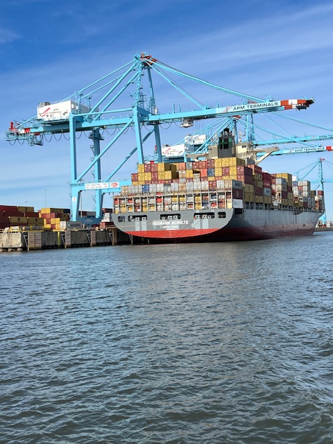
When we got to the mouth of Mobile Bay, it was exciting to see the cargo ships that made Mobile famous, but those were not nearly as exciting as… DOLPHINS! My first sightings!! We saw several as we continued along in the Bay.
Cargo ship ……at APM TerminalsMy first sighting of dolphins!
Mobile Bay looks big, but on either side of the channel our chart showed 5 feet on one side and 2 feet on the other.
Big Mobile Bay……but a very narrow channelTurning into the Dog River Channel. Downtown Mobile is 12 miles behind us
Dog River Channel is just as narrow, but MORE shallow, because we are no longer in a shipping channel. As Tim kept us between the red and green markers, we saw depths go as shallow as 4’9” – HOMES needs 4’ 8” inches to float! Once we got under Dog River Bridge and turned into the channel for Turner Marine, their channel was even MORE narrow and shallow! However, we were told that the muddy bottom is like pudding, so we just kept slugging through – it was low tide, so it won’t get worse.
Keeping HOMES between the green and red markers5 feet showing in the channel – HOMES needs 4’8” to float!Cruising under the Dog River Bridge into yet a more shallow channel into Turner Marine
Tim was very relieved once we got tied up. Here is where HOMES will be until after Christmas. Later in the evening, we walked to Mobile Yacht Club, where Tim got a well-deserved beer!
Friday- Sunday, Dec. 15-17 – Mobile, AL – Turner Marine (Dog River) – Layover days
Since we are staying here, until flying home on Tuesday, we decided to get a rental car. We took a 13-mile Uber ride to the Mobile Regional Airport to pick up the car.
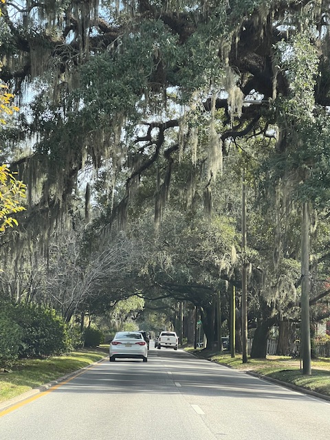
Getting supplies at Lowe’sDriving down streets lined with live oaks covered in Spanish moss
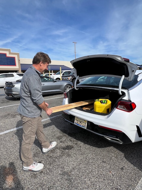
Our first stop was Lowe’s. Tim needed a storage container for changing the oil in the engines tomorrow. He also bought lumber and rope to make fender boards, which will protect HOMES from the dock.
Since we have a car, I wanted to drive across the Mobile Bay Causeway – called the Bayway. It was built in 1977, but is considered an aging structure, so there are plans to replace it by 2028. Before getting to the 7.5 mile-long Bayway bridge, we drove in a tunnel under the Mobile River. We had no idea that we cruised over a tunnel yesterday! This George Wallace Tunnel was built in sections and floated to the proper positions, then sunk. The sections were then joined underway.
Going into the tunnelIn the tunnelThe Causeway.
Once over the Bayway, we turned south, along Mobile Bay, and headed to Fairhope, AL to explore. It was listed by Southern Living as one of the South’s Best Small Towns. Fairhope began in 1894 as a Single Tax Colony – a simplified tax system where the only tax was on ground and natural resource rents, with no additional taxation or improvements, such as buildings. The founders bought this “clear-cut wasteland” for $5.50 per acre. They thought the Single Tax plan would give them a “fair hope” of succeeding. In 1908, the city of Fairhope was established, which took over responsibility of the municipal services. Fairhope has always been a resort community because of its beachfront park, park lands on the bluff above the beach and the quarter-mile long pier – all gifted to the city by the Single Tax Colony, which continues to have an active presence in the city to this day.
Coffee at Latte Da Coffee Shop in Page & Palette BookstoreThe 1928 city hall/ fire department- Now historical museumFairhope Brewing Co.
When we got back to HOMES, Tim made the fender boards – even though it was dark. He wanted to beat the rain and chillier weather coming tomorrow. We need these fender boards because our dock does not float and the tide runs HOMES up and down. Our fenders are useless when they are above or below the dock. The boards stay in contact with the dock post and keep HOMES from hitting the dock. We have the same set up on the bow.
Making the fender boardsFender boards in place
Yesterday was a work day. Tim changed the oil in both engines – 8 1/2 gallons in each! He also changed the oil filters and 4 fuel filters. I am his assistant. The marina had a bin for our used oil.
We had all of the oil on boardTaking out the old oilPutting in the new oilChanging the fuel filtersThe port engine is harder to get toTime to dump the used oil in the bin at the marina
Today is a day to relax and to find a coffee shop.
There will be no blog next week. We fly home for Christmas on Tuesday. As the song goes…”There’s no place like home for the holiday”…so we’ll be heading home from the “Dixie sunny shores.”
Happy Holidays / Merry Christmas! We will post our next blog on New Year’s Eve. We may be in Florida for the New Year!
Thanks for reading!
Beth
17 Dec, 2023
Beth
10 Dec, 2023
Blog
Week 20, Part II – Dec. 4 – Dec. 10, 2023 – Anchorage near Aberdeen, MS to Bobby’s Fish Camp, Silas, AL
Highlights this week: Getting to a new state- Alabama; exploring Columbus, MS and Demopolis, AL; two beautiful anchorages; and staying at the iconic stop of the Loop – Bobby’s Fish Camp.
Monday, December 4, 2023 – Anchorage near Aberdeen, MS to Columbus, MS
Finally, the sun came out! Our voyage today took 5 hours, going 23.5 nm (27 miles), at an average speed of 6.7 knots (7.7 MPH).
Since we had a short cruising day, with only one lock, we were in no rush to leave our beautiful anchorage. The sun and 60-degree temperature felt so good that I had breakfast on the back deck.
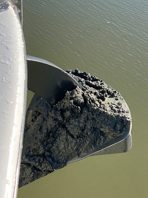
Around 9:15 AM, we pulled up anchor. The caked-on mud was an indication of why HOMES didn’t move much last night. Despite hosing off the anchor as it came up, I still had to wash down the deck. My hands were equally as muddy, after using my hand tool to scrape the mud off the anchor.
Muddy anchor chainMuddy anchorOn our way
We continued along the Tennessee-Tombigbee Waterway today, enjoying the waterfowl and an eagle soaring above HOMES. We continued to see the Tombigbee River off to one side or the other. The Tenn-Tom Waterway is a series of locks and dams that make the Tombigbee River navigable until it merges with the Alabama River to form the short Mobile River, which empties into Mobile Bay on the Gulf of Mexico. The Tenn-Tom Waterway has three federally authorized purposes: navigation, wildlife mitigation (for the habitats it destroyed) and recreation. Navigating the Tenn-Tom, as opposed to the Mississippi River, reduces the trip to the Gulf Coast by more than 800 miles. And, with its creational component, it is friendlier to pleasure boaters. Very few Loopers take the Mississippi River to the Gulf Coast.
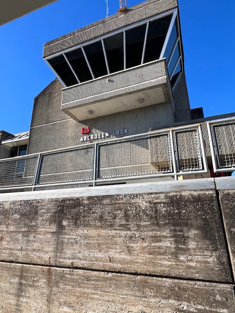
As we neared our only lock for today, the Aberdeen Lock, another Looper boat was coming up behind us. We waited for them inside the lock, before both of us dropped 28 feet in 12 minutes. Soon after coming out of the lock, we passed an up-bound barge – glad we beat him to the lock! Tim radioed the tow captain to see how he wanted us to pass. After telling us to pass on the 1 (on our left), he said he really liked HOMES.
A huge bird nest behind our green light to enterAberdeen Lock……and the Tenn-Tom Waterway on the other side – 28 feet downThreading through the red and green markersInto out slip
We knew we were getting close to the marina when Air Force jets shot overhead. Columbus is home to Columbus Air Force Base. We got to Columbus Marina around 1:15 PM. Despite being on Columbus Lake – a 9,000 acre lake created by the Stennis Lock – the channel back to the marina was very narrow and only 5-feet deep. Tim skillfully threaded HOMES through the red and green markers and into our slip.
After getting checked in at the marina office and making lunch, Tim changed the oil in the generator. We ran the generator for about 5 hours last night and we’ll be using it when we anchor out three more times this week. The marina took our used oil, so that was a plus.
Opening the generatorPumping out the oilPutting in the new oil
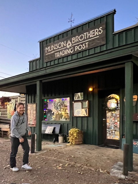
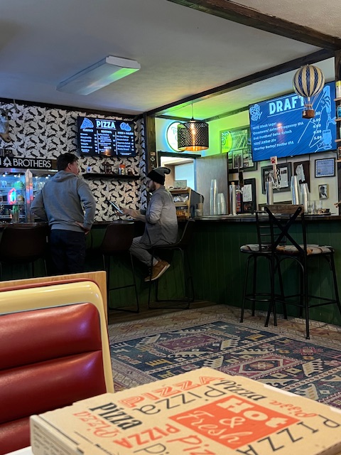
Around 4:30, we decided to see if the courtesy car was available to go find somewhere for a drink. A guy on another boat was just taking the car. He said that he was just taking the car to Walgreens so he wouldn’t be long. We said no problem, because we were just going to go in for a beer. He said, “I’d love a beer.” So, we introduced ourselves to Oscar, and the three of us drove the 10-minutes into Columbus. After a stop at Walgreens for his tennis elbow brace. We drove to a unique bar – Munson Brothers Trading Post. Over pizza and craft beer, Oscar explained that he just bought his boat in Destin, Florida and is on his way back home to Chattanooga, TN. He hopes to do the Loop someday.
Columbus MarinaMunson & Brothers Trading Post……had good craft beer and pizza.
Tuesday, December 5, 2023 – Columbus, MS (Layover day)
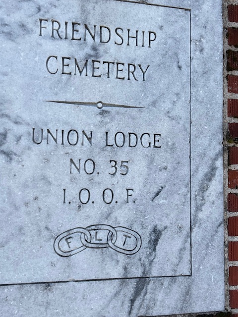
We reserved the courtesy car from 11:00 AM to 2:00 PM today to explore Columbus, Mississippi. Columbus has many antebellum (pre-Civil War) mansions. Union Forces burned many southern towns down, but Columbus was spared because it opened it churches and homes as hospitals for both Confederate and Union soldiers. Friendship Cemetery is only blocks away from these antebellum mansions.
Errolton -1848Belle Ridge – 1856Whitehall – 1843
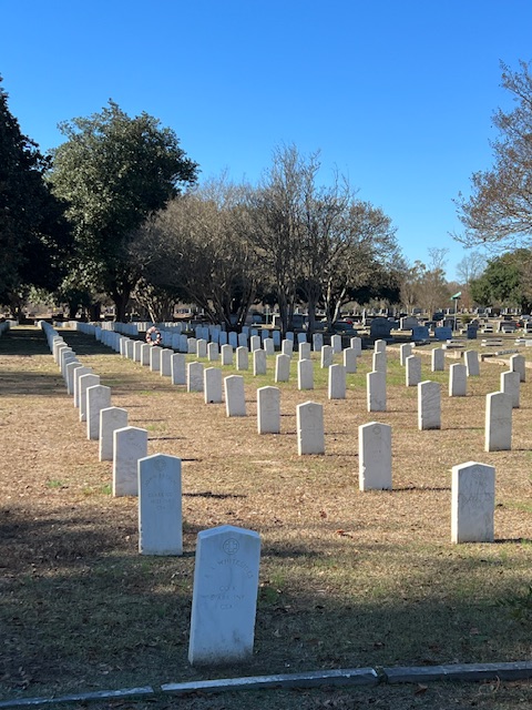
At Friendship Cemetery, Columbus claims to have celebrated the first Memorial Day; however, Waterloo, N.Y is counted as the official birthplace of Memorial Day. On April 25, 1866, Columbus held the first annual placing of flowers on graves of Blue and Gray at Friendship Cemetery. More than 2,000 Confederate soldiers were interred in Friendship Cemetery, along with 40 to 150 Union soldiers. A large group of ladies met at the home of Miss Matt Morton at Twelve Gables Mansion and organized this tribute – treating the Confederate and Union soldiers as equals. This tribute inspired poet Francis Miles Finch to write the poem, The Blue and the Gray, which was published in an 1867 edition of The Atlantic Monthly. In 1867, the remains of all Union soldiers were exhumed and reinterred in Shiloh National Cemetery.
2,194 Confederate soldiersThe Twelve Gables Mansion where the annual placing of flowers on graves of Blue and Gray
Catfish Alley in Columbus is known as the epicenter of blues, jazz and soul music in North Mississippi. In the late 1800s and early 1900s, Catfish Alley was the central meeting and business district for the Aftrican-American Community. It was called Catfish Alley because of the fish frying in the street cafes. African Americans would bring horse-drawn wagons full of vegetables and iced tubs full of large catfish into the alley. An annual carnival would be held in the fall after cotton picking season ended. Many legendary blues musicians came out of Catfish Alley. The notoriety of Catfish Alley later attracted acts like B.B. King, Duke Ellington, Little Richard, Louis Armstrong and James Brown. During the era of segregation, there was a hotel owned by a former slave that catered to African Americans.
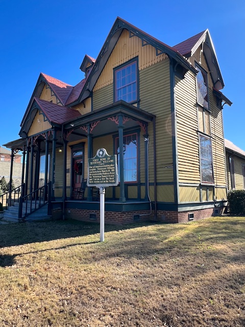
Columbus is also the birthplace of Tennessee Williams – playwright of plays such as The Glass Menagerie, A Streetcar Named Desire, and Cat on a Hot Tin Roof. Born Thomas Lanier Williams in Columbus, on March 26, 1911, he was raised by his mother at the home of his grandfather, the reverend of St. Paul’s Episcopal Church. His father was a traveling salesman and rarely home. The 1875 Victorian rectory is now a museum and welcome center. Unfortunately, it wasn’t open on a Tuesday.
Our courtesy car in downtown Columbus, MSThe 1875 St. Paul’s Episcopal Church Rectory, where Tennessee Williams was raisedCoffee at Coffee House on 5thBaldwin Locomotive No. 601The diamond corssing.
We also visited the Columbus and Greenville (Mississippi) Railway to see the Baldwin Locomotive No. 601, built in 1946. It was the first “Road Switcher” of its type in the U.S. and was the railway’s first diesel powered locomotive. It was retired in 1984. Columbus also has the a “diamond crossing,” which is a rare occurrence where two railway lines cross, forming a diamond shape.
Campus of Mississippi State College for Women
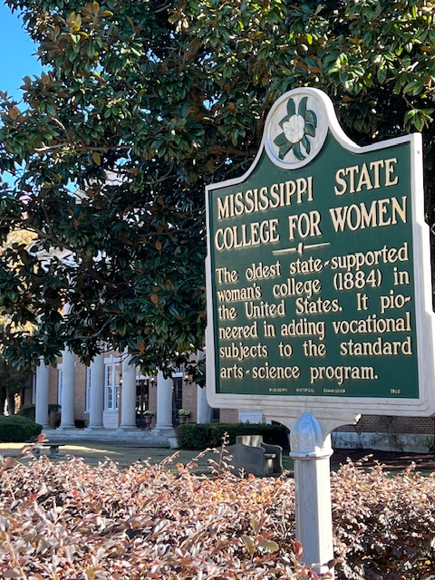
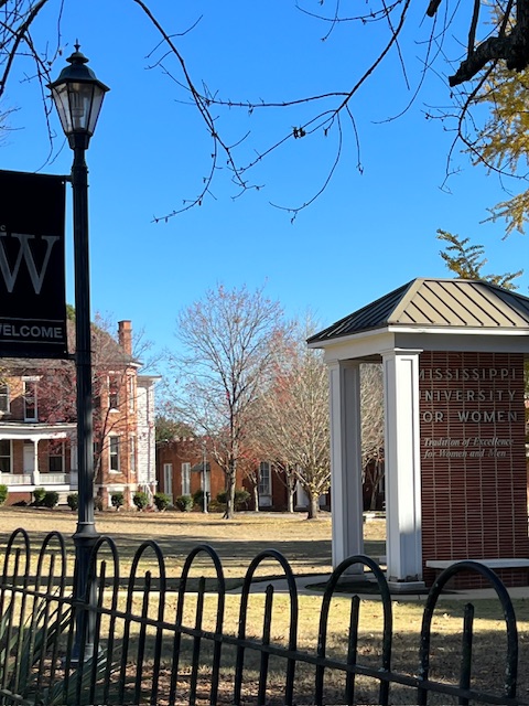
On our way back through town, we drove through the campus of Mississippi State College for Women. Founded in 1884, this is the oldest state-supported women’s college in the U.S. Ironically, Mississippi was the last state to ratified the 19th Amendment, granting women the right to vote, a century later in 1984. The university was originally called the Industrial Institute and College for the Education of White Girls. The mothers of Tennessee Williams and William Faulkner both attended the college. Since 1982, men have been admitted and now make up 20 percent of the student body of this liberal arts college.
Before going back to the marina, we stopped at O’Reilly Auto Parts to get oil to replace what Tim just used on the generator yesterday. We also stopped at Kroger to get a few things and to put gas in the courtesy car. Unleaded gas is $2.86 here.
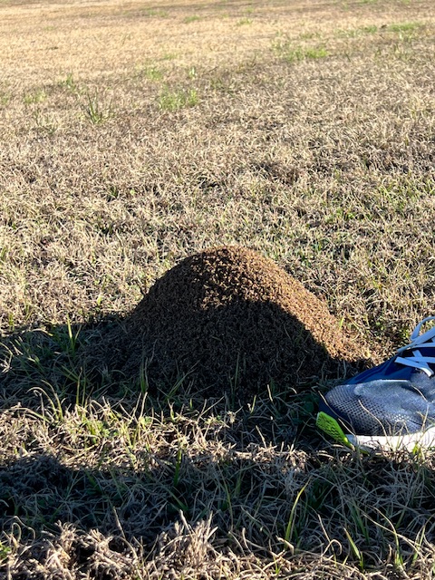
Later in the afternoon, we took a walk to the nearby lock – John C. Stennis Lock – which we’ll be traveling through tomorrow. We were surprised to see large anthills everywhere. A quick Google search explained that they are fire ants! Fire ants entered the U.S. around 1918 near Mobile, AL and are now common in Mississippi.
Another thing that I have noticed since being in the south is that their “blacktop” has a brown/red color, because of the color of their gavel used in the asphalt mix. Sometimes the roads appear red because of the iron compounds in the aggregate.
Anthill of Fire AntsThe John C. Stennis Lock and Dam, Columbus, MS. We’ll be going through this lock tomorrow morningExample of the brown pavement and more anthill in the distance
Wednesday, December 6, 2023 – Columbus MS to Littles Island Anchorage (near Eutaw, AL)
Our voyage today had a duration of 10 hours and 31 minutes, being underway 8 hours, going 54.7 nm (62.9 miles), at an average speed of 6.8 knots (7.8 MPH). We had 2 locks, which explains the 2-1/2 hour difference between our “duration” and “underway” times.
Last evening, we coordinated departing with another Looper boat, Passport. We followed Passport out of Columbus Marina around 7:00 AM. Tim threaded HOMES back through the narrow and 5-foot deep channel. Just around the corner was the John C. Stennis Lock. After dropping 27 feet in about 12 minutes, we were back on our way down the Tenn-Tom Waterway at 7:30 AM.
Threading back through the narrow, 5-foot deep channelEntering the John C. Stennis LockExiting the lock and on our way.A telephone booth!Barge being unloaded
The sun continued to warm the day from a chilly 36 degrees to 50 degrees, by the time we got to our second lock. Along the way, we saw a barge full of scrap metal being unloaded and reloaded onto trucks, and interesting enough – a telephone booth! 😁 I’m sure there is a joke behind that.
Before getting to our second lock – the Tom Bevill Lock – we entered a new state – Alabama! We had to hover outside the lock for about 15 minutes for a barge to come out. While we hovered, I took some pictures of the Tom Bevill Lock and Dam Visitors Center – which is a reproduction of a mid-19th Century plantation house. Docked on the river below the visitors center is a historic paddle wheeler work boat – the U.S. Snagboat Montgomery. This boat was one of the last steam-powered sternwheelers that served as a Snagboat. With its large grapple on a boom, Montgomeryremoved snags, underwater trees, stumps or branches that created obstructions to river navigation. It worked on seven southern rivers, beginning in 1926, removing 120-170 snags a day. It was retired in 1982.
Tom Bevill Lock Visitors Center – a reproduction of a mid-19th Century plantation houseU.S. Snagboat MontgomeryBarge coming out and us going in behind Passport
After the barge came out of the lock, the lock master told us that we could enter and get secured, but we’d have to wait for some maintenance to be completed below the lock before he could lower us – which could take about 45 min. We were disappointed, but just thankful that he was letting us tie up in the lock instead of making us hover outside. So, I tied us off to the floating bollard and Tim shut off the engines. However, before we could get our lunch made, we heard the maintenance boat radio the lock master, telling him to go ahead and let us down, because their computer was in the middle of a software update. We quickly put our lunch fixings back in the refrigerator and restarted the engines and were all ready when the lock master radioed to tell us that he would be lowering us.
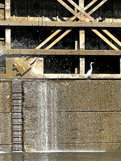
The Tom Bevill LockThis Great Egret was enjoying the leaky lock spray and even got a drinkThe survey boat heading to the lock to do some maintenance
After dropping 30 feet, we followed Passport out of the lock. We waved at the maintenance boat sitting outside the lock. Soon, we passed Passport, because the anchorage that we had chosen for tonight is farther down the river than the one that they had chosen.
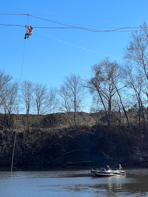
Now that we have exited the Bevill Lock, we are cruising completely on the Tombigbee River – as opposed to the straighter, man-made Tenn-Tom Waterway. We enjoyed an afternoon of twisting and turning with the Tombigbee River. The Alabama shoreline is steeper, with short, white cliffs. Near Cochran, AL, we saw utility worker sliding along a power line over the river. I’m guessing he doesn’t go zip lining in his spare time.😁
Passing PasportShort, white cliffs along the shore line of AlabamaA utility worker dangling above the Tombigbee River
About 2 hours later, we attempted to anchor. We had hoped to be anchored by 3:30 PM, but a boating schedule is never set in stone. We pulled off where the river split and made an island – the Warsaw Cut Off. I was disappointed to see houses all along the southern bank; however, that was just a minor annoyance. The real problem was that the shallowest water depth that we could find was 27 feet – not the 15 feet listed on the chart. We attempted to anchor in three different locations, with multiple tries at each location. With the sun setting fast, we decided to go back up the river to the next closest anchorage.
About 20 minutes later, we got back to the Littles Bar Cut Off – another spot where the river went around and made an island. We continued off the channel for about a mile to a spot where the chart marked a nice sandy bottom anchorage. Luckily, our anchor found that sandy bottom on our first try – just before dusk! It was a beautiful anchorage, in the middle of nowhere! In the clear night sky, we could see the Milky Way and all of the constellations above us. Unfortunately, the low 40-degree temperatures made it too chilly to admire the night sky for too long.
Anchored just before sunsetA peaceful anchorageThe night sky was amazing!
Thursday, December 7, 2023 – Littles Island Anchorage (near Eutaw, AL) to Demopolis, AL
After a foggy start, our voyage today lasted 9 hours and 17 minutes, going 52 nm (60 miles), at an average speed of 7.4 knots (8.5 MPH).
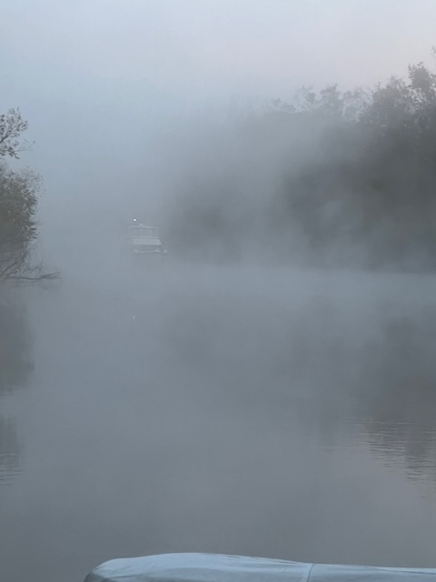
Today would be another long day, with one lock, so we got up at 5:45 AM and planned on leaving around 7:00 AM. However, we awoke to dense fog. The fog appeared to be lifting around 7:30 AM, but then it set back in more dense than before.
Around 8:00 AM, we pulled up anchor. The anchor was caked with mud, but since it was more of a sandy mixture, it slid off easily with my hand tool. A little hosing off and it was all clean. With the fog still hovering over the water, we began heading back out to the Tombigbee River.
Fog at 6:15 AMFog at 7:25 AMPulled up anchor at 7:50 AM, full of mud/sand
We glided through the fog as we re-entered the Tombigbee River. It took 1 hour and 15 minutes to get to the one-and-only lock of our day – Howell Heflin Lock, near Gainesville, AL. It only took 15 minutes for the lock keeper to turn the lock around for us. The lock dropped us 30 feet.
Gliding through the fogTim’s viewIn the Howell Heflin Lock – Gainesville, AL
The below map shows an example of why the locks and dams are needed to make the Tombigbee River navigable. The locks are put where the river is too shallow or the turns are too tight. This map shows how the lock canal cuts straight, as the Tombigbee River snakes around on the left.
See how the lock canal straightens out the Tombigbee RiverTim radios all of the tow captains to see how they want him to pass. They usually wave as we pass.Another pass tow and barge today. We passed at least 3 going north and we had to pass one going south
As we neared Demopolis, AL, we began to see the white chalk cliffs – some 80-feet high – which makes this part of Alabama unique. The chalk is a form of limestone, a sedimentary rock deposited when this part of Alabama was still underwater 145 million years ago. Some formations are more than 500 feet thick, representing at least 9 million years of dead algae and plankton building up on the seafloor. Since this chalk doesn’t let water through, water tends to pool on the surface, developing a dark, rich soil on top of the chalk. For that reason, this area is call the Alabama’sBlack Belt. This dark, rich soil proved ideal for cotton farmers.
The white chalk cliffsThe white chalk cliffsThe white chalk cliffs
Around 3:15 PM, we entered the channel to Kingfisher Bay Marina. We pulled up to the fuel dock to pump out our waste tank. While Tim was checking in and paying for our two-night stay, he signed us up for the marina’s courtesy car from 6-8 tonight and noon to 2:00 tomorrow.
Pumping out the waste tankAll tied up at Kingfisher Bay Marina
At 6:00 PM, we drove into Demopolis to The Red Barn for a drink. As we came to find out, it is a southern iconic restaurant. While we were sitting at the bar, the TV was tuned to a show called True South on SEC (Southeastern Conference) ESPN. The show’s hosts travel the south for restaurants that define the South…and on this Dec. 5th episode, one of the restaurants was The Red Barn! On the show, the owner was being interviewed right at the bar where we were sitting! Several of us at the bar said: “look you’re on TV,” but the bartender didn’t seem impressed. Maybe they have been playing the episode continuously since Dec. 5th. 😁 The history of the barn goes back to the late 1950s when the community built it from whatever old materials they could find. The barn was constructed with large wood timbers taken from old lock #5 when it was removed from the Tombigbee River. The community built the barn for a high school student who was paralyzed in a car accident, so that he could open an antiques shop. It became a restaurant in 1971.
The Red Barn outside……and insideThe True South episode summary
Friday, December 8, 2023 – Demopolis, AL (Layover day)
I finally got a picture of a Kingfisher at our anchorage on Dec. 9th
We had both chores and exploring on our to-do list for today. While I was exercising this morning, I saw a Belted Kingfisher land on the dock post right outside the saloon (living room) window! It was too fast for a picture, but it was a medium-sized bird with a slate blue head with a shaggy crest and a body that is white and slate blue. It is a common bird along the waterways in Alabama. As their name suggests, they feed almost totally on fish. I didn’t get to see him catch a fish, but I did watch a white egret catch a fish yesterday after we docked.
Working on the generatorMaking calls trying to find glow plugs
Tim used this morning to see why the generator has been having issues starting. He determined that the we need new glow plugs. Unfortunately, the NAPA store in Demopolis didn’t have any, so he ordered them online to be shipped home. We’ll be home in about two weeks for Christmas.
At noon, we took the courtesy car into Demopolis. I found an antebellum house museum open today! Bluff Hall was just a 5-minute drive over the bridge from the marina. Bluff Hall stands on historic White Bluff overlooking the Tombigbee River. It was built in 1832 by the slaves of Allen Glover. It was a gift for his daughter, Sarah and her husband Francis Strother Lyon. It was common for plantation owners to also have homes in town. Lyon was a lawyer, plantation owner and a U.S. congressman, as well as serving two terms in the Confederate States Congress. He made his fortune in corn, tobacco and cotton. Corn made him the most money because it was used to make alcohol. Our tour guide said that Lyon worked to help keep Alabama from going bankrupt from 1845- 1853, donating $6 million dollars of his own money to keep the state going.
Bluff HallOur tour guide and lead docent of the Margenco County Historical SocietyThe main hallLooking out onto the main hallThe dinning roomBluff Hall sits on the White Bluff
After the tour of Bluff Hall, we walked around the historic downtown of Demopolis. Demopolis – City of the People – was founded in 1817 by exiled French Bonapartists after Napoleon’s Empire fell. The French were given parcels of land by the federal government on the condition that they grow grapes and olives. However, the soil was not suitable for growing grapes and olives, but the town soon thrives as a commercial river hub in the 1830s.
As a robust, frontier river town, churches were slow to take hold. Rooster Hall is one of the oldest and most historic buildings in Demopolis. It was built in 1843 by the Presbyterians, using locally-made bricks. The church was confiscated by Union soldier during the Civil War. During Reconstruction, after the Civil War, a garrison of federal troops moved the county seat to Demopolis and used this building as the Marengo County Courthouse for a short time. In 1869, the church sold the building to the city and it became the Demopolis Opera House until 1902. It continues to be owned by the city.
After the historic downtown, we drove another 5 minutes out to the commercial shopping area on Route 80. We relaxed with a coffee and a huge lemon bar at Simply Delicious. Before heading back to the marina, we pick up some fresh fruit, veggies and beer at Walmart. There were no other grocery stores around.
This courtesy car was a little nicer than the last one in Columbus, MS, which had over 200,000 miles. However, this car had a the driver’s window that wouldn’t go up all the way. 😁 Oh well, we’re just thankful to have wheels to go explore and pick up groceries.
In the afternoon, we continued to do our chores. Tim rigged up a trip line for the anchor. He read that the anchorage for tomorrow night has snags. This trip line will allow us to pull the anchor up from the front and dump off any snags.
He also check the anodes or “zincs” on the engines and the generator- all looked good! There are anodes anywhere metal touches water – the swim platform, dingy lift, prop shaft, thrusters and fins. The anodes are sacrificial metal (zinc or magnesium) that corrodes instead of your boat. When we get back to saltwater, our anodes will deteriorate faster, so we’ll need to keep an eye on them and eventually replace them.
Rigging up the trip line for the anchorAttaching the trip line to the anchorChecking the “zincs” on the engines and generator
In the evening, we talked with other Loopers on the dock. Three new boats came in this afternoon. We met Sea Cottage and Passport back in Columbus, MS. We had never met the young couple and their cat on Yippy Ka Ay. Robin came into the marina after us yesterday. We met Robin back in Holland, MI. They are a young couple who are documenting their trip on YouTube – Wind Sails and Dog Tails. HOMES has a brief appearance on their episode in Holland, MI.
How many Loopers does it take to dock a boat? 😁 Everyone likes to help! Loopers with their cats and dogsReady to move on tomorrow
Saturday, December 9, 2023 – Demopolis, AL to Edna Bend Anchorage (near Naheola, AL)
Our voyage today had a duration of 8 hours and 34 minutes (but we were underway 4 hours and 26 minutes), going 32.8 nm (37.7 miles), at an average speed of 7.4 knots (8.5 MPH).
Why the huge discrepancy between duration and underway times? Our “duration” is the time we turn on our electronics to when we turn them off. Anchoring takes more time, plus this morning we turned our electronics on 2 hours early, due to an unexpected delay.
Six boats signed up to go through the lock at 8:00AM. There was a signup sheet in the boat house, which the lock keeper allegedly picks up. When Tim called the lock at 7:00 AM, the lock keeper said the lock was fogged in, so call back in 30 minutes. When Tim called back, the lock keeper said that now he had a barge coming 2 miles away, which would get preference over us.
Three Looper boats decided to stay put for another day, estimating that we probably wouldn’t get through the lock until at least 11:00 AM and the safest anchorage was about 9 hours away. Tim search Navionics for closer anchorages and found a safe anchorage only about 6 hours away. So, we decided to go, if we could got in the lock before 10:00 AM. At 9:00 AM, Tim saw on AIS that the barge was already in the lock, so he ran over to tell the other two boats who were still considering leaving today. He then immediately called the lock and told the lock master that three pleasure crafts were on their way! Good thing he did, because another barge was on its way up.
Who’s staying and who’s going?Sea Cottage and the non-Looper boat following us out of the marinaBluff Hall on the White Bluff of Demopolis
Sea Cottage and a non-Looper boat followed us out of Kingfisher Bay Marina. 15 minutes later, we arrived at Demopolis Lock – just as the barge was coming out of the lock. The lock master invited us to come straight in. There were at least seven egrets flying around in the lock. One egret sat on the lock gate the whole time it opened!
HOMES cruising to Demopolis Lock HOMES in Demopolis LockTim exiting the lock. See the egret on the gate?
After dropping 40 feet, we came out to see the waiting barge. It didn’t give us much room to pass! The non-Looper boat sped out of the lock in front of us and was soon gone. Sea Cottage followed along behind us all day – hence the pictures with HOMES in them! The ride today was scenic, but the white chalk cliffs soon faded away.
The view from HOMES passing the barge and……Sea Cottage’s view of HOMES passing the bargeThe white chalk banks finally faded away.
Around 2:00, we got to Edna Bend Anchorage. We had our bow anchor set by the time Sea Cottage arrived. This anchorage is right along the bank – not up a little cut. So, for the first time, we set a stern anchor. The stern anchor will keep us from swinging out into the channel where barges will be passing.
Setting the stern anchorHOMES at anchorSea Cottage anchoring
The temperature got up to 78 degrees today. We enjoyed spending time on the decks well into the evening.
Lunch/supper on the back deckPlanning for tomorrowRelaxing on the top deck
While enjoying the night sky, suddenly a search light lite up the bank. Eventually, we heard and saw the barge coming out of the darkness. We are out of the channel and visible on AIS, but Tim radioed the captain anyway, to let him know two pleasure crafts were anchored on the bend. The captain said “Roger, Roger.”
A barge’s search light lit up the bankIt soon emerged from the darknessIt passed us and then gave us a little bumping from its wake
Sunday, December 10, 2023 – Edna Bend Anchorage (near Naheola, AL) to Bobby’s Fish Camp, Silas, AL
Our voyage today took 8 hours and 36 minutes, going 51 nm (58. 7 miles), going 6.9 knots (8 MPH).
The anchor alarm, which would sound if our anchor would start draggingA passing back at 6:30 AM
Last night, we had a nice night at anchor. We left the generator on until we went to bed. With a low temperature of 55 degrees, we didn’t need to run the generator all night. Tim got up at 5:00 AM to restart the generator, so we’d have hot water for showers when we got up at 6:00 AM. While exercising, I watched a barge pass in the morning light.
Tim started pulling up the stern anchor around 7:00 AM. A long limb was stuck on the anchor, so I had to kneel on the swim platform to hold it while Tim got the anchor free.
I was pleasantly surprised when the bow anchor came up with no mud! It just had a little gravel/sand stuck on it, which easily washed off with the wash-down hose.
The limb hooked on the stern anchorStern anchor upOn our way to our next anchorage
We pulled out of the anchorage before Sea Cottage and headed on to our next anchorage. When we came to the Naheola Bridge, I realized that we have seen very few bridges on the Tombigbee River. There really are very few towns around. Tim commented on how narrow the bridge span would be for a barge. When we went under the bridge, we saw that many barges have hit it!
Heading out past Sea CottageNaheola Bridge……which as been hit a few times by barges!
We passed a lot of barges today. Around 2:00 PM, we got to the anchorage that we had picked out in Choctaw National Wildlife Refuge. Before pulling into the cut, we got a message on Nebo from our Looper friends who are docked 3 miles away at Bobby’s Fish Camp. They said they couldn’t get their anchor to hold there, plus the locals in bass boats yelled at them. We decided to give it a try anyway. However, after about 40 minutes of unsuccessful anchoring attempts, we headed to Bobby’s Fish Camp. A group of our Looper friends were standing on the dock waiting to help us tie up.
Bobby’s Fish CampOur Looper friends waiting to help us tie upDos Gatos Locos and Dirtless are in front of us. The line tied to a tree root on shoreThe first Spanish moss that we’ve seen
HOMES is hanging out over the dock about 3 feet, but we got tied up and hooked to electric. After we got tied up, another boat came in, who we have never met, Gigi III. They rafted off of us, since the dock is full. Since Gigi III is bigger than HOMES, Tim tied another line from HOMES to a tree root on shore.
Dirtless said that the owner will come find us when he wants paid. Dirtless called the owner twice yesterday and was told, “what’s your rush?” Around 5:00, the owner finally came by and said: “Any one of you who need to pay me, come on up to the building.”
Bobby’s Fish Camp OfficeBobby’s Fish Camp office.Inside the office, which also used to be a restaurant
Tomorrow morning, we will all be heading out. Our LAST LOCK on the Tombigbee River will be first thing in the morning!! Mobile, AL, on the Gulf Coast, is just days away!
See you next week! Thanks for reading.
Beth
10 Dec, 2023
Beth
4 Dec, 2023
Blog
Weeks 17-19 – Nov. 13 – Dec. 3, 2020 – Fulton, MS to near Aberdeen, MS
Month of November stats: We traveled 10 days, going 470.1 nm (541 miles) through Illinois, Missouri,Kentucky, Tennessee and Mississippi. We had an average speed of 8 knots (9.2 MPH), but thanks to the fast current of the Mississippi River, we hit a maximum speed of 13.8 knots (15.9 MPH)!
Highlight for these weeks: Realizing that a beautiful side effect of traveling is the joy of going home! We rented a car in Tupelo, Mississippi and spent two weeks at home for Thanksgiving. I saw more family and friends in those two weeks than in probably the last year combined. It’s funny how being away has made me realize how important it is to make the time and effort to see those people who mean so much to me.
HOMES and another boat that will be staying here for ThanksgivingMidway Marina Office
We are now in Elvis territory! Fulton Mississippi is the hometown of Elvis’s father, Vernon Presley, and where Elvis allegedly bought his first guitar.
We booked into Midway Marina for a month, because it is cheaper to reserve a spot for a month than for two weeks. We had Monday and Tuesday as free days before getting the rental car. On Monday, we did some cleaning on HOMES and then took the marina’s courtesy car into Fulton to explore the small downtown, which had a few independent shops and a cute coffee shop.
Mopping floorsDowntown Fulton, MississippiRiverbank Community Center Coffee ShopBill and Tim in the pilot house of CheersCheers
That evening, we finally ran into fellow Loopers, Bill and Louise on Cheers. Tim worked with Bill at the Columbus Fire Department. They gave us a tour of their Kadey Kroger 48 North Sea and we gave them a tour of HOMES. They aren’t taking any time off to go home for the holidays, but we might catch back up with them in the Bahamas in early spring.
On Tuesday, we picked up our rental car from Tupelo Regional Airport. There is no Uber in Fulton, but there is a “Louber” – which is a guy named Lou who lives on his boat at the marina. Lou drove us the 20 miles to Tupelo for $40 and pointed out sights along the way.
Picking up the car at Tupelo Regional AirportOur rental car. First stop – Tupelo River Coffee ShopTupelo River Coffee Shop
Once we got our wheels, we headed to Tupelo River Coffee Shop, where we planned out the rest of our day in Tupelo. Just up the street from the coffee shop was the Tupelo National Battlefield. In July 1864, General Andrew J. Smith’s Union forces moved toward Tupelo, being pursued by Confederate forces. The U.S. Colored Troops fought heroically to defend the rear of the column, allowing the union troops to set up a strong defensive position in Tupelo. Union troops succeeded in their main goal: keeping Confederate General Nathan Bedford Forrest (who I mentioned in previous blogs) and his troops away from the Union railroads in Tennessee.
General Smith wrote that the fighting and discipline of the colored brigade “removed from my mind a prejudice of twenty years’ standing.” Formerly enslaved men often gave an alias when they enlisted to avoid capture, which made it difficult for a wife to prove a husband’s identity on an application for his pension.
From the battlefield, we headed to the birthplace and childhood home of Elvis. My mom is a huge Elvis fan, so we had to stop. Elvis Aaron Presley was born on January 8, 1935 to Vernon and Gladys Presley. Elvis’s twin brother, Jesse Garson Presley, was stillborn 35 minutes before Elvis was born. Elvis was born in a two-room house built by his father, grandfather and uncle. This style of house is called a “shotgun house,” which is a narrow rectangular house, usually about 12 feet wide, with rooms arranged one behind the other and doors at each end of the house. It was a popular style of house in the south from the end of the Civil War (1865) through the 1920s and can be traced to Africa. The family had to move out of this house when Elvis was only a few years old for lack of payment. The family’s years in Tupelo were marked by financial difficulties. Elvis’s father was convicted of altering a check in 1938 and served eight months in prison.
The front of Elvis’s houseThe back of his house13-year-old Elvis and me1939 Plymouth like the one the Presley’s ownedElvis’s childhood church
Elvis revolutionized popular music by blending the blues he first heard as a youth in Tupelo with country, pop and gospel. Elvis’s childhood church, where he fell in love with gospel music, was moved to this site from several blocks away.
On Nov. 6, 1948, at the age of 13, Elvis and his family left Tupelo for Memphis. Elvis is quoted as saying, “We were broke, man, broke and we left Tupelo overnight. Dad packed all our belongings in boxes and put them in the trunk and on top of the 1939 Plymouth. We just headed for Memphis. Things had to be better.” Things did turn around for the family with the release of Elvis’s his first commercial single, “That’s All Right,” in 1954.
Heading home for ThanksgivingHOMES’s spot for a few weeks
On Wednesday morning, we said good-bye to HOMES and headed home for Thanksgiving. We decided to make this a two-day trip, taking the scenic route. We don’t foresee ever traveling this area again, so we wanted to take in its sites.
We began day one – hitting 5 states (Mississippi,Alabama, Tennessee, Kentucky, and Indiana). We traveled up the roads paralleling the rivers that we took down on our voyage to Fulton. However, it took us a month on HOMES to accomplish what we could do almost in this one-day trek.
About 30 minutes after leaving Fulton, Mississippi, we crossed over the Alabama state line. In about another hour, we crossed over the Tennessee River and had coffee in Florence, Alabama. Florence was the home of indigenous people dating back to 100 BCE. Here, you can visit the Florence Indian Mound and Museum. At 43-feet high, it is the largest surviving earthen mound of its type in the Tennessee River Valley. After the Chickasaw Nation was removed by the Federal government in the 1800s, Florence thrived because of its steamship and railroad routes. By 1831, the area expanded with plantations, due to increased cotton cultivation. Today, it is a quaint town – home of the University of North Alabama, as well as having two plantations and the Frank Lloyd WrightRosenbaum House.
Florence, AL
We crossed over into Tennessee around 10:00 AM. For a time, we traveled on the Natchez Trace Parkway – a historic forest trail, which extends 440 miles from Natchez, Mississippi to Nashville, TN. Construction of the parkway began in the 1939 as one of the many Civilian Conservation Corps during the Great Depression. The trail, which largely follows a geologic ridge line, was used by Native Americans for centuries as they followed the “traces” of bison. By the time of European exploration and settlement, the route had become the well-known fastest means of communication between the Cumberland Plateau, the Mississippi River, and the Gulf of Mexico settlements of Pensacola, Mobile and New Orleans.
Natchez Trace Parkway
Today, the 50-MPH, two-laned road, cutting through forested land has many scenic overlooks, historical sites and hiking and horse trails. We pulled off at the site where Meriwether Lewis, of Lewis and Clark fame, died in 1809, at the age of 35. At the time, he was serving as appointed governor of the Louisiana Territory and was traveling to Washington, D.C. from his base in St. Louis, MS to settle some financial problems. He was distraught over many issues and was possibly affected by his use of opium, alcoholism and possibly had malaria, which causes dementia. It is believed by many historians that Lewis shot himself, since he had tried to kill himself several times in the past. Thomas Jefferson and Lewis’s explorer friend, William Clark, acknowledged that Lewis had suffered from “sensible depressions of mind” and “melancholy states.” He may also have felt like a failure because while Lewis and Clark made many discoveries, they did not find the Northwest Passage to the Pacific Ocean – their main goal- and many of the trading posts that they’d established began to fall apart before the explorers returned home. To top it off, he now found himself in a desk job. However, some historians believe that Lewis was killed by bandits roaming the notoriously dangerous Natchez Trace.
Over the Ohio River and into IndianaGood Irish beer and food after a long day on the road!
Fortunately, we made it through Natchez Trace without seeing any bandits and, by 12:30 PM, we were driving over the Cumberland River and driving into Evansville, Indiana. We skirted a little piece of Kentucky around the military post of Fort Campbell, KY. We then ended our day in Bloomington, IN. We stayed in the downtown area – basically on the campus of Indiana University. The downtown was cute and we found a locally-owned Irish pub – Irish Lion Restaurant & Pub – in a restored historic 1882 vintage brick tavern, with cast iron columns, stained glass windows and a Civil War vintage front bar. The good meal was a nice end to the long day of travel. Tim ranks their fish and chips second only to the Kirby House in Grand Haven, MI. Of course, his all-time favorite was in Kinsale, Ireland.
Back in OhioCelebrating Nick’s birthday. My annual b-day sign
Thursday morning, we had just a 3-hour drive to get home. It was so great to see Nick! Norah, our grand dog, was excited to see us too. We had a nice lunch at Tim’s parents house… and so began our two weeks of: socializing with family and friends, holiday decorating, a hair cut, dentist appointments, well-visits, flu and COVID shots, coffee at Winans, and the main event – Thanksgiving!
Setting up for ThanksgivingOne of my favorite parts about Thanksgiving – the parade!Tim, my cousin Andrew and NorahTim, Nick, me and my momNorahThe tree Nick used to put in his bedroom will be our Christmas Tree for now.
Thursday, November 30, 2023 – Plain City, OH to Fulton, Mississippi
We took the fastest route back to Fulton, Mississippi today. It took us about 10 hours, with some slow downs in Nashville and a few stops for lunch and gas. We gained an hour coming back to the Central Time Zone, so it was only 8:30 PM CT when we got back to HOMES. That would have seemed like an impossibly long day, if we hadn’t experienced several 6-10 hour days on HOMES over the last month.
Friday-Saturday, December 1 -2, 2023 – Fulton, MI – Midway Marina (Layover days)
On Friday, we took advantage of our final day with the car by getting groceries. We hadn’t stocked up since having a car back in Holland, MI when we went home in October.
Stocked up on groceries Putting it all awayMy festive purchases!Lost + Found Coffee Co.
After unloading groceries, we headed back to Tupelo to return the car, since Budget Rental Car isn’t open there on weekends. We allowed time to have coffee at Lost + Found Coffee Co., before dropping off the car. The coffee shop and the employees were decked out for Christmas and Christmas songs were playing. I do love this time of year!
Lou, our “Louber,” was waiting for us after we turned in the car. We texted Lou last night and he agreed to come get us. At $40 for 20 miles, Lou is probably cheaper than Uber.
Guy’s Place at Midway MarinaFried green tomatoes and a bowl of shrimp gumbo
It’s funny how we can be so happy to pick up a car, and then be equally as happy to take it back. Since we are car-less again, we walked up to the marina restaurant – Guy’s Place– for dinner. As usual, I tried the local cuisine – fried green tomatoes and shrimp gumbo. I was going wait until Alabama to have fried green tomatoes, since that was the setting for one of my favorite movies – Fried Green Tomatoes; however, I thought I shouldn’t pass up the opportunity, in case I don’t find any in Alabama.
Saturday was a rainy and foggy day, so we had no intentions of cruising. We took the extra day to do chores and maintenance. Our heaters had been shutting off since getting back yesterday, so Tim investigated. He found that the crustacean remnants, from our time in saltwater, which had been stuck to the inside of the sea strainer, had finally fallen off and were clogging the sea strainers. It took several attempts over two days to clean them all out.
Checking the sea strainersCrustaceans from our salt water days……finally fell off and clogged the sea strainers
We had a lunch of pie and coffee at Guy’s Place. Last night, we were too full to indulge in their homemade pecan pie and key lime pie. Both were delicious! Tim made cooked cabbage and sausage for dinner, while I worked on my blog. Another Looper boat, Serendipity, came in and docked behind us. So, we will have a boat to share locks with tomorrow. We’ll be heading out at 8:00 AM.
A foggy and rainy dayKey lime pie and pecan pie for lunchTim cooking and me blogging
Sunday, December 3, 2023 – Fulton, MS – Midway Marina to near Aberdeen, MS
We were not lucky with the timing of the locks today. Our voyage of 27.5 nm (31 miles) lasted 9 hours and 37 minutes, but we were only underway 4 hours and 7 minutes. We had to wait at all three locks today, which ultimately changed our final destination.
Pulling away from Midway Marina around 8:00 AM felt good. We haven’t cruised since November 12th. We pulled out behind the Looper boat, Serendipity. Our first lock – Fulton Lock – was only minutes away. We only had to wait 20 minutes to pull into the lock. By the time we dropped the 35 feet and pulled out of the lock, it was 9:00 AM.
The next lock was Wilkins Lock. We had to wait for a tow and barge to come up, but we still only had to wait about 20 minutes. Once the barge, which was carrying coal and wood chips, came out, we headed in. This lock dropped us 25 feet.
HOMES in the lock. No more pumpkinsGoing downTows and barges all day!
Our final lock of the day was Cochran Lock. This is where our luck ran out. We had to wait for a barge to go down in front of us. Instead of refilling the lock and letting us go down, the lock keeper waited for an up-bound barge – which was 2 miles away. We had to wait for that barge to get to the lock, come up and exit the lock. So, after waiting about 2 hours, we finally entered the lock around 2:40 PM. By the time we dropped the 30 feet and exited the lock, it was 3:00 PM and we still had 12 miles to get to Aberdeen Marina, which was our planned destination.
Now that it gets dark here at 4:45 PM, we decided to anchor tonight, instead of trying to get to Aberdeen Marina. The marina has a narrow channel, so it would be a challenge to pull in there even in full light. So, we found an anchorage on the map that is just north of Aberdeen. The “Acker Lake Cutoff” Anchorage is about 200 feet off the river, up a little cut. Two barges have gone by on the river, but we are safely tucked up in this little cut. We saw an otter or beaver swimming and enjoyed a beautiful sunset.
Our view tonightA passing bargeA beautiful sunset in the middle of nowhere
It is now time to heat up some dinner and relax. The generator is running, so we have all of the comforts that we’d have at a marina. We’ll turn off the generator before going to bed and enjoy the peace and quiet of this beautiful setting.
Tune in next Sunday for our continued trip down the Tenn-Tom Waterway, toward the Gulf of Mexico.
Thanks for reading!
Beth
4 Dec, 2023
Beth
13 Nov, 2023
Blog
Week 16, Part II – Grand Rivers, KY – Green Turtle Bay (Land Between the Lakes) to Fulton, MS – Midway Marina
Highlights this week: Visiting two new states – Tennessee and Mississippi; going through 4 locks (Pickwick Lock, Jamie Whitten Lock, Montgomery Lock, and John Rankin Lock); traversing Kentucky Lake, the Tennessee River and entering the Tennessee-Tombigbee Waterway, which will take us to the Gulf of Mexico.
Tuesday, November 7, 2023 – Grand Rivers, KY -Green Turtle Bay to Paris, TN – Paris Landing State Park Marina
Yesterday, we used our final day at Green Turtle Bay to do some route planning, cleaning and stowing away our winter coats, hats and gloves. The sunny and 75-degree weather was such a welcome change, especially after the cold and challenging week that we had last week.
HOMES coming into Green Turtle Bay, Grand Rivers, KYHOMES leaving Green Turtle Bay, after 3 days off
Our voyage today took 5 hours and 10 minutes, going 38 nm (43.7 miles), at 7.3 knots (8.4 MPH). We had no locks today, so we were completely on our own schedule.
Since this was more of a normal cruising day, we were in no rush to get going this morning. We pulled out of Green Turtle Bay Marina and back onto the Cumberland River/ Lake Barkley, around 8:30 AM. However, within a matter of minutes, we turned right — entering the Barkley Canal. This 1.75-mile canal took us over to Kentucky Lake/ Tennessee River. If we continued on the Cumberland River/ Lake Barkley, we could have gone to Nashville, TN. However, that trip would take about 10 days, and we prefer to keep heading south. Yesterday, Tim made reservations at a marina near Tupelo, Mississippi to leave HOMES while we come home for Thanksgiving – so Tupelo is our new goal.
Lake BarkleyBarkley Canal – connecting Lake Barkley and Kentucky LakeThe 1.75 mile Barkley CanalOn Sunday, Tim made cookiesCruising Kentucky Lake and eating cookies
After exiting the Barkley Canal, we were in Kentucky Lake, which is a part of the Tennessee River. If you recall from last week, I explained that a lock and dam on the Tennessee River (Kentucky Lock and Dam) and a lock and dam on the Cumberland River (Barkley Lock and Dam), made the Land Between the Lakes National Recreation Area in Kentucky and Tennessee. This 171,280 acres was designated as a national recreation area in 1963 by President John F. Kennedy.
Today, we’ll be traveling on Kentucky Lake, through the Land of the Lakes, along with multiple other Loopers. We only encountered two barges. Kentucky Lake was created in 1944 by the Tennessee Valley Authority (TVA). The TVA was created in 1933 as part of Franklin D. Roosevelt’sNew Deal to provide employment to this area, which suffered from both lack of infrastructure and extensive poverty during the Great Depression. The project also provided navigation, flood control and electricity generation.
Kentucky Lake with other LoopersOne tow and bargeEggner Ferry Bridge
Kentucky Lake is the 7th largest man-made lake in the U.S., covering 250 square miles (160,300 acres), stretching 184 miles. By mid-morning, we began cruising in between the states of Kentucky and Tennessee. A little after 1:00 PM, we put the state of Kentucky behind us as we continued through Kentucky Lake to enter a new state – Tennessee.
We pulled into Paris Landing State Park Marina around 1:30 PM. This 842-acre Tennessee state park was founded in 1945. In the 1800s, this landing served steamboat traffic on the Tennessee River. Unfortunately, the town of Paris was too far to walk. Paris was named for the French capital in honor of Revolutionary War hero, Marquis de Lafayette, who visited Tennessee in the early 1800s. Paris is considered the oldest incorporated town in West Tennessee. During the Civil War, Henry County sent more than 2,500 volunteers to the Confederacy and was given the title “Volunteer County of the Volunteer State.”
At Last II arrivingThe dock hand (in orange) used to live in Dayton, OH
By the time we got settled, our friends in At Last II pulled into the slip next to us. After helping them with lines, we walked to the marina office to check in. The marina dockhand told us that he had lived in Dayton OH for years and had been a firefighter in Fairborn. He knew exactly where our hometown of Plain City is. Such a small world.
We took a walk around the state park. There was an aviary – large enclosures confining birds, but allowing them to fly in a natural environment. Here, they rehabilitate birds of prey that are native to West Tennessee. Many are released back into the wild. The raptor and owls that we saw appeared to have injured wings or eyes. From the aviary, we found a short hiking trail.
In Tennessee now!A short hike
After our hike, we headed back to HOMES. Later, we walked up to the Lodge at Paris Landing for drinks with At Last II. It was a great evening with friends and beautiful weather.
The Lodge at Paris LandingEnjoying time with At Last IIA nice end to the day
Wednesday, November 7, 2023 – Paris, TN – Paris Landing State Park Marina to Waverly, TN – Cuba Landing Marina
Leaving our slip in between Loose Moose and At Last IIThe Ned R. McWherter Bridge – view from our walk to the Lodge at Paris Landing last nightThe Ned R. McWherther Bridge – view from the water
Our leisurely voyage today took 6 hours and 36 minutes, going 43 nm (49 miles), at an average speed of 6.5 knots (7.5 MPH).
We exited Paris Landing State Park Marina and immediately cruised under the Ned R. McWherter Bridge. This bridge takes U.S. Highway 79 across Kentucky Lake to the Land Between the Lakes.
Cruising Kentucky Lake is relaxingThe Benton-Houston Ferry
Later, the Benton-Houston Ferry cruised in front of us. This is one of only two ferries in Tennessee and is considered the last ferry on the Tennessee River. Many locals rely on the ferry service to get to work.
Immediately past the ferry, we saw half of a railroad bridge and an building emerging from the water. These sites reminded us that many towns were flooded when the Kentucky Dam impounded the Tennessee River to create Kentucky Lake in the 1940s. These towns are still under the water and are marked on our charts as hazards.
These two structures in front of us are the only visible reminders of Danville, TN. Danville was established in 1860 because of the L&N Railroad. This railroad bridge carried trains over the Tennessee River connecting West Tennessee and Middle Tennessee – a very important freight route and strategic to the south. The original bridge at this site opened in April 1861 – the very month that the Civil War broke out. During the Civil War, Union troops disabled the bridge to prevent trains from delivering supplies to the south. The bridge that we see today was built in 1931 and was dismantled in 1941 when the area was flooded. Our charts mark “submerged bridge,”which is about 20-30 feet below the surface.
The 1931 L&N Railraod BridgeA private residence now stands at the end of the bridgeThe Danville Freight Elevator
Just past the bridge, a portion of the Danville Freight Elevator can be seen rising out of water. This four-story concrete structure was built in 1914 on the bank of the Tennessee River. This freight elevator allowed cargo ships to transfer goods from the river to the railroad tracks. The structure still stands, reminding us of the peanuts, grain, coal, mussel shells and general merchandise that once passed through this area.
Throughout our cruise today, we saw shallow areas, islands and things poking through the water outside the channel, indicating that Kentucky Lake is man made. We also saw multiple eagles. We only saw one barge, but we did encounter some industrial areas. We cruised past the Johnsonville Cumbustion Turbine Plant, which has been generating electric using natural gas since 1975. When the CSX lift bridge at New Johnsonville appeared, Tim radioed the operator. We were told that the clearance today is 27 feet, because of low water. HOMES is 21 feet, so we cruised right under. The town of New Johnsonville is “new” as of 1949, because the old Johnsonville is now under Kentucky Lake.
Islands, old structures and shallow grassy areas dotted our curiseNew Johnsonville CSX BridgeJohnsonville Cumbustion Turbine Plant
Around 3:00, the U.S. Rt. 40 bridge came into view, and we knew Cuba Landing Marina was right before that bridge. The marina is on the Tennessee National Wildlife Refuge and boasts of having a nesting pair of eagles with two eaglets. Jesse James owned a nearby farm and hid here with his gang. Nearby at the confluence of Duck and Buffalo Rivers, a prehistoric village dating back to AD 1100 was discovered in 1895. These mounds are known as Duck River Temple Mounds or the Link Farm State Archaeological Area.
Without electronic navigation, we would never have noticed or attempted to go into this marina. The 30-foot wide channel was unnerving to me, but Tim negotiated the tight turns and we final got into a wider area. We could see a guy on the end of the dock waving us to our dock…but then we heard a huge thunk and one of the engine died! Fortunately, the engine immediately restated for Tim. He revved the engine and didn’t feel any vibrations, so we continued on to the dock. The engines created a huge pool of mud as Tim turn HOMES around to dock on our starboard side.
The narrow channel getting into Cuba Landing MarinaHOMES churning up some mud in this shallow marinaHappily docked! But this metal roof caused us to have no Starlink internet
While navigating the marina was tough, the husband and wife owners of the marina were phenomenal! The wife came to meet us and gave us the keys to her car! She said that she gives all Loopers her car so they can see “Loretta Lynn country” and get some authentic southern food. She said that since we’re the only Loopers here tonight, we could even take her car the 70-minute ride to Nashville, if we wanted. We declined her invitation to drive to Nashville, but we accepted her offer to take her car into Hurricane Mills, TN.
After a winding and hilly ride to U.S. Rt. 40, we drove the 5 miles to the recommended Log Cabin Restaurant. The restaurant says that the building was originally a home built over 100 years ago of ten-inch hickory logs, and since 1966 has been “the home to one of the most authentic country-style menus in Tennessee.” We embraced the cultural experience – putting concerns for our cholesterol and blood pressure aside. 😁 I had the boneless fried chicken, green beans with chunks of bacon, sweet potato casserole and corn bread. Tim had the country fried steak, coleslaw, a roll and onion rings. It was all very good. By the time we finished eating, however, it was dark. It gets dark a little before 5:00 PM now. So, we didn’t get to go see Loretta Lynn’s Ranch and The Coal Miner’s Daughter Museum.Loretta Lynn passed away in 2022, but her rags-to-riches story continues to be a source of pride in this area.
Our wheels to see Loretta Lynn countryHome of authentic southern foodOur authentic southern meal. The Heinz was not made in Fremont
Thursday, November 9, 2023 – Waverly, TN – Cuba Landing Marina to Clifton, TN – Clifton Marina
Our voyage today, started as smoothly as it ended yesterday. As Tim started pulling away from the dock, one of our antennas caught on the dock roof. He immediately reversed and freed it. We then stopped at the fuel dock to fix it. The antenna mount had come loose and needed to be screwed back into place. The next joy was navigating that narrow channel back out onto the Tennessee River.
We didn’t notice the antenna sideways in this pictureTim fixing the antenna mount at the fuel dockNegotiating through the narrow channel markers
Our voyage today took 5 hours, going 37.2 nm (43 miles), going 7.4 knots (8.5 MPH). It was another day of having no locks.
We have left Kentucky Lake behind us yesterday. Now, we can see the natural lines of the Tennessee River. The river was once called the Cherokee River, because these banks were the homeland of the Cherokee people. The first major battles of the Civil War occurred along the Tennessee River in 1862. Union commander, General Henry Halleck, considered the Tennessee River to be more significant than the Mississippi.
We got to see some of the work that it takes to keep this river navigable. We passed a dredge and then passed the tow pushing a barge full of material that a dredged had cleared out of the river. Then, we saw a U.S. Coast Guard boat out maintaining the channel markers.
U.S. Coast Guard boat maintaining channel markersBarge full of dirt cleared by the dredge up river
On the scenic Tennessee River, we winded our way though hills, with occasional campgrounds or houses on the banks. The houses on the low banks are on stilts. Other than passing two Looper sailboats, we were the only pleasure boat around.
Our voyage was cloudy, but it never rained. The clouds, while maybe gloomy, make it easier to navigate than the sun in our eyes.
The winding Tennessee RiverBeautiful shorelineHouses on stiltsBrowns Bluff Lighthouse
We passed Browns Bluff Lighthouse, on the bluff at Sugar Tree, TN. This 6-story wooden residence is no longer an operational lighthouse, but it is an historical landmark. The only working lighthouse on the Tennessee River is a 26-foot pyramidal wooden tower that marks the entrance of the Kentucky Dam Marina. We didn’t go through the Kentucky Lock, so we missed that lighthouse.
Around 1:00 PM, we were making our approach to Clifton Marina. It was wider, deeper and had a shorter approach, so it seemed easy compared to yesterday. Once inside the cut, we turned right and had the whole dock – right in front of the marina restaurant.
The cut back to Clifton MarinaThe marina restaurant is right off the bowClifton Marina, Clifton, TN
After checking in at the marina office, we had a quick lunch on HOMES and then headed into the town of Clifton, TN. Yes – they have a coffee shop! The 1-mile walk took us on some “historical sidewalks” through the town’s Victorian neighborhood. SDG Arts Gallery & Coffee Bar was on Main Street, along with the bank, drug store, a medical clinic and a few other businesses. Being the only customers, we talked with the manager the whole time. I enjoyed my coffee and Tim his hot chocolate.
Stores on Main Street
It rained hard while we were in the coffee shop, but it was just drizzling when we continued our walk around Clifton, which was founded in 1840 on this high cliff. The Landing Hotel stood at the end of Main Street, overlooking the Tennessee River. This beautiful three-story hotel was built in the late 1800s. From the iron-railed porch of the hotel, I could see a historical marker.
The end of Main StreetThe late 1800s Landing Hotel with a view of……historical markers!
Despite the drizzle, I couldn’t pass up a historical marker! Confederate General Nathan B. Forrest crossed the Tennessee River at this point twice, leading his cavalry brigade on a raid through West Tennessee from Dec. 15, 1862 – Jan. 3, 1863. By night, approximatey 2,100 confederate soldiers ferried across the river in two flatboats capable of carrying 25 men and their horses. According to a diary entry, they pushed their horses off this 10-foot-bluff and into the swift, icy cold water and all but eight horses made it to the sandbar. In two days, they were all over the river and destroying railroads and severing General Grant’s union supply lines. General Robert E. Lee said that Forrest was the greatest general of the war. After the war, Forrest worked as a planter and railroad president and was a prominent figure in the foundation of the Ku Klux Klan. If you are a fan of Forrest Gump, you may remember that Forrest Gump was an ancestor of General Forrest and was named for him.
Later in the evening, we met up with the other Loopers for dinner and to coordinate our plans for sharing the lock tomorrow. The couple on Surprise is doing the Loop with two young sons and a dog.
Seeing HOMES on our walk back from town.5 Looper familiesEnjoying Tennessee craft beer
November 10, 2023 – Clifton, TN to Iuka, Mississippi- Safe Harbor Aqua Yacht
Today, we had one lock, but it took a long time! Therefore, we were underway 6 hours and 43 minutes, but our voyage lasted 10 hours and 6 minutes, going 49 nm (56.4 miles), going 7.3 knots (8.4 MPH).
We started our day calling our son, Nick, and wishing him a happy 20th birthday! That was a fast 20 years, but definitely the best 20 years.
It was a drizzly morning, as our group of five boats made our way out of Clifton Marina around 7:30 AM. The Tennessee River gave us a curvy ride against a strong current – which got stronger as we got closer to the lock. Pickwick Lock and Dam was named after the community at the site of the dam at the time it was constructed. And yes, for you Charles Dickens fans, the community was named after the title character in his 1837 novel, The Pickwick Papers.
Tim helping Brand New Day cast offSurf Rider and Dorothy’s Gale 2 getting ready to pull outOur last day on the Tennessee River
Pickwick Lock and Dam came into view around 12:30 PM. The lead boat, Brand New Day, radioed the lock when we were a mile away and explained that three boats would be approaching and three other boats were at least 45 minutes to an hour behind. When asked if we should slow down and let the others catch up, the lock keeper told us to just keep coming. To maintain our speed, we went from 1300 RPM to 1700 RPM and still lost a whole knot.
The buoys show ……the current that we’re fightingBurning the fuel today!
When we arrived, we were surprised that the lock wasn’t ready for us. We radioed again and was told that would be entering large lock chamber – larger an additional 400 feet. Pickwick Landing Dam is a significant producer of hydroelectric power, with six generating units. While the dam opened in 1938, these two massive locks opened in 1984; however, there have been many locks and canals in this area since 1827. The area was originally known as Muscle Shoals and divided the Tennessee River into two sections and presented the single greatest obstacle to navigation.
We hovered for 20 minutes before the lock keeper began to empty the lock. To hover, we had to keep HOMES in idle speed. Normally at idle speed, we go 4.5 knots, but idle speed in this current was 1 knot. So, we sat in idle speed and remained relatively still. The lighter boat in our group had a more difficult time hovering.
The Pickwick Lock and DamFinally, the rushing water means the lock is being emptied We hovered behind the sign for over 20 minutes
Around 1:30 PM, the gates finally opened and we went into the chamber. I secured a line around the floating bollard. By this time, one more boat had caught up and was entering the chamber. I stood there holding the cold, wet line for at least 15 minutes before I realized that he was making us wait for the two sailboats that were still 1 mile away, going 5 knots in the strong current. So, we decided to make the best use of our time. I cleated off my line and went inside the boat to keep warm. Tim shut off the engines and transferred some fuel in the tanks, getting ready for our fuel fill up when we get to the marina.
Finally, going into the lockBrand New DayThe massive gate
The sailboats finally pulled into the lock and, around 2:12 PM, the gates began to close. The lift of 63 feet took a little over 30 minutes. Around 2:45 PM, we exited the lock into Pickwick Lake, which is one of the few lakes in the U.S. to be located in three different states – Tennessee, Mississippi and Alabama.
Gates closingGoing up 63 feetAt the topAt the tristate borderAt the tristate border
Within an hour, we were passing the tristate-border area. If we continued going on the Tennessee River, we would have ended up at Chattanooga, TN, but we have been there before, so instead, we turned off Pickwick Lake/ Tennessee River in the direction of our next leg – the Tennessee-Tombigbee Waterway.
Our marina for the next two nights – Safe Harbor Aqua Yacht – was just minutes off Lake Pickwick. We pulled up to the fuel dock. We haven’t filled up since the Safe Harbor in Muskegon, MI on September 27th – 994.5 miles ago. HOMES took 521 gallons, which is about 2 miles to the gallon. We normally get 3 miles to the gallon, but on this leg, we have been fighting a current at times and going faster speeds to keep up with our flotillas.
It took 50 minutes to fuel up HOMES, so it was getting dark by the time we tied up at our slip, just around from the fuel pump. We were too tired to cook, so we went up the the Marina restaurant for a pizza. We sat with our friends from New Day and then our old friends on Regular Eggs came in. Regular Eggs left our yacht club on Middle Bass Island the same day that we did. We had been meeting them regularly up Lake Huron, but we haven’t seen them since Presque Isle, MI. It was nice catching up.
Filling up -4:06 PMFinally filled up – 4:57 PMHooking up at our slip – 5:15 PM
Saturday, November 11, 2023 – Iuka, MS -Safe Harbor Aqua Yacht (Layover day)
Dorothy’s Gale 2HOMES and Brand New Day at Clifton
Today, was a land adventure with Dorothy’s Gale 2 and Brand New Day. We reserved one of the marina’s courtesy vans to visit Shiloh National Military Park, which was only 14 miles away, just over the border into Tennessee. We passed this bluff at Pittsburg Landing yesterday on the water. The Battle of Shiloh took place on April 6-7, 1862, which began a six-month struggle for the key railroad junction at Corinth, TN. It was one of the first major battles in the Western Theater of the Civil War, involving 65,000 union troops and 44,000 Confederates troops. The Confederates had hoped to surprise Grant’s troops, and they did on the first day, but more Union troops arrived the next day, surprising the Confederates. The two-day battle resulted in 24,000 killed, wounded or missing – the largest battle fought in America at that time. The Civil War raged on for another three years, but it is said that the South never smiled again after Shiloh. It was a sobering visit. Killing follow Americans and destroying our own infrastructure, led by men who all went to the same military school – West Point. It was refreshing to hear the old southern dock hands at the marina tell us that this is our history and no matter how ugly it is, this site needs to be visited. They said it was a war created by politicians and financiers and we need to learn from history, so we don’t repeat our mistakes in the future. Amen.
It’s a National Cemetery, so there are soldiers from other wars buried here as wellSome of the troops were from Ohio.
We took the remainder of our day to drive to Iuka, Mississippi to the Piggly Wiggly Grocery Store/ ACE Hardware. Groceries and hardware in the same store – a boaters dream come true!
Sunday, November 12, 2023 – Iuka, MS – Safe Harbor Aqua Yacht to Fulton, MS – Midway Marina
Our voyage today involved 3 locks, so we were underway 6 hours and 44 minutes, but the duration of our trip was 8 hours and 37minutes, going 48.3 nm (56 miles), at an average speed of 7.2 knots (8.3 MPH).
We pulled out of our slip around 6:20 this morning and headed down Yellow Creek, which is part of the Tennessee-Tombigbee Waterway – known as the Tenn-Tom. This waterway will take us all the way to the Gulf of Mexico. The Tenn-Tom, a 234-mile artificial waterway, had been a vision since 1875, but construction didn’t begin until 1971. Construction was completed in 1985, at a cost of $2 billion. The Tenn-Tom runs from where we started our day – at the junction of the Tennessee River– and ends near Demopolis, Alabama. It has ten locks and dams. Today, we conquered three of those locks.
We spent the first four hours of our day traveling on the canal and/or on the creeks and lakes feeding the canal. We passed two tows – one going up stream and one going downstream. This morning, we saw three Looper boats leave the marina before us. Soon after we left, there were three more Looper boats behind us.
The Tenn-Tom WaterwayYellow Creek above us, feeding the canalPassing a barge full of wood mulch
Our first lock of the day was the Jamie Whitten Lock, completed in 1983. When we were a mile away from the lock, Tim radioed the lock keeper. He told us that if we get there by 10:30 AM (in 15 minutes), then he would wait for us. So, Tim revved HOMES up and pushed some water! When we arrived, we followed five boats into the lock. However, the lock keeper then waited another 30 minutes to allow three other boats to arrive.
Tim revved it up to 11.5 MPH to make it to the lockHOMES was pushing some water!We made it! We followed the other 5 boats into the lock
Once the 9th boat was secure, we began our 84-foot drop – the biggest drop of the 10 locks. This was a deep and leaky lock. Water sprayed out of hatches and doors in the lock walls. This was something new!
Jamie Whitten LockWater spraying out of doors and hatches in the lock wallTim getting sprayed on
We were in the lock for about 25 minutes before pulling back out onto the canal and parading on to our next lock.
Dorothy Gale 2 behind us 84 feet down in this massive lockGoing out……and parading on
About 40 minutes later, our newly-formed flotilla reached the Montgomery Lock. Since we were all in a tight group now, it didn’t take long for everyone to get secured. About 20-minutes later, we had dropped the 30 feet to the canal below. The average cost to keep this lock and dam operational averaged $5.8 million per year between 2010 and 2014; however, in 2015, the shippers realized average annual transportation cost savings in excess of $197 million- transporting coal, stone, sand, gravel and cement from Pennsylvania, Ohio, West Virginia and Kentucky.
The lock keeper walking the back gateDown 30 feet
An hour later, we were pulling into our last lock of the day – John Rankin Lock – and making our final 30-foot drop for today. In all, we will drop 341 feet over the 450 miles of the Tenn-Tom Waterway. After today, we have 7 more locks and 197 feet more to drop.
John Rankin LockA tow and barge waiting for us to come downGoing out after dropping 30 feet
We were reminded all day that the Tenn-Tom is a working waterway, connecting the eastern Gulf Coast and much of the mid-continental U.S. There was a tow and barge waiting for us to exit the lock. We were all relieved to have gotten through all three locks without waiting for any tows and barges. They have precedence over pleasure boats, so we would have had to sit and wait.
Tenn-Tom is a working waterwayThis looks like wood chipsThis tow and barge was waiting to go up the John Rankin Lock
Once out of the John Rankin Lock, we traveled another 40 minutes before six of us filed into Midway Marina. For us, this is the end of the road until after Thanksgiving. On Tuesday, we’re picking up our rental car in neighboring Tupelo, Mississippi. We’ll be heading home on Wednesday or Thursday to enjoy the Thanksgiving holiday with family. Thanksgiving is my favorite holiday!
There will be no blogs for 2 weeks, since we’ll be HOMES-less. We’ll catch back up with you on Sunday, December 3rd, when we continue down the Tenn-Tom Waterway – hoping to get to Mobile, AL before coming home for Christmas.
Midway Marina – Fulton, MSHOMES’s spot for the Thanksgiving holiday
Thanks for reading! It’s nice having you travel along with us!
Beth
13 Nov, 2023
Beth
5 Nov, 2023
Blog
Week 15, Part II – Grafton, IL to to Grand Rivers, KY- Green Turtle Bay Marina (Land Between the Lakes)
Highlights this week: Record breaking week for longest voyage (109 miles) and fastest speed (15.9 MPH); freezing temperatures; passing the St. Louis Gateway Arch; getting to a 2 new states (Missouri and Kentucky); cruising 3 new rivers (the Upper Mississippi, the Ohio and the Cumberland); completing 5 locks; and our first anchorage of the year. In October, we traveled 492 miles. This week, we added another 293 miles to that!
Monday, October 30, 2023 – Grafton, IL – Grafton Harbor Marina (Layover day)
When we left you last Sunday, Tim had just fixed the raw water pump on the starboard engine – after five hours of sitting in a cramped space. So, today was just a day to relax and catch up on needed chores.
We filled up the water tank. We’ll be using our own water for at least the next week. The marinas are starting to turn off their water, plus we plan to anchor out three nights this week. HOMES has a watermaker, which can make 37 gallons/ hour, so we have no fear of running out of water. However, we fill up our tank when we can.
Cooking up some foodFilling up our water tank
After Tim did some cooking to fill up the refrigerator, we walked about 15 minutes to the nearby “market.” The Grafton Market was more of a convenience store at this time of year. There were no fresh fruits or vegetables, as shown on their website. I did get a head of iceberg lettuce, since that’s all they had.
We then walked back past the marina to see what the town of Grafton looked like. Being located at the confluence of the Illinois and Mississippi Rivers, Grafton was once a bustling town. During the Civil War era, Grafton’s hills, caves, hallows and islands harbored bushwhackers (Confederate guerrillas), jayhawkers (Unionist guerrillas) and outlaws, including Jesse James, who began his career as bank, stagecoach and train robber, as a bushwhacker.
The town of Grafton, ILThe Bloody Bucket Salon, which claims to have hosted Jesse JamesBack at the marina. HOMES can be seen at the very end of the dock
Grafton currently has a population of about 630. The Great Flood of 1993 caused significant damage to many of Grafton’s structures, and a third of the city’s residents moved away. That year, the Mississippi River hit 38.2 feet – 20.2 feet above flood stage. Beginning in April of 1993 many of Grafton’s residents had to flee, and the flood consumed most of the summer. The damage was estimated at around $25 million, but there were no deaths or injuries.
Later in the evening, we walked up to the Grafton Pub for a drink and to talk to some local people. It was too cold and rainy last evening to venture outside. Tonight wasn’t any warmer, but at least it wasn’t raining.
A chilly, but sunny dayGrafton PubHad fun talking with some locals, while enjoying a drink and pretzel bites
Tuesday, October 31, 2023 – Grafton, IL to Alton, IL
We awoke to no running water. I walked outside to see if someone had turned off the spigot, but found it was still on. So, I looked at our hose going into the boat. I found the front deck covered in slippery frost and an ice sickle hung from our hose. It got down to 25 degrees last night, so I guess it should have been expected. Tim switched on the fresh water pump, so we had water. This is why we filled up the tank yesterday!
Luckily, the marina’s pump-out station was still working in the cold. We waited for two other Loopers to pump out before we untied and pulled up the the pump-out/ fuel dock. At this point, pumping out is like getting water – if it’s there, we’re going to take it.
Frost on the front deckFrozen water. Had to use our water tank this morningGetting a pump out, even though we don’t need it yet.
On our voyage down the Mississippi River today, we were underway 2 hours, going 13.9 nm (16 miles), at an average speed of 6.6 knots (7.6 MPH). Yes, we could have driven in a car from Grafton to Alton in about 17 minutes, but where would the fun in that have been! 😁 There were no locks, so we could travel at our own speed. It was also a nice test for the starboard engine after Tim fixed it.
The shoreline has changed again. The Illinois side of the river has cliffs and we even saw some caves – luckily no outlaws. The Missouri side is more flat with many little inlets and little islands.
Our Lady of the Rivers Shrine, in Portage des Sioux, Missouri, was constructed in 1956 this site where three major rivers – the Illinois, Missouri and Mississippi – intersect within a few miles of the site. There is an annual Blessing of the Fleet Parade in which a priest blesses the boats for a safe and prosperous year.
Beautiful cliffs on the Illinois sideThe Missouri side. Our Lady of the Rivers Shrine – Portage des Sioux, MissouriThe Mississippi River, making the boundary of Missouri and Illinois
When we saw the Clark Bridge, we knew that Alton Marina was close. The Clark Bridge was built during the Great Flood of 1993, that I just mentioned. It was featured in a NOVA documentary called “Super Bridge.” This documentary highlights the difficulties of the bridge’s construction, because, in addition to the flood issues, the engineers were using a new techniques never before used in the U.S. – a light, steel-framed, cable-stayed design, combined with a cable saddle type of pylon. It is named for William Clark, of the famous duo Lewis and Clark, who explored the Mississippi River from 1804 to 1806.
Had to pass the bridge and come back under to get into Alton MarinaHOMES amongst her Looper friendsMy travelling pumpkinGermanic Brew Haus
Despite the 40 degree day, we walked into the town of Alton, IL. A cup of coffee, at Germania Brew Haus, hit the spot after a walk around town in the biting cold wind. After warming up, we headed off again in search of history.
The Lincoln-Douglas Square was the site of the last of seven debates between Stephen Douglas and Abraham Lincoln for the 1858 U.S. senate race. At this spot on October 15, 1858, 5,000 people watched Lincoln give his famous speech – “A House Divided against itself cannot stand.”Lincoln believed slavery was a moral, social and political evil against the American Constitution; however, he did not believe in full equality for black citizens. Douglas argued that outlawing slavery would make black citizens believe they were equal to white citizens and that states rights were paramount over national rights. Douglas defeated Lincoln for the senate seat, but two years later, Lincoln defeated Douglas in the race for the U.S. Presidency.
Lincoln-Douglas Square5,000 people watched Lincoln give his speech – “A House Divided against itself cannot stand.”
Also in Alton, abolitionist, Elijah Lovejoy, was violently murdered in 1837. His death is considered the first casualty of the Civil War. After a mob destroyed his printing press in St. Louis, Lovejoy came to Alton, where he led the College Avenue Presbyterian Church and started the Alton Observer – which regularly featured his anti-slavery columns. Anti-slavery groups began gaining momentum in the 1830s. Lovejoy’s martyrdom is considered one of two events that hastened the onset of the Civil War. The other event was John Brown’s raid on Harpers Ferry. Lovejoy, being a member of the clergy, foretold the coming crisis of conscience among American’s clergy. Abolition arguments would rock the foundations of American religion in the coming years.
Our next stop was Old Bakery Beer Company. We decided to check out the local craft brewery, since it was unlikely that we’d be coming back into town this evening – even though we were told that the Halloween parade was spectacular. Luckily, the brewery had a stocking hat. It doesn’t match my coat, but it will feel good during tomorrow’s voyage.
The Old Bakery Beer CompanyMy new warm hat for tomorrow’s cold voyageAlton, with the Old Bakery Beer Co. in the forefront
When we got back to HOMES, we rolled up the water hose, since we won’t be using it for a while. Tim also put a heater inside the dinghy. He hadn’t thought we’d need to winterize the motor, but the heater will work – as long as the motor survived last night.
Putting the hose away for nowPutting the heater inside the dinghy HOMES and his Looper friends, waiting for tomorrow
Wednesday, November 1, 2023 – Alton, IL to Kimmswick, MO – Hoppie’s Marina
This morning, we received our monthly Nebo report for October.
In October, we travelled 11 days and went 427.5 nm (492 miles), at an average speed of 7.2 knots (8 knots).
We began October in Grand Haven, MI and ended in Alton, IL. We added a few extra miles by backtracking from Saugatuck, MI back to Holland, MI, where we left HOMES for a few days, while we went home for a visit.
Today, we left Alton Marina with 10 other Loopers. Our 7-hour-and-29-minute voyage included 2 locks, so we were actually only underway 4 hours and 43 minutes. We went 37.1 nm (42.7 miles), going an average of 7.9 knots (9 MPH). The current really gives us a boost.
We could see the Melvin Price Lock and Dam from the marina. This facility, constructed in 1989, is a state-of-the-art installation with two locks and a visitor observations tower. It stands as the first replacement for one of the original 1938 structures. We had planned on pulling out of the marina at 7:00 AM, but we could see a line of tows and barges listed on the website, as well as going past the marina. Instead, we took off at at 8:00 AM, but still had to hover in front of the lock for 40 minutes. The Melvin Price Lock is named for a congressman who served Illinois from 1945 until his death in 1988. This is our first lock on the Mississippi River. It is central to river traffic of commodities such as soybeans, corn, grain, asphalt…and pleasure boaters.
Heading under the Clark Bridge with the Mel Price Lock and Dam in front of us10 of us hovering outside the lock, waiting our turnOn our way in, after 40 minutes of waiting
After the tow and barge in front of us finally exited the lock below, the lock was refilled for us and we entered the main lock. The massive lock – 1,200 feet long – had plenty of room for all of us to have floating bollards. In this modern lock, the lock gate lifts up behind us wall – instead of swinging shut.
Holding onto my line around the floating bollardThe gate lifted into place… …and became more visible as we lowered
After dropping 24-foot, the gates swung open in front of us and the horn sounded – signaling that we could proceed out of the lock. The 11 of us paraded out of the lock and continued down the Mississippi River.
In about 30 minutes, we veered off the Mississippi River onto the Chain of Rocks Canal – a 8.4 mile long, man-made canal. A large arrow pointed the way. After 1940, this 17-mile stretch, with its series of rock ledges beneath the water, was the only spot preventing navigation from St. Paul, Minnesota to New Orleans. This canal, built in the 1940s and 1950s, allowed vessels to bypass this portion of the river that is unnavigable in low water due to its “chain of rocks.”
The massive gate, which opened to let us outThe massive sign, pointing the way to the Chain of Rocks CanalPassing the massive tow and 16 barges. Everything on the Mississippi is massive
In the canal, we encountered a tow pushing several barges. After radioing the tow operator, he invited us to pass. The Chain of Rocks Lock has two chambers, so he would be using the big chamber, while we used the smaller chamber. In the smaller chamber, we had to raft off one another. Since our group wasn’t organized like our original flotilla was, we ended up rafting off a much smaller boat, RYKHER. Tim had a nice time talking with this German couple. So far, this is the first couple who we have met from a country other than Canada and the U.S. Their English was excellent.
Tim taking with RYKER as we raftedMy new hat kept my ears warmThe lift gate is up and we can now go down
The drop of the Chain of Rocks Lock can vary from a few feet to over a ten-foot drop. The actual drop probably only took 10 minutes; however, we were in the lock for about 30 minutes, getting rafted and waiting for a stray sailboat catch up to us.
After exiting the lock, we started to see the St. Louis Gateway Arch off in the distance. We went under the Stan Musial Veterans Memorial Bridge – named for St. Louis Cardinals baseball player inducted into the Baseball Hall of Fame in 1969, who passed away in 2013. This cable-stayed bridge opened in 2014.
Our next bridge was the oldest bridge on the Mississippi River. The Eads Bridge, completed in 1874, was a major engineering feat – the largest bridge built at that time and the very first steel bridge. Once under the Eads Bridge, we had perfect views of the St. Louis Gateway Arch.
Our first glimpse at the St. Louis Gateway ArchThe Stan Musial Veterans Memorial BridgeThe 1874 Eads Bridge – oldest on the Mississippi River
After getting under the Eads Bridge, Tim put HOMES on autopilot for a quick few selfies with the arch. In 1935, President Franklin D. Roosevelt designated this property to be developed as the Jefferson National Expansion Memorial – in honor of Thomas Jefferson’s vision of a transcontinental United State when he negotiated the Louisiana Purchase in 1803 – doubling the size of the U.S.
In 1948, there was a nationwide design competition. In 1963, construction began on this stainless steel arch. The arch was completed in 1965. The Gateway Arch National Park stretches from the Old Courthouse to the steps overlooking the Mississippi River, with the Gateway Arch standing in between as a monument to the pioneering spirit. The architect, Eero Saarinen, meant for the arch to celebrate the diverse people who shaped the region and the country.
Two landmark cases came out of the Old Courthouse, which was built in 1839. The first case was in 1846, when Dred and Harriet Scott filed for their freedom from slavery, based on the Missouri Compromise of 1820 – “once free, always free” doctrine. 300 other enslaved people followed their lead. However, the 1857 U.S. Supreme Court “Dred Scott” decision ruled that, despite the Scott family living in a free state and then returning to a slave state, they were still slaves because they were property. The ruling made the Missouri Compromise void and no African-Americans were entitled to citizenship. This landmark ruling hastened the Civil War.
The second landmark case in the Old Courthouse was filed by Virginia Minor, a St. Louis suffragette. In 1872, Minor was denied the right to register to vote. She had to file suit through here husband, because married women could not sue in Missouri until 1889. After many appeals, the U.S. Supreme Court unanimously ducked the issue of women being full citizens under the law. Its ruling merely upheld the right of individual states to decide which citizens could vote within their borders. While Minor lost her suit, it caused all suffragists to turn their efforts toward state-by-state campaigns. The 19th amendment, giving women the right to vote, was ratified by enough states in 1920 to pass. It is shocking to know that the lasts states to ratify the 19th amendment were Maryland in 1941, Alabama and Virginia in the 1950s, Florida, South Carolina, Georgia, Louisiana and North Carolina between 1969 and 1971. The last state was Mississippi in 1984! Get out there and vote on Tuesday!
The remaining two hours of our journey involved Tim negotiating the fast current and continuous tows and barges. We were happy to get to Hoppies Marina. However, calling Hoppies a “marina” may be an overstatement. Despite being three barges tied together, Hoppies is an iconic stop on the Great Loop. We’re glad that we made our reservations last week, because six of the boats in our little flotilla today had to continue down the Mississippi to find an anchorage.
Tim radioed Hoppies and was told to come to the backside of the “floating dock.” The dock hands were there to tie us up. After hooking up our water and electric, we cut through the “boater’s lounge” to the catwalk that took us up to shore.
Tim hooking up the electric and waterHeading to the “boater’s lounge”Tim peeking out of the “boater’s lounge” on the fuel dockCutting through the “boater’s lounge”The catwalk leading to shoreHOMES before his friends arrived
Once on shore, we saw that the catwalk was hooked to a truck. I guess on the Mississippi River, you have to be ready to deal with rising water fast. Our 10-minute walk into Kimmswick, Missouri took us over the historic 1874 Windsor Harbor Road Bridge, which is on the National Register of Historic Places. The Kimmswick Historic District was developed between 1859 and 1940. The town is named for its founder, Theodore Kimm.
The truck holding the catwalkThe 1874 Windsor Harbor Road Bridge
We had coffee and lunch at the Dough Depot. It is in one of the 44 historic buildings that make up this town of 132 people. On the way back to the marina, I took a picture of the Fred and Mabel Ruth Anheuser Memorial Estateand Museum. It was built in 1867 on the Mississippi River, 25 miles south of St. Louis. It is just north of Hoppies; however, the guys at Hoppies said they’ve never visited it. Fred’s great grandfather, Eberhard Anheuser, was the founder of E. Anheuser Brewing Company, later becoming Anheuser-Busch Brewing Company after Eberhard’s daughter married Adolphus Busch.
Kimmswick, MO Coffee and lunch
By the time we got back to Hoppies, the rest of the Loopers had arrived. Later that evening, our group met in the boater’s lounge to hear a “briefing” by a person from Hoppies. She gave us information about anchorages and other tips. She pretty much said that all of the anchorages listed are too dangerous, except for two. So, we are going with her recommendations – which will make for two long days.
Hoppies is the last fuel stop before getting to Paducah, KY – 200 miles away. A Looper boat has to have two things: 1) it has be be lower than 19.6 feet – for that fixed bridge after Chicago; and, 2) it has to be able to go 200 miles without a fuel stop; However, this year that distance is 239 miles, because the PaducahCity Dock is under construction and has no fuel. HOMES holds 1,000 gallons, so we have no worries.
HOMES at HoppiesThe Looper meeting in the boater’s loungeWalking back to our boats, suing flashlights and watching our steps
Thursday, November 2, 2023 – Kimmswick, MO – Hoppies Marina to the Little Diversion Anchorage -Castor River/ Cape Girardeau, MO
Today was a record breaking day for longest voyage ever! Our voyage lasted 9 hoursand 56 minutes, going 95 nm (109 miles) at an average speed of 10.8 knots (12.4 MPH) – with a maximum speed of 12.6 knots (14.5 MPH)!
The distance wasn’t really our choice. That is just how far we had to go to get to a safe anchorage- according to the lady at Hoppies. Traveling with the fast current helps us go faster, but it’s also the reason there are so few safe anchorages.
Knowing we had a long day ahead, we got an early start. However, we still had to wait until daylight to see if there was fog. If there was fog, the lady at Hoppies said that we had to wait until it burned off – we didn’t want to meet a barge on a bend in the fog.
Seeing no fog, we pulled away from the dock a little after 7:00 AM. Being on the inside of the dock, we had to back out. The little boat behind us made that slightly more difficult, but the thrusters did their job and moved us sideways, so that we could back out past him.
At the briefing last night, the lady explained how all of us should exit the marina. She told the boats on the outside what they needed to do with their engines to clear the logs that would have collected under their boats overnight. Being on the inside of the dock, we were were told to back our stern into the river and let the current take us. That was easier said than done. Once clear of the dock, Tim did a circle and nosed out into the current – – and we were off another day on the Mississippi River.
Another early startLeaving HoppiesA barge within minutes.
We made sure that there were no barges in our way and no fog before pulling out of Hoppies. However, within minutes we were at the first bend and saw a little fog hovering above the water. Through that fog, we saw our first barge of the day. The rest of the day was filled with fast current, floating logs, debris and barges. Tim got a workout steering and talked to a lot of tow captains about “passing on the 1” or “passing on the 2.”
Our biggest scare of the trip came today. A tow without a barge was in front of us, going in our direction. Tim was getting ready to radio for a pass when the tow switched directions and stated going backward at full speed. The distance closed so quickly that Tim had no time to even radio him. Tim steered sharply to the starboard and missed the tow by 20 foot! During Tim’s maneuver, we heard someone on the radio say “There’s someone behind you!” However, at that point, it was too late for the tow to do anything. It never even slowed down!
FogCurrentTows and barges with backwash
It took a while for our hearts to get back to normal beats. However, we soon saw the Bill Emerson Memorial Bridge – the cable-stayed bridge – which meant that we were in Cape Girardeau, Missouri. Our anchorage for tonight was just a few miles away.
Cape Girardeau was founded by a French soldier, Jean Girardot, who established a trading post in this remote region populated by more than 20 Native American tribes. In the 1800s, part of the cape was destroyed to make room for the railroads. The town was the busiest port between St. Louis and Memphis, with the arrival of the steamboat in 1835. During the Civil War, General Ulysses S. Grant set up his headquarters here before moving it the Cairo, IL (which we’ll pass tomorrow).
Post-Civil War, Cape Girardeau grew. In 1873, a teaching college was founded, which is now Southeast Missouri State University – providing education in all disciplines for 8,000 students.
We would never have found our anchorage without electronic navigation. The route plotter told us to turn, but it looked like a ditch. Once we made the turn, we could see four other boats in the anchorage. We had already made plans to “buddy boat” with the boat behind us – At Last II. At least two more boats would be coming, so we moved as far up in the anchorage as we could. We dropped the anchor twice before we got it to hold. Once set, our buddy boat anchored in the opposite direction and then we tied our sterns together. This is how the lady at Hoppies recommended we anchor in this anchorage.
After a drink with our buddy boat, we called it a day.
Tied up to our buddy boatHaving a drink with our buddy boat friendsThe two Looper boat behind us, anchored like us
Friday, November 3, 2023 – Little Diversion Anchorage- Castor River /Cape Girardeau, MO to Paducah, KY
Today was another record breaking day. This time for speed.
Our twisty and turning voyage down the final portion of the Upper Mississippi and onto the Ohio River, took us 10 hours and 37 minutes, going 83.7 nm (100 miles), at an average speed of 9 knots (10 MPH) with a maximum speed of 13.8 knot (15.9 MPH) – breaking our speed record from yesterday! The lady at Hoppies said that the Mississippi River would get faster the farther we go. However, once we turned onto the Ohio River we were fighting the current – no more free ride.
With another long day ahead, we were ready to go at first light. After helping At Last II free a log that had lodge under their boat, we untied from them and pulled up anchor. I had forgotten about the fun of cleaning off the anchor. The sandy mud held us tight last night, but it was tough to get off the anchor this morning.
After checking for barges on the AIS, we pulled out of our anchorage – a little after 7:00 AM. It was just a matter of minutes before passing an oncoming barge. Since At Last II and HOMES go faster than the two Looper boats who left the anchorage before us, we soon passed them. We took the opportunity to send each other pictures of our boats.
Freeing a log from under their boatLeaving Little Diversion Anchorage- Cape First barge before the sun is up
Our cruise today was like our other days on the Mississippi – fast current, confused water that turned into little whirlpools, and floating logs the size of trees. We will be glad to get off the Mississippi today!
Once we started to get closer to the confluence with the Ohio River, the barge traffic became more complicated. We came up behind a barge making a tight turn in front of us. We heard this captain talking with two barges on the Ohio River. He told them he was “at the point of no return,” so they’d have to wait for him, before they turn up the Mississippi. The captain told us we could pass him, but give it as as much speed as we’ve got – hence, our record breaking speed day! We radioed the captain when we were clear. All of the tow captains have been nice on the radio.
Talking with the tow captainMade it around!
After passing the barge, we passed the southern most tip of Illinois. We have been travel in between Missouri and Illinois all week. After making our turn up the Ohio River at Cairo, IL, we began traveling in between Illinois and Kentucky.
Southern most tip of IllinoisUnder the Cairo Mississippi River Bridge and around the corner……and onto the Ohio River and the waiting barges
Once we turned up the Ohio River, we saw the two barges sitting there waiting for the barge on the Mississippi to make it around the tight bend and continue his way down the Mississippi. As expected, fighting the current up the Ohio River slowed us down about 3 knots. However, the slow and wide Ohio River was a welcome experience, after going down the fast and chaotic Mississippi. About 2 hours later, we came to our one and only lock on the Ohio River – the Olmsted Lock and Dam. This $3 billion project became operational in 2018, after 30 years of construction slowdowns and funding problems – becoming the largest and most expensive inland waterway project in the United States. Near the confluence of the Mississippi, Ohio, Tennessee and Cumberland Rivers, more commerce traverses through Olmsted Lock than any other location on the entire U.S. inland waterways – with an economic benefit of $640 million annually. Ironically, the owner of Walking Distance Brewery (our favorite Marysville, OH brewery), who is an electrical engineer, did some of the work on this lock.
Fortunately, we only had to wait about 10 minutes to get into the lock. The lock keeper loaded a tow and barge in the first chamber, before letting us into the second chamber. Since we are going up river, this is our first lock to take us up. We raised about 40 feet.
Waiting to enter the lock, with At Last II for Into the lock……out of the lockLeaving the lock behind the tow and barge in the neighboring chamberOur “plans”
Since we made good time on the Mississippi and didn’t have to wait at the Olmsted Lock, we decided that we had time to push onto Paducah, KY – instead of going to the anchorage that we had picked out on the Ohio River. So, once out of the lock, we called and moved our stay up one day at Paducah and canceled the other day; then, we called Green Turtle Bay Marina and added a day to the beginning of our stay there. We like to have a plan, but our plans are fluid – based on how our days go.
The Ohio River was choppier than the Mississippi, but the shoreline looked similar. However, for the first time we saw barges filled with coal. We continued splitting the state lines of Illinois and Kentucky, until going under the Paducah Bridge. Now we are now fully in Kentucky.
At the Paducah City Dock, we rafted next to At Last II. Our friends on Rana VI were there already, so Mitch texted us with the tip to stay closed to the dock when going behind the dock. Once settled, we met old and new Looper friends on the dock to catch up on Looper news. Unfortunately, we found out that our friend on Lucky Chicklette had a heart attack. He is okay now, but they will be taking their boat out in Alton, IL. We then learned that it had been a tragic summer for some Loopers – one death from a heart attack; one women had a heart attack, but after getting stints, she was back on the boat in weeks; and, two women have lost parts of fingers. This is not an easy trip and we’re thankful everyday for our health and safety.
Coal bargesChatting with other LoopersThe town of Paducha
Since we hadn’t eaten much all day, we were happy to join three other Looper couples for dinner at Broussard’s Cajun Cuisine. We had been told by multiple people that we’d have trouble understanding the tow captains on the Mississippi because of their Cajun/ Louisiana accent, but we had no problems.
It had been another long day, but we’re pushing on one more day, because the Paducah City Dock doesn’t have water and there isn’t a close grocery store. However, from what we saw, it is a lovely town.
Leaving Bussard’s Cajun CuisineHOMESHOMES rafted to At Last II
Saturday, November 4, 2023 – Paducah, KY to Grand Rivers, KY – Green Turtle Bay (Land Between the Lakes)
On our journey today, we were underway 7 hours, going 38.3 nm (44 miles) at an average speed of 7.3 knots (8.4 MPH). Those numbers are almost back to a normal HOMES day!
It was another early day. We untied from At Last II – who will be staying another night in Paducah – and cruised back onto the Ohio River around 7:30 AM.
Today, we will say goodbye to the Ohio River, as we turn onto the Cumberland River. If we stayed on the Ohio River, we would have gone through Evansville, IN, Louisville, KY and gotten to Cincinnati, and even continued on to Pittsburgh, PA. However, that will need to be an adventure for a different time… in a different season. For now, we are intent on getting south!
Beautiful sunrise at PaduchaUnhooking electric and untying from At Last IIOn our way up the Ohio River
Around 9:00 AM, we made our turn off the Ohio River and onto the Cumberland River at Smithland, KY. The Cumberland still had some barge traffic, but the river is more rural. We even saw a few cows.
Confluence of the Ohio and Cumberland RiversMaking the turn onto the Cumberland River, with a Looper behind usStill a little barge traffic
Around noon, we could see the Barkley Lock and Dam in front of us, which will lift us up to Barkley Lake – 57 feet, during normal lake levels. In 1966, this lock and dam, along with the Kentucky Lock and Dam, formed the Land Between the Lakes National Recreation Area. It is named for Kentucky politician, Alben Barkley, who served as vice president from 1949-1953 under President Harry S. Truman. If we would have taken the Tennessee River this morning – instead of the Cumberland River – we would have gone through the Kentucky Lock. Loopers are advised that the Kentucky Lock does not like pleasure crafts, so it is advisable to take the longer and less commercial route of the Cumberland, like we did.
Going inInsideGoing out
Whether you take the Tennessee River or the Cumberland River, you end up at Green Turtle Bay Marina. The marina is right outside the lock. Around 1:15 PM, our group began filing into the marina. Some went to the fuel dock, but we went straight to our slip. Since we made that last-minute reservation change yesterday, we are not at the same slip today as for our next two days. This slip is separated from the main marina by the bay. It’s not a huge distance over water, but it requires a shuttle by land. However, that was not a problem for us. We are very tired and have socialized plenty in the last few days, so we have no plans to go anywhere.
We are not totally alone on this dock. We were greeted by a couple who just finished their Loop. Their brand new gold Looper burgee was proudly flying on their bow. They are now selling their boat and planning some new adventures on land.
The remainder of the day involved filling the water tank, laundry, route planning, a nap and moving diesel from the back tanks to the front tanks, through the polisher. We have really burned the fuel this week – despite the push from the current on the Mississippi. This week, we burned an average of 8 gallon/hour. At our usual pace, we burn about 2.5 gallons/hour.
Filling the water tankMoving diesel from the back tanks to the front tanks through the polisherThe sight tube show how low the fuel is in this tank.
Sunday, November 5, 2023 – Grand Rivers, KY – Green Turtle Bay (Layover day)
Making routes and reservationsFinishing up the blog
Today is a much-needed layover day. We had a leisurely morning. Tim made more routes and reservations out through next Sunday, while I worked on my blog.
At 11:00 AM, we moved to our new slip, which is closer to the marina and town. We then walked the 1.5 miles into Grand Rivers, KY to the coffeeshop – Lite Side Cafe & Bakery. On the walk back, we stopped at the Village Market. We had intended to only buy some fruits and veggies, but we ended up with a backpack, plus a bag, full of food. Since it’s 67 degrees and sunny today, we took the opportunity to eat outside. Hard to believe it was 30 degrees with a biting wind last Sunday.
For the rest of the day, Tim wants to do some cooking and I’ll post my blog and Facebook post. Tonight, we will walk up the the marina restaurant – Thirsty Turtle Tavern – for a drink and to chat with other Loopers.
Tune in next Sunday, as we begin our voyage down the Tennessee River.
Thanks for reading! See you next Sunday!
Beth
5 Nov, 2023
Beth
29 Oct, 2023
Blog
Week 14, Part II – Chicago, IL to Grafton, IL
Highlights this week: Locking into the Chicago River and going through Downtown Chicago; completing all 8 locks on the Illinois Waterway – which dropped us 163 feet from Lake Michigan to the Mississippi River; docking in an 1800s lock and onto a barge; getting to our first stop on the Mississippi River, despite engine problems.
Record Breaking Day: On Saturday we had our longest voyage yet – 87.5 miles– breaking our old record of 83 miles when we went from Buffalo, NY to Erie, PA. This week we went 325 miles in 6 days of continuous cruising! The Illinois River didn’t have a lot of places to stop and we want to get out of the cold weather, so it wasn’t exactly a choice.
Monday, October 23, 2023 – Chicago, IL to Joliet, IL
Calling to confirm the Amtrak Railroad bridge is still workingMarino’s Market – a two-story market, affiliated with Kroger
After leaving you last Sunday afternoon, Tim and I continued our preparations for our start down the river systems. We should get to the Gulf of Mexico by January or February.
As I mentioned in other blogs, traveling the Illinois waterways was trickier this year. Loopers usually start trickling down the Illinois River at the beginning of September. However, this year, the three locks on the Illinois River were closed until October 1st – leaving 265 Looper boats all bottlenecked in Lake Michigan. Add to that, commercial traffic was also bottlenecked – and commercial traffic gets preference over pleasure boats.
AGLCA- Zoom conferenceThe Amtrak Lift Bridge
Therefore, the 3-member staff at America’s Great Loop Cruiser’s Association (AGLCA) organized flotillas, to push through as many boats per day as possible. Despite two Zoom conferences and countless emails, the “plans” changed almost daily, due to weather and people joining/leaving flotillas.
Our personal plans also changed when the Amtrak life bridge, just south of Downtown Chicago, reopened last Wednesday, allowing traffic through the Chicago River again. Going through Chicago had been our plan up until the bridge broke three weeks ago. When that happened, we made plans to go the alternate route – through the Calumet River, near Hammond, IN. Of these two possible routes, most Loopers choose the Calumet River route because they can’t make it under the low bridges through Downtown Chicago. The joy of going through Downtown Chicago was well worth our effort to put HOMES’s flybridge down
The two routes merge just above Lockport, IL, so no matter which way you go, each flotilla meets up in Joliet, IL to stage for going through the previously-closed three locks the following day.
With all of that boring information out of the way, we can pick up on our voyage today! We were underway 5 hours and 22 min., but the duration of our voyage was 8 hours and 23 min. – which indicates how much waiting time we had at the Amtrak lift bridge and two locks. We traveled 36.6 nm (42.1 miles), at an average speed of 6.6 knots (7.6 MPH).
We pulled away from or dock in DuSable Harbor and headed out of the marina and went left around the breakwall, passing the 1893 lighthouse.
The Chicago Harbor Lock was just minutes away at the mouth of the Chicago River! It is called a “stop lock,” which is used to control water diversion from Lake Michigan into the river for navigation. We only dropped three feet, but it took 15 minutes.
The Chicago Harbor Lock was built between 1936 and 1938 and is the fourth-busiest lock in the nation for commercial use and the second-busiest for recreational use. Today, we shared the 600-foot long, 80-foot wide lock with just one other boat – fellow Looper, Solitude.
Pulling into the Chicago Harbor LockThe Navy Pier in the distanceHolding the lines. Tim likes talking to the lockmastersLooper, Solitude, behind us
Despite the crisp morning air, we took in the cityscape of Downtown Chicago from the flybridge. As we began exciting the city, we looked up at the Willis a/k/a Sears Tower and remembered looking on down on the river last Thursday.
As we left the cityscape behind, we looked up at Willis Tower a/k/a Sear Tower and remembered looking down on the river last Thursday from the Skydeck.
Willis Tower looking down on usMy traveling pumpkins Leaving the cityscape behind
The Chicago River is the only river in the world to flow backwards. As I mentioned in my last blog, population growth caused Chicago to build water cribs out in Lake Michigan to house and protect offshore water for drinking water. However, cribs weren’t enough to solve the disease problem. A huge rainfall in 1885 carried sewage from the Chicago River out into Lake Michigan and Chicagoans feared their drinking water could get contaminated with more storms. So, in 1871 the city pumped water from the Chicago River into the Illinois and Michigan Canal (I&M Canal) to maintain its level – which led Chicago’s sewage to float away from Lake Michigan. Construction of the Chicago Sanitary and Ship Canal began in 1892, which also allowed water to flow downhill and in a new direction. We’ll spend most of today on the Chicago Sanitary and Ship Canal.
As we left the skyscrapers behind, we could see the Amtrak lift bridge in front of us. It only lifts at 9:00 AM and 1:00 PM, so we made sure that we were here early – even if we did have to hover for about 20 minutes in Chicago’s Chinatown, beside Tom(Ping) Memorial Park – named in honor of the lifelong resident of Chinatown who formed the corporation responsible for the transformation of a 32-acre rail yard site into Chinatown Square, a $100 million dollar residential and commercial expansion of Chinatown.
The Amtrak StationWaiting, beside Chinatown’s Tom(Ping) Memorial Park, for the Amtrak bridge to liftThe Amtrak lift bridge that just reopened last WednesdayGoing under! Workers waving from the bridgeYeah! We’re under, with Solitude following behind
A “lift bridge” is like an elevator. The whole bridge span slowing rises. This particular Amtrak lift bridge is known to break often, so we were very happy once we were under it.
Once we got past the Amtrak lift bridge, our route was less scenic and more commercial/ industrial, with low bridges – reminding us of what made Chicago the city that it is.
At this point, we had left the Chicago River and were in the Chicago Sanitary and Ship Canal. Mother Nature also beautifully reclaimed the areas no longer used by industry. The air was chilly, so we enjoyed the fall colors from the lower helm, with the heater on 75 degrees. We turned the heaters on today, because we had to turn the generator on anyway to keep our thruster batteries charged. Tim uses the thrusters a lot in the locks to keep us pushed to the lock wall. HOMES has both bow and stern thrusters.
From industry……to natureDriving with the heater on……a toasty 75
As I mentioned earlier, there are two routes from Lake Michigan to get to the Illinois Waterway – – some Loopers go, as we did, through the Chicago River and Chicago Sanitary & Ship Canal, while others go through the Calumet River and Cal-Sag Channel. These two routes meet at Lemont, IL. We came to the confluence about 30 minutes before the 10 flotilla members coming down the Cal-Sag Channel, so we continued on ahead of them.
The confluence of the Chicago Sanitary & Ship Canal and the Cal-Sag ChannelThe aeration waterfall at the confluence“Lighthouse” marking the 1922 completion of the confluence
After the confluence, we soon came to the “electrified water” section of the canal. On January 1, 1900, in the middle of the night, workers blasted the last dirt separating the Chicago River from the canal. They were rushing to open the canal before a lawsuit could be filed to prevent it. Reversing the river alleviated pollution entering Lake Michigan and carried shipping traffic; however, it also created a highway for invasive species, by linking the watersheds of Lake Michigan and the Illinois river system. Today, preventing the influx of invasive water species costs the Great Lakes Region $2 billion every year. This electrified section of water on the canal is supposed to help prevent invasive species from entering the rivers. We will be entering the Des Plaines River in a few miles. We had heard that some boats experienced electrical issues after passing through the electrified section, but we didn’t have any issues.
The electrified-water section
Shortly after the electrified-water section, we came to Lockport, IL and our second lock of the day! The U.S. Army Corps of Engineers manages the locks and dams that provide a water stairway of travel from Chicago to the Mississippi. In 1848, the Illinois & Michigan Canal (I&M Canal) joined the Chicago River at Bridgeport, near Chicago, with the Illinois River at LaSalle-Peru – 96 miles away.
The I&M Canal provided the first direct water link between the Great Lakes and the Mississippi River and helped to shift the center of Midwestern trade from St. Louis to Chicago. Our friend, Louis Jolliet, first suggested the possibility of this link in 1673. The I&M Canal was replaced by the Chicago Sanitary and Ship Canal (which we are on) when it opened in 1900. The I&M Canal finally closed to navigation in 1933 when the Illinois Waterway (which we are traveling) was completed. This Lockport Lock (#1) was opened in 1933.
Tim called the lock master and was told that he was waiting to lock through a tow and barge. While we were hovering with Solitude, the other 10 boats in our flotilla caught up to us. The Lockport Lock couldn’t handle tying up 12 pleasure boats, so Tim and I went into the lock with the tow and barge. The lock lowered us approximately 39 feet in a chamber that was 110-feet wide by 600-feet long. When we exited the lock, we left the Chicago Sanitary & Ship Canal and entered the Des Plaines River, heading downstream to Joliet, IL.
Hovering outside the lock with SolitudeGoing into Lockport LockThe tug was behind us and the barge was beside usAfter lowering about 39 feet, the gates opened……and we exited the lock
Locking through with the tow worked out well for us, because we got the Joliet about an hour and a half before the rest of the flotilla. We took the front position on the wall. There is electric, but no water – as we had expected. When the rest of the flotilla arrived, we helped everyone tie up. At 5:30, we had a group meeting to discuss the strategy for tomorrow.
Joliet is named for Louis Jolliet, the French Canadian explorer, but I’m not sure why they dropped an “l” from his name. If you remember from my other blogs, he and Pere Jacques Marquette were the first European explorers to map the rivers from Chicago to the Upper Mississippi River. We have been following their path most of the summer. Of course, they did this trip without electronic navigation or a heated pilot house, so we’re having a much different experience! 😁
Hooking up our electric on the Joliet wallMy traveling pumpkinsHOMES, before her friends arrivedHere comes the rest of Flotilla 16Flotilla 16 all lined up on the wallOur 5:30 planning meeting
Tuesday, October 24, 2023 – Joliet, IL to Ottawa, IL – Heritage Harbor
Tim and I were up at 5:15 AM, so that we could get showers and eat, before casting off at 6:45 AM. Today was our flotilla’s day to tackle the three locks that had caused all the trouble by being closed until October 1st.
It was quite a sight seeing the flotilla in motion!
Our voyage today was filled with waiting, which accounts for only being underway 6 hours and 17 minutes, during our 10-hour-and-45 minute voyage, going 38 nm (43.7 miles), at an average speed of 6.1 knots (7 MPH).
Within minutes of pulling away from the Joliet wall, we were under the drawbridge and hovering, waiting for the Brandon Road Lock to open.
Flotilla 16 in motionGoing under the Joliet railroad lift bridge and……and under the Joliet Jefferson St. drawbridge
We entered the Brandon Road Lock around 7:20 AM. Like the Lockport Lock yesterday, the three locks and canals that we are traveling today were constructed in the 1920s and 1930s by the State of Illinois, and opened in 1933, with the help of the federal government when Illinois ran out of money for the project.
Going into the lockGetting fenders ready for a boat to raft to our sideLooking over the approx. 34-foot drop
These “modern” locks replaced the original Illinois and Michigan Canal (I & M) locks, which were built and used from the mid-1800s through the early 1900s. Some original portions of the I&M Canal are still part of these lock complexes. Therefore, all of these lock complexes are on the National Register of Historic Places – for their significance as the economic engine that made Illinois the most populous inland American state, by opening trade in the region and in America’s heartland.
Since HOMES is one of the bigger boats in the flotilla, we will always get the position on the lock wall today and smaller boats will raft off of us. With our position on the lock wall, I put one of our lines around a “floating bollard” and cleated it inside our boat. The bollard then “floats” down with the boat as the lock empties. As with the lock yesterday, this is the system used on this section of the waterways. The lock keepers do drop lines to us to steady our stern. We had to hold onto that line loosely as we descend.
My rope around a floating bollardView up the floating bollard shaft, once we are at the bottomI watch the rope on the floating bollard and Tim holds the stern rope
After lowering approximately 34 feet and about 15 minutes later, we were again cruising on this beautiful today – sunny and 79 degrees!
The next lock – the Dresden Island Lock and Dam in Morris, IL – gave us an hour-and-a-half delay. We were told by the lock master that he was in the middle of “locking a split” coming up the river. At the time, we didn’t know that a “split” meant that a tug pushes in 6 barges and then detaches from the barges. Those barges are raised in the lock and pulled out of the lock by a cable. The lock is then re-emptied and the tow pushes in 6 more barges and is raised again. The tow then reattaches to all six barges and goes on its way. All that said… we hovered for about an hour and a half. Luckily there was little wind and it was a beautiful day.
Hovering for 1 1/2 hoursThe offending tug and bargesFinally into the lock
Once the tow and his six barges came out, we all jockeyed around, getting into place for our entrance in to the lock. We try to have a plan of who is on which floating bollard and who is rafting to whom, before we enter each lock. We were on the wall again at the second floating bollard and we had three boats rafting off beside us. As we lowered the approximately 22 feet in 12 minutes, I had to pay attention to the floating bollard and Tim watching the fenders holding us off the side of the wall. The stern fender got caught in a recess in the wall, so he quickly used the thrusters to thrust HOMES away from the wall so that I could free the fender. The boaters rafting off of us had nothing to do put chat.
View of the approx. 22-foot drop3 boats rafted to HOMES. Boaters chatting on the way down
When we exited the Dresden Island Lock, we were on the Illinois River, leaving the Des Plaines River behind. I made some lunch and Tim and I took turns driving while the other ate.
It is important to stay in the channel because the depths range from 9-15 feet of water. While the river and trees look about the same as our trip down from Chicago, the “industry” has changed. We used to see mostly gravel and sand being loaded onto barges, now we are seeing farms and corn or wheat being loaded onto barges.
The channel was 12.4 feet deep at this point.Barges being loaded with corn, soybeans or grainFarms began dotting the riverbanks
Part of boating life is knowing that there is always “unknowns.” One boat in our flotilla radioed after the first lock and said that he lost all of his electronics, so he contacted a nearby marina and would be pulling in there for help. Another boater, who wasn’t a Looper, but was traveling with us through the locks, radioed and said he lost one of his engines. Another boater told us they are having issues with their generator, so they will be staying longer at Heritage Harbor Marina – the marina where we are all staying tonight. It is a blessing every day when HOMES and the two of us have no issues.
We entered our third and final lock of the day around 3:30 PM. Luckily, we were able to go straight into the Marseilles Lock. By this point, we had the hang of rafting up and all went smoothly. We lowered approximately 24 feet in about 10 minutes. This complex sustained $50-million-dollars in damages in during high water in 2013 when a tug pushing 14 barges collided with the dam, sinking four barges and contributing to flooding in the city of Marseilles.
HOMES on the wall, with 3 rafted offTim using his thruster controller to keep HOMES from getting to far from the lock wallLowered about 24 feet
About 20 minutes later, we were filing single file into Heritage Harbor Marina in Ottawa, IL. The harbor master hailed each of us as we entered to give us our dock assignment. Since 15 flotillas came before us, Heritage Harbor was very organized. After checking in at the marina office, we went to the marina restaurant, Red Dog, for dinner and drinks. After dinner, the harbor master gave a presentation – giving us suggestions and tips for our next few days down the Illinois River, into the Upper Mississippi River and a little into the Ohio River. The information was great and I took lots of notes; however, I was DONE by the time the two-hour presentation was over. By the time we got back to HOMES, we had been up for over 16 hours!
11 boats filing in to Heritage Harbor MarinaHOMES in the background as we walk into Red Dog RestaurantEven I needed a drink after that long day!The two-hour presentation – giving us tips and tricks for our next week of travelHOMES……at Heritage Harbor Marina
Wednesday, October 25, 2023 – Ottawa, IL- Heritage Harbor Marina to Henry, IL – Henry Harbor Marina
On today’s voyage, we only had one lock. Before falling into bed last night, Tim texted the 3 other boaters moving on to Henry Harbor today. As planned, we all pulled out at 8:00 AM. Our voyage took 7 hours and 4 minutes, being underway 5 hours and 29 minutes, going 39.7 nm (45.7 miles), at an average speed of 7.2 knots (8.3 MPH).
Before pulling out of Heritage Harbor, Tim checked Army Corps of Engineer’s webpage, which shows real-time traffic in the locks. He didn’t see any tows in the queue for Starved Rock Lock, so we all untied and headed out.
An hour and a half later, we were in Utica, IL at Starved Rock Lock. Luckily, when we radioed the lock keeper upon our arrival, he gave us the green light and invited us in. We dropped approx. 18 feet in about 20 minutes and were happily on our way.
2 of our group preparing to pull out of Heritage HarborPulling into Starved Rock LockWe got the green light!The lock doors are closing behind SolitudeTim chatting with Rana VI who rafted off of us, while I hold the stern lineSolitude, after dropping about 22 feet
We cruised past “Starved Rock” and Starved Rock State Park, as we exited the lock. So the story goes, in 1769, the Illimiwek (Illini) tribe, for whom the state is named, starved out on the rock after being chased there by the Ottawa tribe, after the Illini murdered Pontiac, the war chief of the Ottawa. It is now believed that the story is incorrect; however, the name stuck.
From Starved Rock, we continued down the Illinois River. We encountered multiple tows pushing barges northbound up the river toward us. It always seems like we meet them on a bend, where they usually take up the whole river. Tim would radio the tow captain and ask if we should pass on the 1 (our left side to their left side) or the 2 (our right side to their right side). To make things more interesting, the Illinois River is not very deep or wide, due partly because of low water.
Calling the tug captainPassing on the 1Shore is not far away, due to low water
Around 2:00 PM, we reached Henry Harbor Marina in Henry, IL. The marina is too shallow for most Loopers, but they have an old 1800s lock, in which they allow us to tie up. This lock is all that remains of the 1870 lock that was the first lock and dam on the Illinois River, at a cost of $400,000. Before the dam was built, the river was low enough to be forded near Henry.
Seeing the old lock where we will be docking between those two boatsEntering the old lock
Despite the marina being the owners’ second job, they came and helped us tie up our lines. We had both water and electric, despite being in an old lock. Another reality check was seeing a Looper in front of us who was waiting for repairs and may even need to be towed.
All tied up
After a quick lunch on HOMES, we walked up the hill to the town of Henry. We visited the old hardware store, just because it looked so old. Of course, Tim found a few things to buy.
Henry historic truss bridgeTim shopping at Henry Hometown Hardware
Back at HOMES, we decided to put the arch and flybridge enclosure back up, since all of our low fixed bridges are in our past. Just like when we put to top back up in Buffalo, NY last year September, after completing the Erie Canal, I was amazed that Tim got it all back together!
Arch going upTop going back onAll done!
In the evening, the marina owners came back and made a campfire for the four of us Looper boats. They even provided fixings for s’mores! How nice that I still got to experience one of my favorite things about fall – toasting marshmallows on a campfire!
Flybridge back together Toasting marshmallows Chatting with other Loopers and the marina owners around the campfire
Thursday, October 26, 2023 – Henry, IL- Henry Harbor Marina to Peori, IL – Illinois Valley Yacht Club
Our journey today was short and lock-free, so we were in no rush this morning. On our voyage, we were underway 3 hours and 24 minutes, going 24 nm (27.6 miles), at an average speed of 7.3 knots (8.4 MPH).
As we neared the Illinois Valley Yacht (IVY) Club, the Illinois River opened up into Upper Peoria Lake. Despite the appearance of lots of water, the approach to the marina is narrow and has only 5 feet of water! HOMES needs 4 feet, 8 inches to float. However, we were told that the mud is like tapioca pudding.
Tim skillfully guided HOMES in the channel and we only churned up a little mud. The recent rain has helped a bit.
Aiming for the narrow channelAll lined up and hoping water is over 4’8”HOMES hanging with other Loopers
The IVY Club restaurant was closed, so we and two other Looper couples took Ubers the five miles to Peoria Riverfront. Another Looper couple, who docked at the Peoria City Dock, joined us.
We dinned at the Blue Duck Tavern, which is in a building that was originally the home to the Rock Island Depot and served the Chicago and Rock Island Railroad, from 1899 until 1978.
Peoria, IL is the largest city on the Illinois River. Established in 1691 by a French explorer, it is the oldest permanent European Settlement in Illinois. It gets its name from the Peoria people, a member of the Illinois Confederation. In 1854, Abraham Lincoln made his “Peoria Speech” here, with specific arguments against slavery. That speech was an important step in his political career. The speech argued against the 1853 Kansas-Nebraska Act, sponsored by Stephen Douglas, because it contained language allowing settlers to decide whether they would accept slavery in their region. Lincoln saw this as a repeal of the 1820 Missouri Compromise, which admitted Missouri as a slave state, but declared the remaining Louisiana Purchase north of the 36 degree/ 30 degree parallel would prohibit slavery. With the importance of the river systems, we will be visiting many important Civil War battle areas on our trip south. We are now in Abraham Lincoln territory.
Tim feeling “yachty” at the IVY ClubHOMES with a tow and barge going behind on the Illinois RiverGoing to dinner in downtown/ riverfront of Peoria
Friday, October 27, 2023 – Peoria, IL- IVY Club to Beardstown, IL – Logston Tug Service
Five of us quickly took out of the IVY Club Marina a little after 7:00 AM because the website showed the lock was clear. Our voyage today took 9 hours, going 68.9 nm (79 miles), averaging 8.5 knots (9.8 MPH). You may notice that we are going farther and faster on the river. Our distance is determined by the next place to stay and our our speed is a compromise on what speed our boat buddies can travel comfortably.
After leaving the marina, we went under the the McClugage Bridge. Tim was fascinated by the new McClugage Bridge arch span being constructed in the river. Once assembled, the arch will be floated into place by tugs and winched up and lowered onto the piers. Tim would love to see that. It is supposed to open in 2024.
The old McClusage BridgeThe new McClugage Bridge span and waiting pierOur dinner spot – originally the Rock Island Depot
Around 8:15 AM, we entered our only lock for today – Peoria Lock and Dam. We were afraid that the tow and barge that we passed was heading for the lock, however, we were relieved when the lock keeper gave us the green light and invited us into the lock. This lock lowered us just about 15 feet, so there were no floating bollards – just lines to hold as we lowered.
In the lockView of our 15-foot dropGoing out and continuing down the Illinois River
After going through the lock, we encountered the Peoria & Perkin Union Railroad Lift Bridge. The jolly bridge keeper already had the bridge lifted and hailed us on the radio to come on under. He honked a loud horn and waved as I took his picture.
The Illinois River is not very wide, especially since the water level is down. Our electronic navigation keeps us in the channel, but seeing shore on both side and passing tows pushing multiple barges are harrowing sights at times.
Peoria & Perkin Union Railroad Lift Bridge. See the bridge keeper on top?Shore is so close at times……while sharing the river with these guys!
Also, the backwash from the tows cause huge waves, so Tim gets a work out steering us through. He hasn’t used autopilot much on the rivers. For all of these reasons, navigating the Illinois River is more work than cruising on the Great Lakes. So, after another long day, we were happy to see our “marina” for tonight – Logsdon Tug Service – a barge towing and marine construction company. Logsdon allows Loopers to tie up to its barge if it is open. There is no electric and no water and absolutely no frills; however, it is an iconic stop on the Loop. We pulled up along side the barge and tied up to the massive bollards. We climbed the steep steps up the the office to pay our $56.00 cash for the night.
Tying upLogsdon Tug ServiceThe steep and treacherous stairs
Even though we wasted no time walking into the town of Beardstown, I missed the Lincoln Courtroom Museum by five minutes. Lincoln won his 1858 “Almanac Trial” here, in this 1844 courthouse, two years before he was elected president. He got his client acquitted of murder by using the Almanac to show there was no moon on the night of the murder, so the prosecution’s eyewitness could not have seen the murder from as far away as he was. A few months after this trial, on August 12, 1858, Lincoln spoke in the town park, as the Republican candidate for the U.S. Senate. His opponent, Stephen Douglas, spoke there the next day. Later that month, Lincoln and Douglas officially began their famous series of debates. I couldn’t get inside the courthouse, but I did get some pictures of the outside.
After walking around the small town square, we found a coffee shop/ salon/ boutique. The pumpkin pie latte hit the spot after a chilly walk around town.
For dinner, we went to Little Mexico Restaurant with Loopers from Rana VI and Eirene.
HOMES docked on a bargeDinner at Little MexicoA stop at La Familia Bakery
Saturday, October 28, 2023 – Beardstown, IL – Logsdon Tug Service to Grafton, IL- Grafton Harbor Marina
Today was our longest voyage ever – 76 nm (87.5 miles) – breaking our old record of 72.2 n.m (83 miles), from Buffalo, NY to Erie, PA on September 11, 2022. Today’s voyage took 10 hour and 15 min., being underway 9 hours and 6 min., at 8.3 knots (9.6 MPH).
We all pulled away from Logsdon Tug around 7:00 AM. About an hour later, we were pulling into our one-and-only lock for today – LaGrange Lock and Dam. The last lock on the Illinois Waterway!
LaGrange, opened in 1939, is a Wicket Dam. Wicket Dams were common in the 1800s and 1900s. The dam consists of a series of paddles (wickets) that are attached to the river bottom with a hinge. The paddles can be pivoted upwards to create a blockage in the river to raise the river level. The lock is only used during low and moderate river flows when the wickets are raised to maintain the nine-foot navigation depth.
Early morning departure……Rana VI and Eirene pulling awayHOMES pulling away from Logsdon TugInto to the lock.Holding on to linesThe Wicket Dam next to the lock
We had the green light and pulled right into the lock. After we made it under all of the railroad lift bridges without waiting, we decided to extend our goal from staying in Hardin, IL to Grafton, IL. The dock in Hardin would be at a small dock in front of Mel’s Riverdock Restaurant. There is no electric or water, but it only costs $20 if you eat at Mel’s. We thought that sounded novel, but it’s cold and rainy and we had enough novelty last night. Tim didn’t want to get up again at 5:15 AM to start the generator to heat up the boat before we got up. So, we moved our reservations for Grafton up by two days.
We continued down the Illinois River on this chilly and gloomy day, seeing a few eagles and lots of tows and barges. With about three hours left in our trip to Grafton, we heard the bilge pump keep kicking on and off. Tim went down to the engine room and ran back up, turning off the starboard engine. The raw water pump had blown and water was shooting out of the pump housing! I radioed Rana VI behind us and told them to go around. My sympathy for those boaters with mechanical problems earlier in the week, quickly became empathy, as I stayed at the wheel, while Tim assessed what to do. After a few minutes, he decided to just carry on with one engine. This is one of the reasons he wanted a boat with two engines.
We entered the Mississippi River right before pulling into Grafton Harbor Marina. Missouri is now on the other side of the river. We were only about 30 minutes later to Grafton Harbor Marina than we would have been, without engine problems. It was harder for Tim to control the boat for docking, since he uses the engines to steer while docking. However, we were on a T-head (end of dock) and still had the thrusters, so all went smoothly!
Brussels Ferry, 1 mile from Grafton, ILDocked at Grafton, IL
Sunday, October 29, 2023 – Grafton, IL – Grafton Harbor Marina (Layover day)
We didn’t get up today until 9:30 AM… after going to bed last night at 9:30 PM. We hadn’t realized how exhausted we were from traveling everyday from Monday through Saturday – going 325.6 miles! We’ll be staying here in Grafton until Tuesday morning. Originally, we wondered why so many Loopers stayed here so long. Now we know! We’re looking forward to some relaxation.
Good new! Tim fixed the raw water pump! The first idea didn’t work, but that led him to figure out what the real problem was – the cam inside the pump had come loose when the bolt broke. So, we don’t need a new $1700 pump – just a new bolt that Tim already had. That is my non-technical explanation. As I’ve said before, we would not be doing this trip if Tim didn’t know how to fix diesels and have all of his other talents.
On another happy note, all of the boaters, who I mentioned had mechanical problems last week, are all out running again.
The port engine – How it is should lookThe starboard engineThe broken screwIt took Tim about 5 hours to fix itYES! Water is pumping again!
Tune in next week as we begin our journey down the Upper Mississippi River, past the St. Louis Arch and start up the Ohio River.
Thanks for reading!
Beth
29 Oct, 2023
Beth
22 Oct, 2023
Blog
Week 13, Part II – Holland, MI to Chicago, IL
Highlights this week: Chicago! It may take you days to read this blog, because we made the most our our five days in Chicago! We loved it!
Monday, October 16, 2023 – Holland, MI (layover day)
If you remember from last week, we got back to HOMES late on Friday night from our short trip home. Our original plan was to leave on Saturday or Sunday to go to Benton Harbor, MI. However, Lake Michigan had other plans. We had no desire to travel in 5-7-foot waves, so we used our time in port wisely.
This morning, we walked the short distance to Mt. Pisgah – a 157-foot sand dune. We hiked up the 239 steps leading to the top, where we had views of Lake Michigan on one side and Lake Macatawa (where HOMES is) on the other side.
While Mt. Pisgah is thousands of years old, the sand came from ancient bedrock that is billions of years old. Massive glaciers -up to two miles high- picked up, crushed, scraped, and moved the bedrock from its original location in the north to the Great Lakes region. When the glaciers melted, much of the sand was washed to the lakeshore by the draining glacial met water. The prevailing westerly winds of Lake Michigan move large quantities of sand inland, especially in fall and winter. That is why sand dunes are formed only on the eastern shore of Lake Michigan.
The 239-step staircase was added to the dune in 2008. Before that, visitors would scramble up the dune, trampling the protective grasses – leaving Mt. Pisagh vulnerable to severe erosion. The marram grass is why there are sand dunes. The stems and leaves of the marram grass trap the blowing sand and the many fine roots hold the sand together. As the sand continues to pile up around the grass, the plant grows underground stems called rhizomes that send up new grass plants – allowing the dune to grow higher and wider.
At the top – Lake Macatawa behind us……and Lake Michigan and “Big Red” Lighthouse in front of usMarram grass
The rest of the day, we did chores. Tim replaced the fresh water pump. This pump gives us water from our water tank when we are cruising or anchored. A few weeks ago the pump decided to not shut off, so we would just turn it on when we needed water while cruising. Tim had the new pump delivered to our house last week, along with other supplies he wanted to bring back. After getting the fresh water pump installed, he filled our water tank with water from the marina. We want to be self-sufficient, in case marinas start turning off their water for the season.
Installing the new fresh water pumpInstalling the new fresh water pumpFilling our water tank
Tim also fixed the sliding door to the flybridge. He decided it needs a new spring, but it is fixed for now. He also hung the watercolor painting that his mom painted of HOMES.
Fixing the sliding door to the flybridge October 13 – Tim’s mom, Marsha, painted a watercolor of HOMESHanging the painting
Tuesday, October 17, 2023 – Holland, MI to St, Joseph, MI
We were very ready to get moving again! We got to Holland on October 3rd. Our voyage today took 6 hours and 32 minutes, going 42.6 nm (49 miles), averaging 6.5 knots (7.5 MPH). It was a little chilly in the morning, but we didn’t want to start the generator to run the heaters – knowing that it would warm up when the sun came out. Our decision to wait two days was wise, because we only had 1-2-foot waves at most.
The coastline seemed to be losing some of the beaches and dunes, as we continue south. However, as we entered the St. Joseph River, it looked much like the other “drowned river mouth” harbors. We cruised past the St. Joseph North Pier Inner and Outer Lighthouses, built in 1906 and 1907, then proceeded up the St. Joseph River to the West Basin Marina.
We could never be sailors 😂St. Joseph North Pier Inner and Outer LighthousesSt. Joseph West Basin Marina
We just stayed the one night here, but the marina staff and facility were great! We walked 1.4 miles into St. Joseph to the Silver Harbor Brewing Co. Our walk took us past the Whirlpool Technology Center. St. Joseph and neighboring Benton Harbor houses Whirlpool Corporation’s global and North American headquarters, as well as several technical, research and customer service facilities. Whirlpool started in 1911 in Benton Harbor and introduced the very first automatic washing machine in 1948. Ohio has five Whirlpool plants. Clyde, Ohio, near my hometown of Fremont, OH, employs 3,000 workers, producing 20,000 washers a day. My Uncle John retired from the plant in Marion, Ohio, which has 2,500 employees, producing 20,000 dryers daily. So, if you’re looking to buy American, check out Whirlpool.
St. Joseph, MI Technology CenterSilver Harbor Brewing Co.A beautiful evening to walk walk to HOMES
Wednesday, October 18, 2023 – St. Joseph, MI to Chicago, IL, DuSable Marina
To say that we had an uncomfortable voyage would be an understatement!! We had 3-5-foot waves, with an occasional 6-foot wave that hit the windshield. However, the water tomorrow will be worse and we didn’t want to risk getting stuck at Michigan City, IN, where they told us that they are shutting off the water in the marina. So, we set off across Lake Michigan to Chicago! Our voyage took 9 hours and 11 minutes, going 53.3 nm (61.3 miles), at an average speed of 6.7 knots (7.7 MPH).
We wanted to leave around 7:00 AM, since the waves would get worse in the afternoon, but a computer-software glitch delayed us for an hour. Tim routes our voyages on the iPad, but this morning, the route wouldn’t upload to the chart plotter. Eventually, he had to manually enter our route on the chart plotter, which is much harder. By the time we left, around 8:00 AM, the “red sky in morn” was another indication that we should “be warn.” However, it had to be done. The waves beat us all day long. We had to use the windshield wipers, because of the wave spray. When we heard apples rolling around the salon, Tim ran down and put everything on the countertops onto the floor… trying not to fall over himself.
Red sky in morn, sailors take warnHard to catch the waves on filmNot one of the biggest waves.
About noon, we finally crossed over the state border from Michigan to Illinois! We entered Michigan way back on August 2nd. Michigan exceeded all of our expectations – from the scenery to the municipal-marina system to the friendly coastal towns. We may have been more sentimental about leaving Michigan, if we were not being beaten up my Lake Michigan at the time!
Upon entering Illinois, we also entered the Central Time Zone – which made us go back an hour – ugh! Around 2:00, we started seeing the Chicago skyline – Thank goodness!
Before entering the Chicago Harbor, we cruised past the Four Mile Crib Light, built in 1891. It was the second crib built to supply water to Chicago. It was built 2 miles farther out in the lake than the first crib- to avoid contaminants being fed into Lake Michigan by the Chicago River. When Chicago was incorporated in 1833, the population of 350 used the Chicago River for drinking water. By 1860, Chicago’s population had grown to over 100,000, and the Chicago River had become a cesspool as raw sewage and waste, from the numerous slaughter houses and other industries. With people dying from cholera and typhoid fever, the city built these cribs to intake water from Lake Michigan. Today, Chicago’s water is still transported through tunnels beneath the lake to a purification plant and then it flows to 12 pumping stations, which provide water to Chicago and its suburbs. In 2002, security systems were installed on all the intake cribs to thwart terrorist activity.
Finally – we can see Chicago!The Four Mile Crib LightTim hooking up our electric at DuSable Marina
After tying up and hooking up the water and electric, we picked up all of the stuff that had either been placed or hurled on the floors. We had a nice chat with the Looper on Adventure in front of us and then took a much needed rest before taking an evening walk. The view of the city from HOMES is amazing!
Thursday, October 19, 2023 – Chicago (Layover day)
Last night, I planned our day. First, we got coffee at Stan’s Donuts. With coffee in hand, we walked up N. Michigan Ave. to Millennium Park to take our picture in front of Cloud Gate -the mirrored, bean-shaped sculpture – iconic to Chicago since its installation in 2004. But alas, it was not meant to be. We had to laugh, as we posed in front of the construction fence. “The Bean” is 33 feet high, 42 feet wide and 66 feet long – making it one of the world’s largest permanent outdoor art installations. It was created using computer technology to precisely cut 168 massive steel plates, which were fit together and welded shut to form the completely seamless finish.
Stan’s DonutsMillennium Park – “The Bean” ……behind construction fence
Just like in New York City, Tim was more interested in looking down grates to see the city down below, but I pulled him along to Crown Fountain – another 2004 addition to Millennium Park. It consists of two 50-foot glass block towers at each end of a shallow reflecting pool. The towers project video images from a broad social spectrum of Chicago citizens. From their mouths, the images spout water – a symbol of life.
We continued across Michigan Ave. to E. Adams St. – the starting point of Route 66. Route 66 was established in 1926 and fully paved by the late 1930s – becoming the first all-weather highway connecting Chicago and Los Angeles. It was dubbed the “Mother Road” by John Steinbeck in The Grapes of Wrath, as it carried hundreds of thousands of Depression-era midwesterners to California, hoping for jobs and a better life. On Spring Break in 2019, Tim, Nick and I visited the end of Route 66 on the Santa Monica Pier.
Looking DOWN into Millennium ParkCrown FountainBeginning of Route 66
Our meandering took us to the Marshall Field & Company Building, which is a National Landmark. Once the largest store in the world, it is now the third largest – taking up the entire city block, with 73 acres of floor space. It was built in two stages, 1901-1902 and 1905-1906. If you just look at the merchandise displays, it looks like Macy’s – which acquired Marshall Field’s in 2006. However, if you look up and around, you are taken back in time, with the mosaic vaulted ceiling designed by Louis Comfort Tiffany and its balconied atrium, as well as the the outdoor street-corner clocks.
Marshall Field & Co.Tiffany ceiling and balconied atriumThe The Daley Plaza and……the Farmers Market around the Picasso sculpture
Our continued stroll next found us at Daley Plaza Farmers Market. The fresh fruit and veggies looked amazing! The plaza is home to the 1967 sculpture by Picasso, which was the first monumental abstract public artwork in Downtown Chicago. Picasso said that it represented the head of his Afghan Hound. The Daley Center is named after longtime mayor, Richard J. Daley, and houses offices and courtrooms for the Cook County Circuit Courts.
We then found ourselves in the Financial District and noticed the Money Museum in the Federal Reserve Bank of Chicago. Costing us no money, we decided to take a look. The exhibits focus on economics, money and the roles of the Federal Reserve. We tried to detect counterfeit money, got to see what a million dollars looks like and got to view various U.S. currency, such as Continental Currency from 1776, Confederate Currency from 1861, and Military Payment Certificates (MPCs). I never realized that shortly after World War II to the end of the Vietnam War, spanning 1946-1971, soldiers serving in foreign countries were paid in MPCs to keep U.S. currency from inflating local currencies. We left the museum with two bags of money – worth approximately $364; unfortunately, the bills were shredded. 😁 Every day Reserve Banks shred millions of dollars in unfit currency, issue new bills, send counterfeits to the Secret Service and recirculate fit currency.
Tim and $1MContinental Currency, 1776Confederate Currency, 1861U.S. Military currency from the Vietnam WarAbout $364.00 in shredded bills
At this point, it was time to make our way to Willis Tower a/k/a the Sears Tower, for our 2:00 tickets to the Skydeck! This 110-story skyscraper, opened in 1973 and held the title of the world’s tallest building for nearly 25 years. It still claims the distinction of having the highest occupied floor among North American buildings. The concept for the Sears Tower came about in 1969 when Sears, Roebuck and Co. was the largest retailer in the world.
Before entering the elevator that shot us up to the 103rd floor, we wound our way through the exhibits, which exhibited Chicago history highlights and the history of the building. We had a great view of the Chicago River, which we will be traveling on Monday. We also got to see the pesky Amtrak bridge that had been broken for weeks. Fortunately, it is now working and we can go all the way through Chicago to Joliet, IL on Monday.
The closest that Tim got to climbing the towerThe Chicago River, with the Amtrak Bridge up in the distance. Our route on Monday!The harbor where HOMES is sitting
We walked out on “The Ledge” for a few pictures. The Ledge is a glass balcony extending four feet outside the tower – 1,353 feet in the air!
On “The Ledge”1,353 feet in the air
After a busy day, we headed to Pizano’s Pizza – which has been serving authentic Chicago-style pizza since 1943. Chicago-style pizza has a raised bread dough crust, high-grade canned tomatoes (not paste) and slices (not shreds) of bland mozzarella cheese, topped with a sprinkling of grated Parmesan and oregano. We got sausage and mushrooms as toppings. It was heavenly, but I could only eat one piece. Since we bought a medium pizza ($31.70), we had half a pizza to take back to the boat!
Pizano’s Pizza
Friday, October 20, 2023 – Chicago (Layover day)
This morning, we headed to the Theater District via the Riverwalk. The Riverwalk is just steps away from our dock. We got our first up-close view of the Chicago River, which we will be cruising down on Monday. We had coffee and split a pain au chocolat (chocolate croissant) at Lea – a French inspired cafe.
The beginning of the Riverwalk – right by HOMESThe Chicago River – our route on MondayCoffee and a pastry
We were only a five-minute walk from the Chicago Theatre, where we had tickets for a “Behind the Scenes” tour. Opened in 1921, as the flagship of the Balaban and Katz group of theaters, it was called “the Wonder Theatre of the World,” because of its elegant lobby, majestic staircase and beautiful auditorium, with murals above the stage and on the ceilings. It hosted silent movies that were accompanied by a 50-piece orchestra in the pit and an organist on the mighty Wurlitzer pipe organ. Our guide played the organ for us.
The grand staircaseThe ornate ceiling The Wurlitzer pipe organ
Our tour ended with us getting on stage. My Madonna alter ego came out 😁. A ghost light is always burning on a stage whenever a theater is dark. It is a single bulb in a lamp. The practical purpose is to prevent injury to employees (all of whom are union, including the actors) when entering a dark building. However, the superstitious reason is to keep any spirits or ghosts in the theater happy and content. Live performers leave a little of their character’s “spirit” behind after each performance. However, the Chicago Theater has no reported ghosts.
On stageMy Madonna alter ego coming out The ghost light, which always burns on a dark stage
The vertical “CHICAGO” sign is nearly six stories high. It is a landmark and symbol of Chicago. It is one of the few remaining original exposed lamp electric signs still in use in the U.S.
After the tour, we headed back to the Riverwalk and shared a Chicago-style hot dog at Chicago Brewhouse.
Chicago BrewhouseComing up from the Riverwalk to go across the DuSable BridgeThe DuSable Bridge and the Neo-Gothic Chicago Tribune Tower
After lunch, we crossed the DuSable Bridge to walk out to the 3,300-foot-long Navy Pier. We could see HOMES off in the distance in the DuSable Harbor. Jean Baptiste Point DuSable was Chicago’s first permanent resident. He was a fur trader of African descent who married into to Potawatomi tribe and established a homestead and trading post near the mouth of the Chicago River in the 1780s.
Navy PierSeeing HOMES from the Navy PierBack at the marina. It has a keypad entry and security cameras
Back at HOMES, it was time to do a little work – getting the arch down – for our trip under the bridges of the Chicago River on Monday. When we took the arch down last year, before going up the Erie Canal, we were lucky that we didn’t get hurt. So, this year, Tim had a plan and brought all of the things to make a pulley system – using an old ham radio tower, block and tackle, and rope. It took a while for Tim to rig up his pulley system, but the arch lowered with little effort on our part. It was a relief to have that done!
The ham radio towerPulling the pins on each side of the archAfGoing downDown!All done! What a relief!
To relax after that busy day of fun and work, we walked up the Lakefront Trail (which is right in front of our dock) to the Chicago Yacht Club for drinks. We also split some delicious fish tacos. We received a “Visiting Yachtsmen” card, which is good until the end of the year. The bar staff was very fun.
HOMES’s new lookRelaxing at the Chicago Yacht ClubThe yacht club from the Lakefront Trail on our way back to HOMES
Saturday, October 21, 2023 – Chicago (Layover day)
Sun rising over Chicago
I woke up early, so I decided to watch the sunrise and work on my blog. We were suppose to be moving on to Hammond, IN today, to position ourselves to go up the Calumet River, for our journey to Joliet, IL on Wednesday. However, since the Amtrak bridge is now fixed, we can stay in Chicago and go through the Chicago River to Joliet! I’ll get into all of this planning in more detail in next week’s blog. For now, I was happy to stay in Chicago, because Lake Michigan has not really calmed down since we got here, and it appears it isn’t going to calm down in the near future. It is, after all, late October.
I was also happy to stay in Chicago because by staying today, I got matinee tickets to see Hamilton at the Nederlander Theater! After having lunch on HOMES – still eating leftover pizza from Thursday (you can’t eat more than one piece of that awesome Chicago-style pizza)- we walked up again to the Theater District and entered to beautiful Nederlander Theater. It opened in 1926, just around the corner from the Chicago Theatre that we visited yesterday. It had the same architects and has had a similar history of initial prosperity, to decline, to revitalization and restoration in recent years. It opened as a deluxe movie palace and vaudeville venue, hosting Judy Garland, Al Jolson, Duke Ellington, Danny Kaye, and even the Three Stooges. My dad might have even gone to the theater to see the Three Stooges! He loved the Three Stooges 😁! The theater now presents Broadway theater productions, like Hamilton.
Hamilton is a musical, blending hip-hop, jazz and R&B set to lyrics that tell the story of our founding father, Alexander Hamilton. The musical follows Hamilton from his beginning, as an illegitimate, orphaned, immigrant from the West Indies – to General Washington’s right-hand man – to his creation of the U.S. banking system, as the first secretary of the treasury- to his death at the hands of his political enemy, Aaron Burr. Mixed into this story was the story of his personal life – both happy and tragic. It was a roller coaster of emotions – from sympathy, anger, excitement, sadness, to the tearful ending. I may have been the first person in my section to jump up for the standing ovation. 😁
Upon leaving the theater around 5:00, the city was setting up for the Arts in the Dark Halloween Parade, sponsored by the League of Chicago Theatres. After three hours of sitting through a musical, Tim was ready for a drink at the yacht club, so he skillfully navigated us across State Street – just as the barricades were being placed. He even declined free candy being handed out by the Haribo Bear! We were soon walking away from the hubbub of the parade excitement. Several groups, holding Palestinian flags, were also walking away. They were heading home after a peaceful demonstration of hundreds of Palestinians earlier in the day, calling for peace and a ceasefire in Gaza. Similarly, Jews on the North side fasted for peace. Both sides praying for their loved ones caught in the war zone.
We enjoyed the Michigan coastal towns all summer, but it is invigorating being in a city were diversity has skyrocketed and the median age has plummeted. We never got out of the heart of Downtown Chicago (called “The Loop”); however, what we saw, we enjoyed immensely! The city is clean, friendly and full of young professionals running, riding bikes, playing tennis, walking dogs, and pushing strollers. All of the staff in restaurants, tourist attractions, stores, etc. has been nice, helpful and even returned Tim’s humor and laughed at his bad “dad jokes.” Chicago has been a pleasure to visit!
The Chicago Yacht ClubThe bar manager gave us yacht club hatsLeaving the Yacht Club
Sunday, October 22, 2023 – Sunday (Layover day – as well as prep day)
Today is our last full day in Chicago. We took the Lakefront Trail over the Chicago River for coffee at Cupitol, where we also had coffee yesterday. It is across the street from a dog park, but Cupitol doesn’t allow dogs inside. I noticed a guy tie his dog up in the vestibule while he got his coffee, which I thought looked odd, until I saw that it is an actual dog-tie-up area. I see something new everyday!
Cupitol outside……and inThe dog-tie-up area in the vestibule of Cupitol
Today is prep day for the next leg of our America’s Great Loop adventure — going south on the river systems! Target was just up the street from Cupitol, so we stocked up on beer for Tim. Later we’ll go to Mariano’s Market for fresh fruits and veggies. We moved HOMES over to the pump-out station and back, so that we have an empty waste tank. Tim changed the oil in the generator; tested the fresh water pump; got additional fenders ready for the locks, lowered and secured all of the antennas and the seats on the flybridge; got out a knife in case a line gets caught while locking through; we deposited our trash in the marina bins; and, mapped out voyage for tomorrow.
Pumping out the waste tankChanging the oil in the generatorAdding more fenders
I guess it’s the uncertainty of what to expect on the rivers and locks that has us acting like we are Pere Marquette and Louis Jolliet preparing to go down the unknown river system in 1673 😁.
So, join us next Sunday and you’ll find out how we did going through the locks, the electrified water and traveling in a floatilla of 12 other boats.
See you next Sunday!
Beth
22 Oct, 2023
Beth
15 Oct, 2023
Blog
Weeks 11 and 12, Part II – Saugatuck, MI to Holland, MI
Highlights: Beautiful warm fall weather… to chilly, windy fall weather; a lovely wedding; a short trip home to see family and friends and to vote; back on HOMES; a 7.7-mile walk back from the rental car company; a pump-out; and now, waiting until Tuesday for calm waters to start our voyages to Chicago.
Monday, October 2, 2023 – Saugatuck, MI (Layover day)
After we left you two Sunday afternoons ago in Saugatuck, we walked back up the street and strolled around the quaint downtown of Saugatuck – all decorated for fall. We found coffee at Uncommon Coffee Roasters and sat on the patio and watched the leaves falling from the trees. On the way back to HOMES, we realized that we had no leftovers in the refrigerator, so we stopped at Mitten Brewing Co. We went to their location in North Point back in Week 7, but didn’t get their pizza. Today, we had a “pizza flight.” They quartered the pizza with 4 of their signature pizzas – all baked as one pizza. Tim picked two and I picked two. What a great concept!
Monday, October 2nd, started with a continental breakfast at our “boatel.” We are docked on the wall of the Ship ‘n Shore Hotel, which is a retro, 40-room hotel on the riverfront. It calls itself a “hotel/ boatel.” So, as a guest, we get a free continental breakfast like the hotel guests. Don’t get excited. It wasn’t much to write about; however, it was another fun experience to add to our memories!
After breakfast of cold cereal, we walked to nearby Mildred A. Paterson Nature Preserve, passing the Peterson Grist Mill, which is now a bed and breakfast, as well as a working mill. It wasn’t churning water today, but it looked like it was down for repairs and/or low water.
We would like to have crossed the channel to Sauguatuck’s sister city, Douglas, to climb the 302 steps up Mt. Baldhead – a 230-foot sand dune. However, the Chain Ferry was closed for the season. Without a car, much like the 18th and early 19th-century visitors, the Chain Ferry would have been our mode of transportation. This is the only remaining chain-driven ferry in the county. It has been used since 1838. Three pullies keep it in line as the operator turns a crank, pulling it along the chain, across the Kalamazoo River. I can’t imagine the boating congestion this causes in the summer, as it departs each dock every 10-15 minutes, based on demand.
In the evening, the banks of the Kalamazoo River were beautifully lit. We had a drink at The Barge, which is the riverfront restaurant, sharing the dock with our hotel/boatel. HOMES was just steps away.
Across the Kalamazoo River from usLeaving the Barge restaurantHOMES’s view of the Barge patio where we had been sittingSaugatuck Village HallHOMES at the Boatel
Saugatuck came from the Indian word meaning “mouth of river.” However, Saugatuck is a few miles up the Kalamazoo River from Lake Michigan. The sandy mouth of the river is where the town of Singapore once stood. Singapore was founded in 1836 by a New York land speculator who was hoping to build a port town to rival Chicago and Milwaukee. Singapore was a successful lumbering town and had Michigan’s first schoolhouse. However, it is now a ghost town laying under the sandy beach.
In 1838, Singapore had two banking scandals – printing Bank of Singapore money with no backing. Then, in 1842, a 40-day blizzard would have wiped out the town had it not been for several barrels of flour that washed up on shore from the shipwreck of the Milwaukee. However, the final straw was when the mills closed after the area around Signapore was almost completely deforested by supplying lumber to rebuild Chicago, Holland and Manistee after fires swept through those towns in 1871. By 1873, Singapore exported six million feet of lumber yearly. By 1875, the valuable white pines were gone, the topsoil blew away with the winds off Lake Michigan, exposing the sand. With the sand dunes moving up to 10-feet per year, the town eroded within four years and the remaining buildings were buried under the sand. The town was vacated by 1875, with most people moving south to “The Flats,” or what it now known as Saugatuck.
The beach area that was once Singapore has been a point of contention between developers and environmentalists for decades. This struggle has a long history, but it appears the south side of the river is park/wetlands and the north is being developed for houses and a new marina. Hopefully there has been progress on building houses on shifting sand.
North side of the Kalamazoo River is being developed……with houses and a marinaSouth side of the river is a wetlands/ park/ beach
Tuesday, October 3, 2023 – Saugatuck, MI to Holland, MI
Since our voyage today to Holland was a short one, we had time to stroll around Saugatuck on another beautiful fall morning. We enjoyed a coffee at The Annex, while looking out over the Kalamazoo River.
Our voyage today seemed wrong, because we turned NORTH to go up to Holland. We originally skipped over Holland and continued south to Saugatuck. If we didn’t take that little detour, we would have had to miss Saugatuck – which we didn’t want to do. Once we get back to Holland, after our short trip home, we’ll need to get to Chicago quickly, so stopping at Saugatuck wouldn’t have been an option.
Therefore, our voyage north took 1 hour and 28-minutes, going 8.1 miles (9.32 miles), at an average speed of 5.5 knots (6.33). We cruised past the ghost town sands of Singapore and out onto a beautiful Lake Michigan – flat and blue. The moon was even reluctant to go away on this picture-perfect fall day.
We discovered that we were going in and out of cellphone coverage when Tim’s brother, Tom, called. However, thanks to our Starlink dish, we always have internet. So, Tim used his Google phone number to call Tom back.
Through the Kalamazoo River Channel, with the moon still in the sky ……and back out onto Lake Michigan – heading north.Talking over the Starlink internet – no cell service at the moment
In no time, we could see Holland Harbor Light. Known as “Big Red,” the lighthouse stands at the entrance of the channel connecting Lake Michigan with Lake Macatawa (called Black Lake, prior to 1935). The Dutch emigrants settling in Holland appealed to Congress for a channel; however, the 1849 attempt was inadequate and the Dutch settlers dug the channel themselves. In 1859, the small steamboat Huron was the first into the port. by 1899, the channel had been relocated and harbor work completed, spurring business and resort expansion.
Holland HarborHolland Harbor Lighthouse – “Big Red”HOMES’s dock until we get back
While there are several marinas on Lake Macatawa, none are in the town center of Holland. We are docked at Ottawa Beach Municipal Marina – five miles west of Holland. However, we had plenty to explore at the Ottawa Beach Historic District – listed on the National Register of Historic Places in 1995. This resort community was platted and developed, beginning in 1886, when the Industrial Revolution was creating a middle class with some leisure time, money and railroads to get them out of the cities. Many prominent Michigan families, especially from neighboring Grand Rapids, owned cottages in the community – including the founder of Bissell Carpet Sweeper Company in 1876, as well as Gerald Ford Sr., father of President Gerald Ford. President Ford and his brothers also owned a cottage. President Ford was raised in Grand Rapids, MI and began his political career as U.S. representative from Michigan’s 5th congressional district for nearly 25 years, with his final nine years as House minority leader. From there he was appointed vice president after Spiro Agnew resigned, and then he became president after President Richard Nixon resigned – making Ford the only person to become president without winning an election for either president or vice president.
Once we got docked, we knew we had to enjoy this 76 degree, sunny, beautiful day! Ottawa Beach was full of people doing the same thing- even though it was a Tuesday! Many people told us that this is not common October weather here! We got our feet wet because after today, the weather will be getting more seasonally chilly again.
Wheels again!
Wednesday, October 4th – We went and picked up our rental car. We didn’t want to bother the nice lady who we met in Saugatuck, if we could find a taxi. We found one, but it was quite a ride! The guy had no markings on his car saying he was a taxi and his girlfriend was in the front seat. He drove 60 MPH to pass a cement truck on a road that was 35 MPH and he went through a red light. However, we got there and our rental car was waiting for us. It was nice having wheels again! We took the opportunity to explore Holland.
We started with coffee at The Good Earth Cafe, then we walked the Historic District. The Dutch founded the City of Holland in 1847. We missed the beautiful tulips that Holland is known for, since tulip season is late April through mid-May; however, we did browse the farmers market and the quaint streets with local shops and restaurants.
Centennial Park
In the afternoon, we got HOMES buttoned up for our departure. Tim mended some of the shades before putting them on the windows. In the evening, we visited two local breweries- Brewery 4 two 4 and Big Lake Brewing.
Fixing some snaps on the window shadesBig Lake Brewing
Thursday, October 5 – Sunday, October 8, 2023 – Holland, MI to Farmington Hills, MI (Via car)
Leaving HOMES Meeting up with friends
Since last year, we have had Rob and Lauren’s wedding on our calendar. Before starting our trip this year, we had the goal of getting to Holland to leave HOMES for the wedding. We had an uneventful, under 3-hour drive to Farmington Hills, MI, even though it rained the whole way. It was nice meeting up with our friends, Janet and Ewan at the hotel and getting dinner before joining the parents of the groom, Theresa and Willie, at Farmington Brewing Co.
Friday, October 6 was spent going to the Henry Ford Museum, in neighboring Dearborn, MI, with Janet and Ewan. The museum began as Henry Ford’s personal collection of historic objects, which he began collecting in 1906. Today, the 12-acre site has automobiles, locomotives, aircraft, farm machinery, furniture, pop culture items, etc. My favorites: the car that President Kennedy was assassinated in; the rocking chair President Lincoln was shot in; and, the bus that Rosa Parks was arrested on for refusing to give up her seat, which led to the Montgomery bus boycott in 1955. Janet’s goal was to see the 1952 Oscar Mayer Wienermobile!
1952 Oscar Mayer WienermobileKennedy carTim in a train!
In the evening, we met up at the hotel with more friends. After having dinner at the neighboring Indian restaurant, we came back to the hotel and enjoyed an evening together.
Saturday, October 7 was the wedding. We visited the Farmington Hills Farmers Market in the morning with Robb and Tracy. The wedding was beautiful! The groom, Rob, is the son of our friends, Theresa and Willie. Rob is an ENT doctor, in his third year of residency in Detroit.
An evening of catching upPretzels at the Farmers MarketCleaned up for the weddingTheresa – proud mother of the groom!Rob made the DJ play a Madonna song for us. We are close to her hometownJanet was sporting a Madonna look earlier in the day. We didn’t have time to drive the 17 miles to Madonna’s childhood home 😁
Sunday, October 8, 2023 – Farmington Hills, MI to Fremont, OH
Mom and meNick and Norah
After breakfast with our friends, we headed to my mom’s house, which was only an hour and a half away. We combined a belated birthday weekend for me and our winterizing chores for my mom’s house. Mom treated us to a birthday lunch and, of course, a delicious mom cake and ice cream!
Monday, October 9 – Thursday , October 12, 2023 – Fremont, OH to Plain City, OH (via car)
It was nice getting home and seeing our son, Nick! We also love seeing his dog, Norah. He and his roommate are doing a good job taking care of the house. The next few days flew by – doing things with Nick, friends and family, and voting early. What a great time!
Coffee at Winans in Dublin, OHBINGO with friends at Walking Distance in Marysville, OHBarb, with one of her BINGO winnings!Nick and Pap making lunch with the squirrel they shotVOTEWatching Tom coach Kolton’s flag football teamNick’s school uniformNick’s fire clothes. Nick and Pap out to hunt more squirrels
Friday, October 13 to Sunday, October 15, 2023 Plain City, OH to Holland, MI (via car)
We had a late breakfast with Nick, Tom and Tim’s parents, Jim and Marsha. Marsha painted a picture of HOMES. Nick and Jim then headed off to go squirrel hunting. After tidying up the house, we packed up and headed back to Holland. It took about 6 hours, with a stop for dinner. It rained for the last two hours of the trip. When we got out of the car at the marina, HOMES was all alone at the end of the dock. It was pitch dark with rain and 2-foot waves cresting on Macatawa Bay. We only carried in what we needed.
Yesterday, we took advantage of having a car and went to the grocery store to stock up the cupboards.
Tim washed down the decks and installed the new TV that we brought back.
Grocery shopping doneDecks washedNew TV installed
Today, we returned our rental car. We thought it looked like an Uber was available, but when we tried to schedule it, there was no driver. So, we walked the 7.7 miles back to HOMES. We started our walk through Holland at around 11:45 AM and stopped for lunch at 2:00 PM – just 10 minutes from HOMES. It wasn’t a bad walk.
Our 7.7 mile walk from Holland……to Ottawa Beach and some lunchAll pumped out and hooked back up until Tuesday
Once we got back to HOMES, we moved her to the dock with the pump-out station. The last time we pumped out the pump wasn’t working properly, so it only half emptied the tank.
Now, we are ready to head out on Tuesday morning for Benton Harbor, MI. The waves on Lake Michigan, which are now 3-7 feet, will be back down to 1-2 feet by then.
Next week, we’ll be back to a normal cruising blog. See you next week!